See important
guidance on the use of this record.
If you have any comments or new information about this record, please email us.
| HER Number: | MDV39356 |
|---|
| Name: | Vickers Machine Gun Emplacement S.V.13, circa 194 metres southeast of Hedge Corner, Axmouth |
|---|
Summary
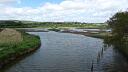
A rectangular concrete pillbox of a type to house a heavy machine gun. One of two gun emplacements overlooking Hedge Corner, a tight bend on the River Axe. Part of the Second World War Taunton Stop Line constructed in 1940.
Location
| Grid Reference: | SY 261 921 |
|---|
| Map Sheet: | SY29SE |
|---|
| Admin Area | Devon |
|---|
| Civil Parish | Axmouth |
|---|
| District | East Devon |
|---|
| Ecclesiastical Parish | AXMOUTH |
|---|
Protected Status
- SHINE: Pill boxes, anti-tank ditches and obstacles, World War II at the Boshill Cross Stong Point of the Taunton Stop Line, a defensive crossing on the River Axe
Other References/Statuses
- National Monuments Record: 1417503
- Old DCC SMR Ref: SY29SE/159
- SHINE Candidate (Yes)
Monument Type(s) and Dates
- PILLBOX (Built, World War II - 1940 AD to 1940 AD)
Full description
Royal Engineers, 1940, Plans of Taunton Stop Line, LXXXIII NE (Cartographic). SDV325259.
Pillbox marked on Royal Engineer's plan as S.V.13.
Royal Air Force, 1946, RAF/106G/UK/1412, RAF/106G/UK/1412 RP 3357-3358 13-APR-1946 (Aerial Photograph). SDV352504.
A small structure is visible.
Royal Air Force, 1947, CPE/UK/1974/2493 (Aerial Photograph). SDV361972.
Pillbox visible.
Wills, H., 1985, Pillboxes. A Study of UK Defences 1940, 74 (Monograph). SDV336210.
Wills lists two rectangular concrete pillboxes facing west at SY260922.
Hellis, J., 1990, List of Defensive Sites (Un-published). SDV99101.
Pillbox of Type 29 at SY260922.
Horner, B., 1993, Weycroft Site Visit (Personal Comment). SDV356798.
Site visit on 6th February 1993. Site visible from Axe Bridge Road. Appears to be intact.
Horner, W., 1994, East Devon Pillboxes (Personal Comment). SDV356839.
Site visit on 16th March 1994. Rectangular concrete pillbox of a type to house a heavy machine gun. Faces west-northwest. A blast wall covers the door on the south face. A similar pillbox lies buried to the east. Both cover a series of bends in the Axe and the approaches to Axe bridge.
Cochrane, J. N., 1996, Two Pillboxes West of B3172 (Worksheet). SDV356830.
Pillbox in field west of B3172. Rectangular heavy machine gun type with large aperture, blast wall protecting entrance adjacent to A6. Photo.
Dobinson, C. S., 1998, The Taunton Stop Line. Component Listing, 7 (Report - non-specific). SDV109230.
Vickers machine gun pillbox of type FW3/27.
Exeter Archaeology, 2003-2004, East Devon Area of Outstanding Natural Beauty Archaeological Survey, Site No. 1477 (Archive - Survey). SDV351568.
Pillbox visible on 1947 Aerial Photograph. May represent pillbox recorded on ground at SY 260 922. Part of Taunton Stop Line.
SMR.
Next Perspectives, 2006, Pan Government Agreement, Next Perspectives PGA Imagery SY2692 17-JUN-2006 (Aerial Photograph). SDV352652.
A small structure is visible.
THE DEVONSHIRE ASSOCIATION, 2008, WWII Pill Boxes in the Axe Valley, 3, 20-23 (Report - Survey). SDV347565.
Vickers machine gun emplacement SV13. The walls are of 3 feet 6 inch reinforced concrete with an entrance on the south-west side protected by a blast wall. Other details: Photos, plans and sections.
GetMapping, 2010, GetMapping 2010 aerial photographs (Aerial Photograph). SDV351585.
A small structure is visible.
Passmore, A. + Passmore, M., 2010, The Taunton Stop Line, 4 (Leaflet). SDV345322.
The photograph on the front shows a machine gun emplacement adjacent to the B3172 south of Boshill Cross. Other details: Photograph.
Hegarty, C., Knight, S. and Sims, R., 2013 - 2014, South Devon Coast RCZAS National Mapping Programme Project Site Visit, 09-MAY-2014 (Site Visit). SDV351142.
The structure is extant and when viewed from the road appears to be in good condition.
Hegarty, C. + Knight, S. + Sims, R., 2013-2014, South Devon Coast Rapid Coastal Zone Assessment Survey National Mapping Programme Project (Interpretation). SDV351146.
This pillbox, part of the Taunton Stop Line, is visible as a small flat roofed structure on aerial photographs taken between 1946 and 2010. It is roughly 4 metres square in plan with a smaller lower rectangular structure appended to its south-west side, probably the blast wall noted in ground observations in 1993. As far as can be ascertained from the aerial photographs it appears to be relatively extant. Its depiction on modern mapping does not match the extent visible on the aerial photographs, so it has been transcribed.
Ordnance Survey, 2019, MasterMap 2019 (Cartographic). SDV362729.
Structure depicted.
Sources / Further Reading
| SDV109230 | Report - non-specific: Dobinson, C. S.. 1998. The Taunton Stop Line. Component Listing. Twentieth Century Fortifications in England. AI/S/3. Photocopy. 7. |
| |
| | |
| SDV325259 | Cartographic: Royal Engineers. 1940. Plans of Taunton Stop Line. Royal Engineers Survey Plan circa July 1940. Unknown. LXXXIII NE. |
| |
| | |
| SDV336210 | Monograph: Wills, H.. 1985. Pillboxes. A Study of UK Defences 1940. Pillboxes. Hardback Volume. 74. |
| |
| | |
| SDV345322 | Leaflet: Passmore, A. + Passmore, M.. 2010. The Taunton Stop Line. A Brief Introduction to Twentieth Century Military and Civil Defence Archae. 22. A4 Folded + digital. 4. |
| |
| | |
| SDV347565 | Report - Survey: THE DEVONSHIRE ASSOCIATION. 2008. WWII Pill Boxes in the Axe Valley. Devonshire Association. Digital + A4. 3, 20-23. |
| |
| | |
| SDV351142 | Site Visit: Hegarty, C., Knight, S. and Sims, R.. 2013 - 2014. South Devon Coast RCZAS National Mapping Programme Project Site Visit. AC Archaeology. Digital. 09-MAY-2014. |
| |  |
| | Linked images:48 |
| SDV351146 | Interpretation: Hegarty, C. + Knight, S. + Sims, R.. 2013-2014. South Devon Coast Rapid Coastal Zone Assessment Survey National Mapping Programme Project. AC Archaeology Report. Digital. |
| |  |
| | Linked documents:1 |
| SDV351568 | Archive - Survey: Exeter Archaeology. 2003-2004. East Devon Area of Outstanding Natural Beauty Archaeological Survey. East Devon Area of Outstanding Natural Beauty Archaeological Survey. Digital + Mixed Archive Material. Site No. 1477. |
| |
| | |
| SDV351585 | Aerial Photograph: GetMapping. 2010. GetMapping 2010 aerial photographs. Getmapping. Photograph (Digital). |
| |
| | |
| SDV352504 | Aerial Photograph: Royal Air Force. 1946. RAF/106G/UK/1412. Royal Air Force Aerial Photograph. Photograph (Paper). RAF/106G/UK/1412 RP 3357-3358 13-APR-1946. |
| |
| | |
| SDV352652 | Aerial Photograph: Next Perspectives. 2006. Pan Government Agreement. Pan Government Agreement Aerial Photographs. Digital. Next Perspectives PGA Imagery SY2692 17-JUN-2006. [Mapped feature: #90259 ] |
| |
| | |
| SDV356798 | Personal Comment: Horner, B.. 1993. Weycroft Site Visit. Not Applicable. |
| SDV356830 | Worksheet: Cochrane, J. N.. 1996. Two Pillboxes West of B3172. Defence of Britain Project. Worksheet + Digital. |
| SDV356839 | Personal Comment: Horner, W.. 1994. East Devon Pillboxes. |
| SDV361972 | Aerial Photograph: Royal Air Force. 1947. CPE/UK/1974/2493. Royal Air Force Aerial Photograph. Photograph (Paper). |
| |
| | |
| SDV362729 | Cartographic: Ordnance Survey. 2019. MasterMap 2019. Ordnance Survey Digital Mapping. Digital. |
| |
| | |
| SDV99101 | Un-published: Hellis, J.. 1990. List of Defensive Sites. Manuscript. |
| |
| | |
Associated Monuments
| MDV119535 | Part of: The Taunton Stop Line (Monument) |
| MDV52898 | Related to: Vickers Machine Gun Emplacement S.V.14 circa 229 metres southeast of Hedge Corner, Axmouth (Monument) |
Associated Finds: none recorded
Associated Events
- EDV4929 - Survey of Defensive Structures on the Taunton Stop Line
- EDV5167 - Survey of Pillboxes in the Axe Valley
- EDV6127 - Rapid Coastal Zone Assessment Survey National Mapping Programme (NMP) for South-West England - South Coast Devon (Ref: ACD618)
| Date Last Edited: | Jun 7 2019 4:58PM |
|---|
Search results generated by the HBSMR Gateway from exeGesIS SDM Ltd.