List Entry Summary
This monument is scheduled under the Ancient Monuments and Archaeological Areas Act 1979 as amended as it appears to the Secretary of State to be of national importance. This entry is a copy, the original is held by the Department for Culture, Media and Sport.
Name: Motte and bailey castle 150m north east of Wilmington
List Entry Number: 1012864
Location
The monument may lie within the boundary of more than one authority.
County:
District: Shropshire
District Type: Unitary Authority
Parish: Chirbury with Brompton
National Park: Not applicable to this List entry.
Grade: Not applicable to this List entry.
Date first scheduled: 30-Jun-1969
Date of most recent amendment: 26-Jul-1995
Legacy System Information
The contents of this record have been generated from a legacy data system.
Legacy System: RSM
UID: 19197
Asset Groupings
This List entry does not comprise part of an Asset Grouping. Asset Groupings are not part of the official record but are added later for information.
List Entry Description
Summary of Monument
Legacy Record - This information may be included in the List Entry Details.
Reasons for Designation
Motte and bailey castles are medieval fortifications introduced into Britain
by the Normans. They comprised a large conical mound of earth or rubble, the
motte, surmounted by a palisade and a stone or timber tower. In a majority of
examples an embanked enclosure containing additional buildings, the bailey,
adjoined the motte. Motte castles and motte-and-bailey castles acted as
garrison forts during offensive military operations, as strongholds, and, in
many cases, as aristocratic residences and as centres of local or royal
administration. Built in towns, villages and open countryside, motte and
bailey castles generally occupied strategic positions dominating their
immediate locality and, as a result, are the most visually impressive
monuments of the early post-Conquest period surviving in the modern landscape.
Over 600 motte castles or motte-and-bailey castles are recorded nationally,
with examples known from most regions. As one of a restricted range of
recognised early post-Conquest monuments, they are particularly important for
the study of Norman Britain and the development of the feudal system. Although
many were occupied for only a short period of time, motte castles continued to
be built and occupied from the 11th to the 13th centuries, after which they
were superseded by other types of castle.
The motte and bailey castle 150m north east of Wilmington survives well and is
a good example of its class. It will retain archaeological information
relating to its construction and occupation. Environmental evidence relating
to the landscape in which the castle was constructed will survive sealed
beneath the motte and in the ditch fill. Such motte and bailey castles
contribute information concerning the settlement pattern, economy and social
structure of the countryside during the medieval period.
History
Legacy Record - This information may be included in the List Entry Details.
Details
The monument includes the remains of a motte and bailey castle situated on a
low ridge on the south side of Rea Brook. The castle is positioned to overlook
the natural valley routeway from Shrewsbury in the north east to Montgomery in
the south west. It includes a substantial earthen mound, or motte, circular in
plan with a base diameter of 32m standing up to 4.6m high. The circular summit
of the mound is 9m in diameter and shows slight traces of mortared masonry
walls with scattered stone rubble indicating that a building once occupied the
summit. The motte stands on the summit of the ridge, the hillslope surrounding
it has been cut back to create a well defined scarp up to 1.8m high enclosing
an oval area of roughly level ground. The largest portion of this enclosure
extends to the north of the motte and would have functioned as a bailey, a
defended area in which the domestic buildings associated with the castle would
have stood. It has dimensions of 35m north to south by 42m transversely. The
bailey scarp continues to the south of the motte to enclose the tail of the
spur, forming a small triangular area of defended ground. Although this could
have been used in a similar fashion as the main bailey, it appears to have
been principally designed to give additional defensive strength to the motte
in this quarter. There are no visible surface traces of ditches surrounding
either motte or bailey though they will survive as buried features.
Sections of boundary hedges within the area are not included in the scheduling
although the ground beneath is included.
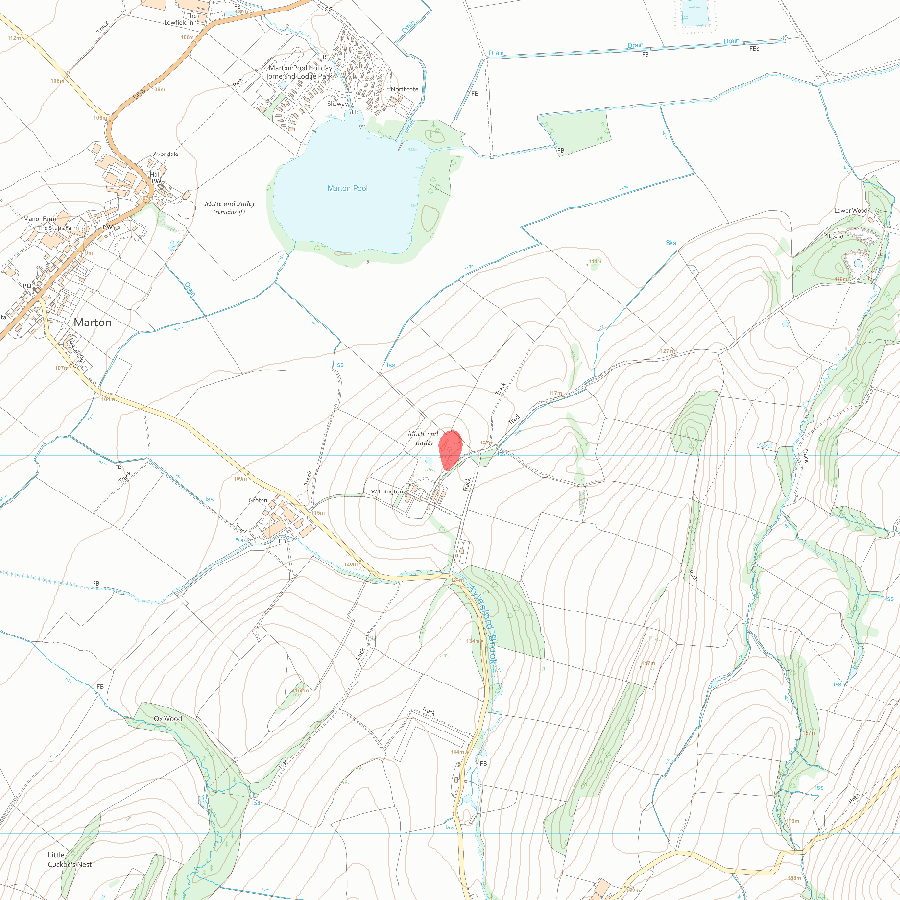
MAP EXTRACT
The site of the monument is shown on the attached map extract.
It includes a 2 metre boundary around the archaeological features,
considered to be essential for the monument's support and preservation.
Selected Sources
Legacy Record - This information may be included in the List Entry Details
Map
National Grid Reference: SJ 29751 02018
The below map is for quick reference purposes only and may not be to scale. For a copy of the full scale map, please see the attached PDF - 1012864.pdf - Please be aware that it may take a few minutes for the download to complete.
© Crown Copyright and database right 2018. All rights reserved. Ordnance Survey Licence number 100024900.
© British Crown and SeaZone Solutions Limited 2018. All rights reserved. Licence number 102006.006.
This copy shows the entry on 19-Jul-2025 at 07:00:29.


