List Entry Summary
This building is listed under the Planning (Listed Buildings and Conservation Areas) Act 1990 as amended for its special architectural or historic interest.
Name: FARNHAM CASTLE (COMPRISING CASTLE BUILDINGS TO THE SOUTH ONLY)
List Entry Number: 1044677
Location
FARNHAM CASTLE (COMPRISING CASTLE BUILDINGS TO THE SOUTH ONLY), CASTLE HILL
The building may lie within the boundary of more than one authority.
County: Surrey
District: Waverley
District Type: District Authority
Parish: Farnham
National Park: Not applicable to this List entry.
Grade: I
Date first listed: 26-Apr-1950
Date of most recent amendment: Not applicable to this List entry.
Legacy System Information
The contents of this record have been generated from a legacy data system.
Legacy System: LBS
UID: 290830
Asset Groupings
This List entry does not comprise part of an Asset Grouping. Asset Groupings are not part of the official record but are added later for information.
List Entry Description
Summary of Building
Legacy Record - This information may be included in the List Entry Details.
Reasons for Designation
Legacy Record - This information may be included in the List Entry Details.
History
Legacy Record - This information may be included in the List Entry Details.
Details
SU 8347 SE 1/1
26.4.50
1099
CASTLE HILL
(East Side)
Farnham Castle
(comprising Castle Buildings to the south only)
I
The Castle has been the property of the Bishops of Winchester since Saxon
times continuously to 1927, remaining for some time since that date the residence
of the Bishop of Guildford, and partly for diocesan use; now used by the Overseas
Service College.
The plan consists of a circular mound to the north with an irregular group
of buildings built in a triangle round a court to the south of the mound. The
original stockade defence of the mound (rebuilt in stone in the C18), was probably
by Henry of Blois, Bishop of Winchester 1129 to 117I. This work probably included
the shell keep of 23 sides, more on less a circle, formerly with 5 towers which
remains in part today with some later C15 brickwork over the entrance. In
addition some of the outer walls and entrance gate, the latter altered later,
also of the C12 remain much as shown in a print of 1737 (Buck). The group
of buildings to the south of the keep are of various dates and have been rebuilt
or altered over a period of roughly 800 years. The south front consists of
Fox's Tower, a square brick structure of 3 storeys, beautifully built with
a diaper pattern of vitreous brick all over. The design is unsymmetrical
with a flat arched entry in right hand corner and 2 windows to upper floors
(now C18 sashes) deep machicolated and battlemented parapet between projecting
and splayed angles of greater height. A group of 3 chimneys springs from the
left hand angle. 2 square painted sundials are placed on different faces of
the angles one on each side. This tower dates from 1470 to l475; formerly
thought to date from the time of Bishop Fox in the early C16, hence the name
given to the Tower.
To the left of the Tower is a low range with a kitchen on the south side and
a chapel, recently restored to its use on the north side, probably C12. To
the right hand of the Tower is a long block of 2 storeys, battlemented, of
coursed rough stone with old tile roof. The 1st floor has 9 sash windows,
C18. The main floor has 3 similar windows and 4 large mullioned and transomed
stone windows of C15 date. The lower ground floor, storage, has 3 circular
lights.
The Great Hall, and principal stair are contained in this block. The Hall
was reconstructed under Bishop Morley, as well as the stair and the Bishop's
Chapel on the east side of the court. The interior design may possibly be
connected with John Webb, and is late C17. The Chapel fittings and panelling
are richly carved. The various features and details of design have been illustrated
in numerous books. Good photographs and a comprehensive description of the
building were published in Country Life of December 23rd and 30th 1939. The
Castle dominates the town from its site on the hilltop to the North, and with
the wide approach of Castle Street. The architecture is not dramatic, and
has a strong affinity with the gentle restraint of the small brick C18 buildings
below it. The group of the Castle, together with the whole of the Park, The
Grange (Map No 2) and Castle Street, is very exceptional and should be considered
as a unit for purposes of preservation.
Listing NGR: SU8374447271
Selected Sources
Books and journals'Country Life' in 30 December, (1939)
'Country Life' in 23 December, (1939)
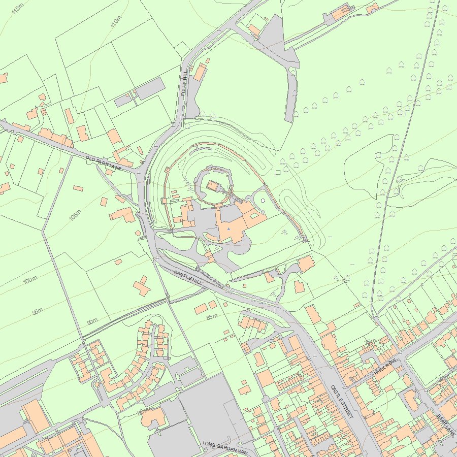
Map
National Grid Reference: SU 83744 47271
The below map is for quick reference purposes only and may not be to scale. For a copy of the full scale map, please see the attached PDF - 1044677.pdf - Please be aware that it may take a few minutes for the download to complete.
© Crown Copyright and database right 2018. All rights reserved. Ordnance Survey Licence number 100024900.
© British Crown and SeaZone Solutions Limited 2018. All rights reserved. Licence number 102006.006.
This copy shows the entry on 18-Apr-2024 at 03:10:22.


