| Name: | Daimler Works, Sandy Lane |
|---|
| HER no.: | MCT14317 |
|---|
| Type of Record: | Monument |
|---|
Summary
The Daimler Works on Sandy Lane, a car factory that started production in 1896 and continued into the 20th century. Much of the site was destroyed by bombing in the Second World War but the power house and an office block remain.
| Grid Reference: | SP 3326 7992 |
|---|
| Former Parish: | Foleshill |
|---|
Monument Type(s):
- CAR FACTORY (Victorian to Early 20th Century - 1896 AD to 1937 AD)
- FACTORY (Victorian to Early 20th Century - 1896 AD to 1937 AD)
- INDUSTRIAL SITE (Victorian to Early 20th Century - 1896 AD to 1937 AD)
- POWER HOUSE (Victorian to Early 20th Century - 1896 AD to 1937 AD)
Protected Status: None recorded
Full description
1> Considered birthplace of British motor industry. Daimler one of group of companies who acquired redundant cotton spinning mill (motor mills) and fitted it out for car manufacture 1896. By the early 1920s the complex had grown to fill the area
between Sandy Lane and Coventry Canal. Daimler occupied motor mills until 1937. Used as air ministry store until 1940. Bombing reduced most of site to ruins except for office block and the power house. Power house abutts canal and interior
shows many of classic features of turn of century power house.
3> Prior to the outbreak of World War II the Government recognised the strategic importance of Coventry's massive engineering and manufacturing capacity and one of the measures taken to exploit local skills was the building of Shadow Factories, financed by Government money. These factories were built to produce aero engines as part of the Government rearmament drive leading up to the Second World War and which were to ultimately play such an important part in the continuity of a prosperous car industry in Coventry after the war. During 1936 and 1937 factories were built at the Standard Works on Fletchamstead Highway, at Capmartin Road near the Daimler parent works and at Stoke Aldermoor next to the Humber motor works.
<1> Ironbridge Institute, 1994, A Survey of Coventry Car Factories 1894-1994 (--MONOGRAPH). SCT667.
<2> Ordnance Survey, 1913-1925, Third Edition Ordnance Survey 25 inch to the mile (or 1:2500) County Series map (-MAP). SCT1569.
<3> Coventry Environmental Education Project, 1986, The Coventry Car Industry, p.5 (-PUBLICATION). SCT90.
Sources and Further Reading
| <1> | SCT667 --MONOGRAPH: Ironbridge Institute. 1994. A Survey of Coventry Car Factories 1894-1994. Collins, P. and Stratton, M.. A4 duplex. 370. |
| <2> | SCT1569 -MAP: Ordnance Survey. 1913-1925. Third Edition Ordnance Survey 25 inch to the mile (or 1:2500) County Series map. |
| <3> | SCT90 -PUBLICATION: Coventry Environmental Education Project. 1986. The Coventry Car Industry. A4 duplex. 53. p.5. |
Associated Finds: none recorded
Associated Events: none recorded
Related records
| MCT16876 | Parent of: Daimler Power House (Building) |
| MCT16875 | Parent of: Former Daimler office block and extension wing (no.2), Sandy Lane (Building) |
Images
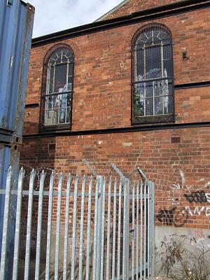 Part of SE elevation, Daimler Power House, Sandy Lane, 2011 © Coventry City Council |
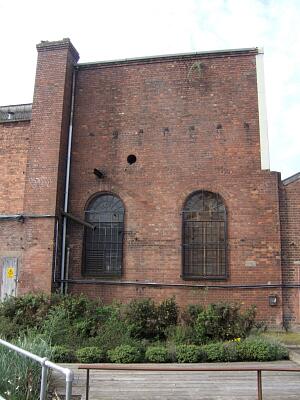 Part of NE elevation of Daimler Power House, Sandy Lane, 2011 © Coventry City Council |
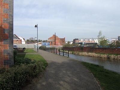 View of the Daimler Power House from the SE, 2011 © Coventry City Council |
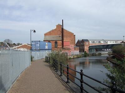 Daimler power house building from the SE, 2011 © Coventry City Council |
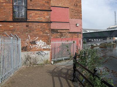 SE corner of Daimler Power House, Sandy Lane, 2011 © Coventry City Council |
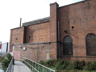 NE elevation of Daimler Power House, Sandy Lane, 2011 © Coventry City Council |
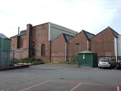 SW elevation of the Daimler Power House, Sandy Lane, 2011 © Coventry City Council |
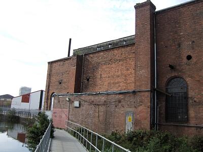 Part of NE elevation of Daimler Power House, Sandy Lane, 2011 © Coventry City Council |
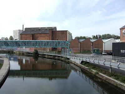 NE elevation of Daimler Power House, Sandy Lane, 2011 © Coventry City Council |
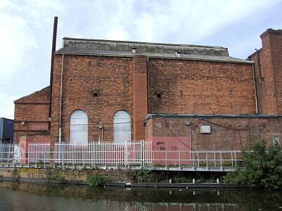 Part of NE elevation of Daimler Power House, Sandy Lane, 2011 © Coventry City Council |
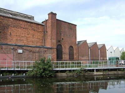 Part of NE elevation of Daimler Power House, Sandy Lane, 2011 © Coventry City Council |
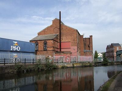 View of the Daimler Power House from the SE, 2011 © Coventry City Council |
If you have any comments or new information about this record, please email us.
Search results generated by the HBSMR Gateway from exeGesIS SDM Ltd.