See important
guidance on the use of this record.
If you have any comments or new information about this record, please email us.
| HER Number: | MDV106372 |
|---|
| Name: | Earthwork Banks within Dalditch Common and Dalditch Plantation |
|---|
Summary
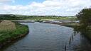
Earthwork banks of potential medieval date are visible as a series of linear features on aerial photographs of 1946 onwards and on digital images derived from LiDAR data captured between 1998-2012, within Dalditch Common and Dalditch Plantation.
Location
| Grid Reference: | SY 044 833 |
|---|
| Map Sheet: | SY08SW |
|---|
| Admin Area | Devon |
|---|
| Civil Parish | East Budleigh |
|---|
| District | East Devon |
|---|
| Ecclesiastical Parish | EAST BUDLEIGH |
|---|
Protected Status: none recorded
Other References/Statuses: none recorded
Monument Type(s) and Dates
- EARTHWORK (Early Medieval to Post Medieval - 1066 AD to 1750 AD (Between))
Full description
Devon County Council, 1838-1848, Tithe Mosaic, approximately 1838-1848 (Cartographic). SDV349431.
The earthwork banks are not depicted on the East Budleigh parish tithe map of approximately 1838-48, although do appear to respect and are confined within boundaries depicted on this map.
Royal Air Force, 1946, RAF/106G/UK/1412, RAF/106G/UK/1412 RP 4025-26 13-APR-1946 (Aerial Photograph). SDV352504.
A series of linear earthwork banks are visible.
Environment Agency, 1998-2012, Lidar data JPEG SY08SW DTM, A series of linear earthwork banks are visible. Map object based on this source. (Cartographic). SDV355698.
A series of linear earthwork banks are visible.
Hegarty, C., Knight, S. and Sims, R., 2013 - 2014, South Devon Coast RCZAS National Mapping Programme Project Site Visit, 11-04-14 (Site Visit). SDV351142.
A site visit was carried out of the potential medieval earthworks on Dalditch Common on 11-04-14. The broad earthwork banks were barely perceptable and were partly covered with thick vegetation, although do appear to exist as archaeological features. The continuation of these banks across the residential area to the west of Inner Ting Tong road was not observed.
Hegarty, C. + Knight, S. + Sims, R., 2013-2014, South Devon Coast Rapid Coastal Zone Assessment Survey National Mapping Programme Project (Interpretation). SDV351146.
Earthwork banks of potential medieval date are visible as a series of linear features on aerial photographs of 1946 onwards and on digital images derived from LiDAR data captured between 1998-2012, within Dalditch Common and Dalditch Plantation. The broadly parallel, linear boundaries are northeast to southwest aligned and occupy an area of approximately 7.5 hectares of moderate northeast sloping ground. The western extent of these earthworks have been partly truncated by construction of a number of 20th century houses. The nature of these earthwork banks is largely unclear, although they do appear to respect and are confined within field boundaries symbolised as common land on the East Budleigh parish tithe map of approximately 1838-48. They may, therefore, represent surviving medieval earthworks associated with this common land. Further field investigation of these earthwork banks, which survive on digital images derived from LiDAR data captured between 1998-2012, may help to shed further light on the nature and date of these features.
Sources / Further Reading
| SDV349431 | Cartographic: Devon County Council. 1838-1848. Tithe Mosaic, approximately 1838-1848. Digitised Tithe Map. Digital. |
| |
| | |
| SDV351142 | Site Visit: Hegarty, C., Knight, S. and Sims, R.. 2013 - 2014. South Devon Coast RCZAS National Mapping Programme Project Site Visit. AC Archaeology. Digital. 11-04-14. |
| |  |
| | Linked images:48 |
| SDV351146 | Interpretation: Hegarty, C. + Knight, S. + Sims, R.. 2013-2014. South Devon Coast Rapid Coastal Zone Assessment Survey National Mapping Programme Project. AC Archaeology Report. Digital. |
| |  |
| | Linked documents:1 |
| SDV352504 | Aerial Photograph: Royal Air Force. 1946. RAF/106G/UK/1412. Royal Air Force Aerial Photograph. Photograph (Paper). RAF/106G/UK/1412 RP 4025-26 13-APR-1946. |
| |
| | |
| SDV355698 | Cartographic: Environment Agency. 1998-2012. Lidar data JPEG SY08SW DTM. Environment Agency LiDAR data. Digital. A series of linear earthwork banks are visible. Map object based on this source.. [Mapped feature: #65893 ] |
| |
| | |
Associated Monuments: none recorded
Associated Finds: none recorded
Associated Events
- EDV6127 - Rapid Coastal Zone Assessment Survey National Mapping Programme (NMP) for South-West England - South Coast Devon (Ref: ACD618)
| Date Last Edited: | Apr 16 2014 10:30AM |
|---|
Search results generated by the HBSMR Gateway from exeGesIS SDM Ltd.