See important
guidance on the use of this record.
If you have any comments or new information about this record, please email us.
| HER Number: | MDV110 |
|---|
| Name: | Barrow on Bursdon Moor, Hartland |
|---|
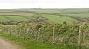
Summary
One of a group of four Prehistoric barrows on Bursdon Moor. The barrow is visible as a circular mound on aerial photographs from 1946 onwards, and has been impacted by modern deep ploughing before 1946. A water trough installed on its northern edge between 1999 and 2007 has been relocated in 2012.
Location
| Grid Reference: | SS 262 202 |
|---|
| Map Sheet: | SS22SE |
|---|
| Admin Area | Devon |
|---|
| Civil Parish | Hartland |
|---|
| District | Torridge |
|---|
| Ecclesiastical Parish | HARTLAND |
|---|
Protected Status
Other References/Statuses
- National Monuments Record: 1328746
- Old DCC SMR Ref: SS22SE/16
- Old SAM County Ref: 306(3)
- Old SAM Ref: 34246
- Ordnance Survey Archaeology Division: SS22SE10
Monument Type(s) and Dates
- BOWL BARROW (Bronze Age - 2200 BC to 701 BC (Between))
Full description
Ordnance Survey, 1880-1899, First Edition Ordnance 25 inch map (Cartographic). SDV336179.
The easternmost of a group of four 'Tumuli' shown on 19th century map.
Royal Air Force, 1946, RAF/3G/TUD/UK/158, DCC RAF/3G/TUD/UK/158 5184-5185 19-APR-1946 (Aerial Photograph). SDV349143.
The barrow is visible as a circular earthwork mound. The ridges of deep ploughing are visible across the mound from east to west.
Ordnance Survey Archaeology Division, 1951 - 1978, SS22SE10 (Ordnance Survey Archaeology Division Card). SDV344767.
Barrow C. A heather covered platform barrow, dug into at its centre, 26 metres overall diameter and 0.8 metres high, the flat top being 18 metres across.
Department of Environment, 1953, Three Barrows on Bursdon Moor (Schedule Document). SDV339643.
Eastern barrow of a group of three on Bursdon Moor. Mound 65 feet (19.81 metres) diameter by 2 foot 6 inches (0.76 metres) high.
Grinsell, L. V., 1970, The Barrows of North Devon, 120 (Article in Serial). SDV7849.
Visited on 15th September 1965. Barrow on heath with a slight hollow centre. Diameter 25 paces, height 4 feet (1.22 metres).
Silvester, R. J., 1977, Earthwork (Worksheet). SDV8568.
Visited on 11th December 1977. The area might be about to be reclaimed.
Ordnance Survey, 1978, OS/78038, NMR OS/78038 309-310 10-MAY-1978 (Aerial Photograph). SDV349082.
The barrow is visible as a circular earthwork mound, and the ridges of deep ploughing are visible across the mound from east to west.
Devon Committee for Rescue Archaeology, 1979 - 1981, North Devon Barrow Survey, DCRA ND36 (Archive - Survey). SDV341310.
Visited on 7th May 1979. Diameter 22 metres north to south and 27 metres east to west. Eastern sector disturbed. Rough grass and furze covered. Visible on a 1979 aerial photograph.
Griffith, F. M., 1985, DAP/EJ, 1a, 3 (Aerial Photograph). SDV341820.
Bayer, O. J., 1996, Barrows in the Torridge District of North West Devon: A Study in Distribution and Location (Undergraduate Dissertation). SDV319515.
GetMapping, 1999, 089/99, DCC GM/089/99 0255-0256 24-JUL-1999 (Aerial Photograph). SDV349037.
The barrow is visible as a circular earthwork mound.
Department for Culture, Media and Sport, 2000, Three Bowl Barrows and One Bell Barrow on Bursdon Moor Situated 670m North East of Lutsford Cross (Schedule Document). SDV339642.
This monument includes three bowl barrows and one bell barrow on Bursdon Moor north-east of Lutsford Cross. The four barrows are arranged in a roughly triangular grouping. The easternmost barrow is a circular mound, 25.9 metres diameter by 0.8 metres high with a rather irregular profile. Cut by oval central depression 3.2 metres by 2 metres by 0.2 metres deep. Buried ditch circa 3 metres.
Next Perspectives, 2007, Next Perspectives PGA Tile Ref:, Next Perspectives PGA Tile Ref: SS2620 22-AUG-2007 (Aerial Photograph). SDV349178.
The barrow is visible as an earthwork mound, and a small rectangular structure is visible on its northern side.
Next Perspectives, 2007, Next Perspectives PGA Tile Ref:, Next Perspectives PGA Tile Ref: SS2620 22-AUG-2007 (Aerial Photograph). SDV349178.
The barrow is visible as an earthwork mound, and a small rectangular structure is visible on its northern side.
Collings, A. G. + Manning, P. T. + Valentin, J., 2007, The North Devon Area of Outstanding Natural Beauty. Phase 1. Archaeological Survey. Summary Report, No. 534 (Report - Assessment). SDV339712.
Round barrow on Bursdon Moor. Diameter 19 metres, height 0.7 metres. No ditch. Signs of disturbance in centre. One of a group of three barrows.
National Monuments Record, 2010, 1328746 (National Monuments Record Database). SDV344770.
Ordnance Survey, 2010, MasterMap (Cartographic). SDV344030.
English Heritage, 2010, Three Bowl Barrows and One Bell Barrow on Bursdon Moor Situated 670m North East of Lutsford Cross (Correspondence). SDV344524.
Scheduled Monument Consent granted, subject to conditions, in respect of proposed works concerning the re-siting of a water trough and reseeding/turfing bare batches.
English Heritage, 2011, Heritage at Risk Register 2011: South West, 114 (Report - non-specific). SDV355280.
but with significant localised problems. Declining. Principal vulnerability scrub/tree growth.
Hegarty, C. + Knight, S., 2011 - 2012, North Devon Coast Area of Outstanding Natural Beauty National Mapping Programme Project (Interpretation). SDV349018.
The barrow is visible as a circular earthwork mound on aerial photographs from 1946 onwards. Narrow ridge and furrow earthworks from modern deep ploughing are visible aligned east to west across the mound from 1946. A small rectangular structure is visible on its northern side in aerial photographs dating to 2007, but not those taken in 1999. A site visit was planned in 2012 to co-incide with works to relocate this feature, a water trough, under an Environmental Stewardship Scheme, and the area has been returfed.
Hegarty, C. & Knight, S., 2012-2013, North Devon Area of Outstanding Natural Beauty National Mapping Programme Project site visit, 18-APR-2012 (Site Visit). SDV349357.
The barrow has just had a water trough removed from its northern edge under an Environmental Stewardship Scheme. The area is poached apart from an area of hardcore under the water trough.
Unknown, Unknown, Untitled Source (Worksheet). SDV358823.
Sources / Further Reading
| SDV319515 | Undergraduate Dissertation: Bayer, O. J.. 1996. Barrows in the Torridge District of North West Devon: A Study in Distribution and Location. University of Leicester Dissertation. A4 Stapled + Digital. |
| |
| | |
| SDV336179 | Cartographic: Ordnance Survey. 1880-1899. First Edition Ordnance 25 inch map. First Edition Ordnance Survey 25 inch Map. Map (Digital). |
| |
| | |
| SDV339642 | Schedule Document: Department for Culture, Media and Sport. 2000. Three Bowl Barrows and One Bell Barrow on Bursdon Moor Situated 670m North East of Lutsford Cross. The Schedule of Monuments. A4 Stapled. |
| |
| | |
| SDV339643 | Schedule Document: Department of Environment. 1953. Three Barrows on Bursdon Moor. The Schedule of Monuments. Foolscap. |
| |
| | |
| SDV339712 | Report - Assessment: Collings, A. G. + Manning, P. T. + Valentin, J.. 2007. The North Devon Area of Outstanding Natural Beauty. Phase 1. Archaeological Survey. Summary Report. Exeter Archaeology Report. 06.22 (rev.1). A4 Stapled + Digital. No. 534. |
| |
| | |
| SDV341310 | Archive - Survey: Devon Committee for Rescue Archaeology. 1979 - 1981. North Devon Barrow Survey. Devon Barrow Survey. Digital + Mixed Archive Material. DCRA ND36. |
| |
| | |
| SDV341820 | Aerial Photograph: Griffith, F. M.. 1985. DAP/EJ. Devon Aerial Photograph. Photograph (Paper). 1a, 3. |
| |
| | |
| SDV344030 | Cartographic: Ordnance Survey. 2010. MasterMap. Ordnance Survey. Map (Digital). [Mapped feature: #69453 ] |
| |
| | |
| SDV344524 | Correspondence: English Heritage. 2010. Three Bowl Barrows and One Bell Barrow on Bursdon Moor Situated 670m North East of Lutsford Cross. Scheduled Monument Consent Letter. Letter. |
| SDV344767 | Ordnance Survey Archaeology Division Card: Ordnance Survey Archaeology Division. 1951 - 1978. SS22SE10. Ordnance Survey Archaeology Division Card. Card Index. |
| |
| | |
| SDV344770 | National Monuments Record Database: National Monuments Record. 2010. 1328746. National Monuments Record Database. Website. |
| |
| | |
| SDV349018 | Interpretation: Hegarty, C. + Knight, S.. 2011 - 2012. North Devon Coast Area of Outstanding Natural Beauty National Mapping Programme Project. AC Archaeology Report. ACD383/2/1. Digital. |
| |  |
| | Linked documents:1 |
| SDV349037 | Aerial Photograph: GetMapping. 1999. 089/99. GetMapping Aerial Photograph. Photograph (Paper). DCC GM/089/99 0255-0256 24-JUL-1999. |
| |
| | |
| SDV349082 | Aerial Photograph: Ordnance Survey. 1978. OS/78038. Ordnance Survey Aerial Photograph. Photograph (Paper). NMR OS/78038 309-310 10-MAY-1978. |
| |
| | |
| SDV349143 | Aerial Photograph: Royal Air Force. 1946. RAF/3G/TUD/UK/158. Royal Air Force Aerial Photograph. Photograph (Paper). DCC RAF/3G/TUD/UK/158 5184-5185 19-APR-1946. |
| |
| | |
| SDV349178 | Aerial Photograph: Next Perspectives. 2007. Next Perspectives PGA Tile Ref:. Pan Government Agreement Aerial Photographs. Digital. Next Perspectives PGA Tile Ref: SS2620 22-AUG-2007. |
| |
| | |
| SDV349357 | Site Visit: Hegarty, C. & Knight, S.. 2012-2013. North Devon Area of Outstanding Natural Beauty National Mapping Programme Project site visit. ND AONB NMP. Digital. 18-APR-2012. |
| |  |
| | Linked images:24 |
| SDV355280 | Report - non-specific: English Heritage. 2011. Heritage at Risk Register 2011: South West. english Heritage. Digital. 114. |
| |
| | |
| SDV358823 | Worksheet: Unknown. Unknown. Devon Committee for Rescue Archaeology Worksheet. Worksheet + Digital. |
| SDV7849 | Article in Serial: Grinsell, L. V.. 1970. The Barrows of North Devon. Proceedings of the Devon Archaeological Society. 28. A5 Paperback. 120. |
| |
| | |
| SDV8568 | Worksheet: Silvester, R. J.. 1977. Earthwork. Worksheet + Digital. |
Associated Monuments
| MDV111 | Related to: Barrow on Bursdon Moor, Hartland (Monument) |
| MDV12410 | Related to: Barrow on Bursdon Moor, Hartland (Monument) |
| MDV109 | Related to: Barrow on Bursdon Moor, Hartland (Monument) |
Associated Finds: none recorded
Associated Events
- EDV6132 - North Devon Area of Outstanding Natural Beauty NMP Project
- EDV4415 - Devon Barrow Survey
| Date Last Edited: | Nov 11 2015 10:03AM |
|---|
Search results generated by the HBSMR Gateway from exeGesIS SDM Ltd.