See important
guidance on the use of this record.
If you have any comments or new information about this record, please email us.
| HER Number: | MDV110227 |
|---|
| Name: | Whetstone Mines Around North Hill, Black Down, Blackborough Common, Tower Plot and Newcombe Common |
|---|
Summary
The remains of 18th, 19th and early 20th century whetstone mine galleries and spoil are visible as extensive linear and roughly circular earthwork pits with an irregular bank downslope of the terrace along the scarp from North Hill to Newcombe Common on aerial photographs taken between 1947 and 1982 and on images derived from lidar data captured in 2010 and 2016.
Location
| Grid Reference: | ST 099 078 |
|---|
| Map Sheet: | ST00NE |
|---|
| Admin Area | Devon |
|---|
| Civil Parish | Broadhembury |
|---|
| Civil Parish | Kentisbeare |
|---|
| Civil Parish | Uffculme |
|---|
| District | East Devon |
|---|
| District | Mid Devon |
|---|
| Ecclesiastical Parish | KENTISBEARE |
|---|
| Ecclesiastical Parish | SHELDON |
|---|
| Ecclesiastical Parish | BLACKBOROUGH |
|---|
| Ecclesiastical Parish | UFFCULME |
|---|
| Ecclesiastical Parish | BROADHEMBURY |
|---|
Protected Status
- SHINE: Prehistoric Iron-working extractive pits and barrow and mining features in Downland Plantation
Other References/Statuses
Monument Type(s) and Dates
- MINE (XVIII to XX - 1755 AD to 1929 AD (Between))
Full description
Ordnance Survey, 1880-1899, First Edition Ordnance 25 inch map (Cartographic). SDV336179.
On the edges of the plateau at Blackborough Common ‘Level (Whetstone)’ is marked in several places and ‘Old Workings (Whetstone)’ depicted once.
Royal Air Force, 1947, RAF/CPE/UK/1974, RAF/CPE/UK/1974 FP 4292-4295 11-APR-1947 (Aerial Photograph). SDV356127.
Extensive areas of linear earthwork ditches, pits and mounds are visible. Map object partly based on this source.
Royal Air Force, 1950, RAF/541/453, RAF/541/453 RS 4110-11 04-MAR-1950 (Aerial Photograph). SDV357845.
A series of earthwork cuttings, pits and earthwork mounds are visible. Map object partly based on this source.
Royal Air Force, 1950, RAF/541/534, RAF/541/534 RS 4044-45; 4065-66 30-MAY-1950 (Aerial Photograph). SDV357615.
A series of earthwork cuttings, pits and earthwork mounds are visible. Map object partly based on this source.
Hunting Surveys Limited, 1982, HSL/UK/82/45 V, HSL/UK/82/45 V 0986-0987 27-AUG-1982 (Aerial Photograph). SDV357955.
The area is scrubbed up, but some linear earthwork ditches, pits and mounds are visible.
Environment Agency, 1998-2012, LiDAR DSM data JPEG image (1m resolution), LIDAR ST0906 Environment Agency JPEG DSM 05-MAR-2010 (Cartographic). SDV357034.
In areas with no tree cover, some earthwork linear ditches and pits are visible along the slopes at North Hill/Black Down. Map object partly based on this source.
Environment Agency WMS, 1998-2014, LiDAR DTM data JPEG image (1m resolution), LIDAR WMS Environment Agency DTM viewed 22-NOV-2016 (Cartographic). SDV359716.
A series of earthwork cuttings, pits and earthwork mounds are visible. Map object partly based on this source.
Environment Agency, 2005-2012, LiDAR DTM data JPEG image (1m resolution), LIDAR ST0906-ST0908 Environment Agency JPEG DTM 05-MAR-2010 (Cartographic). SDV357033.
Irregular ground surface visible along the slopes from Blackborough Common to North Hill, with a wide earthwork terrace, some linear earthwork ditches and an irregularly shaped wide linear bank. Map object partly based on this source.
Hegarty, C. + Knight, S. + Sims, R., 2014-2015, East and Mid Devon River Catchments National Mapping Programme Project (Interpretation). SDV356883.
Extensive linear and roughly circular earthwork pits are visible along the scarp around North Hill in the south to Black Down, Blackborough Common, Tower Plot and Newcombe Common in the north, covering circa 5 kilometers around the plateau. They are interpreted as the openings and collapsed remains of post-medieval whetstone mine tunnels, and are visible, although partially obscured by tree cover, on aerial photographs taken between 1947 and the 1980s. Earthworks are visible on images derived from lidar data captured in 2010, although coverage is partial, and its use is limited since processing seems to have reduced the detail visible on the DTM, although this source shows the scale of the earthwork terrace extremely well. The remains of the exposed galleries and individual pits likely to be collapses into the voids are visible on the DSM covering parts of North Hill where tree cover has not yet established.
The visible earthworks comprise a terrace, circa 40 metres wide, partway up the slope of the plateau. Perpendicular to the contour all along the terrace numerous linear earthworks are visible, having the appearance of ditches circa two to three metres across. These are interpreted as the remains of collapsed galleries dug into the hillside to follow the veins of silicate rock. Many are sited in close proximity, often 5 or so metres apart, and some perhaps intercutting. Where they were clearly defined they have been transcribed, but in many cases the edges of the earthworks could not be clearly distinguished and the extent of the area has been transcribed. The actual extent of the original mines is likely to be more extensive than that recorded from the aerial photographs.
On the downward side of the terrace an irregular raised area, presumably of spoil, is visible as an interrupted linear earthwork mound up to circa 22 metres wide, water erosion and runoff having probably caused its distinctive partially segmented appearance. On the higher ground numerous pits up to 4 metres in diameter are visible above and often in line with the linear earthworks, and interpreted as collapses of overlying soil into the abandoned galleries that run into the hillside. In one area centred at circa ST0978408794 an area of up to 40 metres inland from the edge of the slope is covered by pale linear features likely to be bare ground, presumably disturbed by collapses into the underlying galleries.
There are numerous records resulting from archaeological investigations of these mines, but as they could not be attributed to individual earthworks visible on the aerial photographs these have not been altered as part of the NMP survey, with the exception of linking them to this record (MDV47637, MDV49836, MDV49835, MDV49837, MDV72416, MDV72417, MDV72418, MDV72419, MDV49838, MDV47153, MDV47154, MDV38534, MDV38535 and MDV47630).
Hegarty, C., Knight, S. and Sims, R., 2014-2015, East and Mid Devon River Catchments National Mapping Programme Project Site Visit, 18-DEC-2014 (Site Visit). SDV357653.
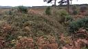
Although much of the area is obscured by dense low vegetation and tree growth, some circular and linear earthwork pits could be seen.
Bluesky International, 2016, LiDAR DTM data (0.5m resolution) Blackdown Hills and East Devon AONBs: 3 transects, LIDAR ST1006; ST1008; ST1009 Bluesky International DTM 27-JUN-2016 (Cartographic). SDV359714.
A series of earthwork cuttings, pits and earthwork mounds are visible. Map object partly based on this source.
Hegarty, C. + Knight, S. + Sims, R., 2016-2018, The Blackdown Hills AONB and East Devon River Catchments National Mapping Programme Project (Interpretation). SDV359463.
A series of linear and roughly circular earthwork pits and irregular shaped mounds are visible along the steep southeast slopes of North Hill to the Devon and Somerset Gliding Club, to the south and along the steep east facing slopes of Newcombe Common, to the north. The earthworks transcribed and recorded here as part of this survey are a continuation of those features recorded by S. Knight during the East and Mid Devon NMP Project in March 2015 and have accordingly been appended to this monument record. The monument polygon for this record has been amended, where appropriate, and any ‘extent of areas’ created by S. Knight which extend into this project area have been copied, pasted and amended, where appropriate. This has necessarily created a slight, but unavoiadable, discrepancy in overlapping transcriptions.
The earthworks have likewise been interpreted as the openings and collapsed remains of post-medieval whetstone mine tunnels, and are visible, although partially obscured by tree cover, on aerial photographs of 1947 onwards and on digital images derived from lidar data captured between 1998-2014 and in 2016. There are two monument records of previous investigations carried out here (MDV49851 & MDV49852) which have been attributed to this record as child records.
The linear earthworks of the galleries, up to 50m in length and 2m in width are northeast to southwest and east to west aligned and perpendicular to the steep sloping contours of the scarps of Newcombe Common and North Hill. Interspersed with these are a series of earthwork pits from the collapsed galleries, up to 12m in length, but typically between 2 to 4m. These are quite extensive in places, in particular along Newcombe Common, although these could not all be transcribed given their poor clarity in places. It is less clear whether the three larger earthwork pits to the east of the gliding club to the south, up to 40m in length, are associated with these workings, the result of another sort of extraction, or are derived from natural slumping. The waste dumps of material are visible on the downslope of these workings, although are particularly extensive along Newcombe Common and are in part depicted on the First Edition Ordnance Survey map.
Sources / Further Reading
| SDV336179 | Cartographic: Ordnance Survey. 1880-1899. First Edition Ordnance 25 inch map. First Edition Ordnance Survey 25 inch Map. Map (Digital). |
| |
| | |
| SDV356127 | Aerial Photograph: Royal Air Force. 1947. RAF/CPE/UK/1974. Royal Air Force Aerial Photograph. Photograph (Paper). RAF/CPE/UK/1974 FP 4292-4295 11-APR-1947. |
| |
| | |
| SDV356883 | Interpretation: Hegarty, C. + Knight, S. + Sims, R.. 2014-2015. East and Mid Devon River Catchments National Mapping Programme Project. AC Archaeology Report. Digital. |
| |  |
| | Linked documents:1 |
| SDV357033 | Cartographic: Environment Agency. 2005-2012. LiDAR DTM data JPEG image (1m resolution). Environment Agency LiDAR data. Digital. LIDAR ST0906-ST0908 Environment Agency JPEG DTM 05-MAR-2010. |
| |
| | |
| SDV357034 | Cartographic: Environment Agency. 1998-2012. LiDAR DSM data JPEG image (1m resolution). Environment Agency LiDAR data. Digital. LIDAR ST0906 Environment Agency JPEG DSM 05-MAR-2010. |
| |
| | |
| SDV357615 | Aerial Photograph: Royal Air Force. 1950. RAF/541/534. Royal Air Force Aerial Photograph. Photograph (Paper). RAF/541/534 RS 4044-45; 4065-66 30-MAY-1950. |
| |
| | |
| SDV357653 | Site Visit: Hegarty, C., Knight, S. and Sims, R.. 2014-2015. East and Mid Devon River Catchments National Mapping Programme Project Site Visit. AC Archaeology. Digital. 18-DEC-2014. |
| |  |
| | Linked images:9 |
| SDV357845 | Aerial Photograph: Royal Air Force. 1950. RAF/541/453. Royal Air Force Aerial Photograph. Photograph (Paper). RAF/541/453 RS 4110-11 04-MAR-1950. |
| |
| | |
| SDV357955 | Aerial Photograph: Hunting Surveys Limited. 1982. HSL/UK/82/45 V. Hunting Surveys Limited Aerial Photograph. Photograph (Paper). HSL/UK/82/45 V 0986-0987 27-AUG-1982. |
| |
| | |
| SDV359463 | Interpretation: Hegarty, C. + Knight, S. + Sims, R.. 2016-2018. The Blackdown Hills AONB and East Devon River Catchments National Mapping Programme Project. Historic England Research Report. Digital. |
| |  |
| | Linked documents:2 |
| SDV359714 | Cartographic: Bluesky International. 2016. LiDAR DTM data (0.5m resolution) Blackdown Hills and East Devon AONBs: 3 transects. Not applicable. Digital. LIDAR ST1006; ST1008; ST1009 Bluesky International DTM 27-JUN-2016. |
| |
| | |
| SDV359716 | Cartographic: Environment Agency WMS. 1998-2014. LiDAR DTM data JPEG image (1m resolution). Environment Agency LiDAR data. Digital. LIDAR WMS Environment Agency DTM viewed 22-NOV-2016. |
| |
| | |
Associated Monuments
| MDV49838 | Parent of: Blackdowns Whetstone Workings (Monument) |
| MDV72416 | Parent of: Kentisbeare, Whetstone Mines (Monument) |
| MDV72417 | Parent of: Kentisbeare, Whetstone Mines (Monument) |
| MDV72418 | Parent of: Kentisbeare, Whetstone Mines (Monument) |
| MDV72419 | Parent of: Kentisbeare, Whetstone Mines (Monument) |
| MDV47637 | Parent of: MINE in the Parish of Broadhembury (Monument) |
| MDV49835 | Parent of: MINE in the Parish of Broadhembury (Monument) |
| MDV49836 | Parent of: MINE in the Parish of Broadhembury (Monument) |
| MDV49837 | Parent of: MINE in the Parish of Broadhembury (Monument) |
| MDV49851 | Parent of: MINE in the Parish of Broadhembury (Monument) |
| MDV49852 | Parent of: MINE in the Parish of Broadhembury (Monument) |
| MDV47153 | Parent of: MINE in the Parish of Kentisbeare (Monument) |
| MDV38534 | Parent of: MINE in the Parish of Uffculme (Monument) |
| MDV38535 | Parent of: MINE in the Parish of Uffculme (Monument) |
| MDV47630 | Parent of: MINE in the Parish of Uffculme (Monument) |
| MDV117178 | Part of: Field boundaries north east of Pitney Farm, Broadhembury parish (Monument) |
| MDV117186 | Part of: Former field boundary west of Wolverstone, Awliscombe parish (Monument) |
| MDV117191 | Part of: Trackway south of Stafford Hill, Broadhembury parish (Monument) |
| MDV1427 | Part of: Whetstone Mines at Blackdown (Monument) |
Associated Finds: none recorded
Associated Events
- EDV6530 - The East and Mid-Devon Rivers Catchment NMP project (Ref: ACD613)
- EDV5558 - Trial Pit Investigation along Bridleway 41, Kentisbeare
- EDV7508 - The Blackdown Hills AONB and East Devon River Catchments National Mapping Programme (NMP) project (Ref: ACD1228)
| Date Last Edited: | Mar 20 2018 1:23PM |
|---|
Search results generated by the HBSMR Gateway from exeGesIS SDM Ltd.