See important
guidance on the use of this record.
If you have any comments or new information about this record, please email us.
| HER Number: | MDV126496 |
|---|
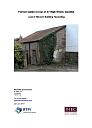
| Name: | Former stable to the rear of 37 High Street, Dawlish |
|---|
Summary
Stable erected between 1888 and 1905. The site was previosuly occupied by an Icen Cottage.
Location
| Grid Reference: | SX 960 767 |
|---|
| Map Sheet: | SX97NE |
|---|
| Admin Area | Devon |
|---|
| Civil Parish | Dawlish |
|---|
| District | Teignbridge |
|---|
| Ecclesiastical Parish | DAWLISH |
|---|
Protected Status: none recorded
Other References/Statuses: none recorded
Monument Type(s) and Dates
- STABLE (Built, XIX to XX - 1888 AD to 1905 AD (Between))
Full description
Ordnance Survey, 1904 - 1906, Second Edition Ordnance Survey 25 inch Map (Cartographic). SDV325644.
Stable first present on OS 25inch map.
White, N., 2019, Former stable at rear of 37 High Street, Dawlish: Historic Buiding Recording (Report - Survey). SDV363138.
A historic building recording of the former stable to the rear of 37 High Street, Dawlish was undertaken by Nils White Conservation.
The stable is a small rectangular building built of concrete block and brick (the presence of sea shells suggests it was collected from a nearby beach), with a timber first floor structure and a single-pitch tile roof. The floor is predominantly cobbled.
The site is clearly marked on the Ordnance Survey maps of the late 19th and early 20th centuries. Based on these maps, it appears the stable was erected between 1888 and 1905. The 1888 map shows that the site was previously occupied by a house marked Icen Cottage. It is assumed due to the similarities in blockwork and brick construction that the building was erected at the same time as no. 43.
Ordnance Survey, 2019, MasterMap 2019 (Cartographic). SDV362729.
Sources / Further Reading
| SDV325644 | Cartographic: Ordnance Survey. 1904 - 1906. Second Edition Ordnance Survey 25 inch Map. Second Edition Ordnance Survey 25 inch Map. Map (Digital). |
| |
| | |
| SDV362729 | Cartographic: Ordnance Survey. 2019. MasterMap 2019. Ordnance Survey Digital Mapping. Digital. [Mapped feature: #121869 ] |
| |
| | |
| SDV363138 | Report - Survey: White, N.. 2019. Former stable at rear of 37 High Street, Dawlish: Historic Buiding Recording. NW Conservation. Digital. |
| |  |
| | Linked documents:1 |
Associated Monuments: none recorded
Associated Finds: none recorded
Associated Events
- EDV8150 - Historic Building Recording: Former stable at rear of 37 High Street, Dawlish
| Date Last Edited: | Sep 19 2019 11:45AM |
|---|
Search results generated by the HBSMR Gateway from exeGesIS SDM Ltd.