See important
guidance on the use of this record.
If you have any comments or new information about this record, please email us.
| HER Number: | MDV15991 |
|---|
| Name: | Relict Field System at North Park, Widworthy Court |
|---|
Summary
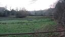
A series of long narrow fields running south from the road may reflect a former medieval open field system. A nmber of boundaries are clearly visible as curvilinear cropmarks and earthworks on aerial photographs taken from 1976 onwards and images derived from lidar data captured in 2016.
Location
| Grid Reference: | SY 206 998 |
|---|
| Map Sheet: | SY29NW |
|---|
| Admin Area | Devon |
|---|
| Civil Parish | Widworthy |
|---|
| District | East Devon |
|---|
| Ecclesiastical Parish | WIDWORTHY |
|---|
Protected Status: none recorded
Other References/Statuses
- Old DCC SMR Ref: SY29NW/79
Monument Type(s) and Dates
- FIELD SYSTEM (Early Medieval to Post Medieval - 1066 AD to 1750 AD (Between))
Full description
APH, Untitled Source (Report - Survey). SDV101105.
Vis=10/5/1996 (horner) boundaries showing up clearly as soil marks indicating active erosion (aph).
Untitled Source (Migrated Record). SDV101106.
Des=griffith, f. M. /as above.
Untitled Source (Aerial Photograph). SDV101107.
Aph=raf/cpe/uk/1974 11 april 1947 no.1437/dcc no.30/99.
Untitled Source (Migrated Record). SDV101108.
Des=timms, s. C. /as above.
Untitled Source (Migrated Record). SDV101109.
Dro=281m/e4/copy in parish file.
Untitled Source (Migrated Record). SDV101110.
Des=tithe map(1839)/in dro.
Untitled Source (Migrated Record). SDV101111.
Dro=281 m/e 2/(survey book 1805-1806).
Untitled Source (Migrated Record). SDV101112.
Des=griffiths, d. M. /as above.
Untitled Source (Migrated Record). SDV101113.
Des=griffith, f. /as above/(10/5/1996).
Untitled Source (Aerial Photograph). SDV101114.
Aph=dap/zb00-3/(10/5/1996).
Untitled Source (Aerial Photograph). SDV101115.
Aph=slide/(10/5/1996)/in smr.
Untitled Source (Migrated Record). SDV3991.
These earthworks are the boundaries of properties on the south side of the main road which were cleared before the construction of widworthy court and its park in c.1830. A detailed plan in dro shows these properties prior to clearance.(timms).
Griffith, F. M., Untitled Source (Report - Survey). SDV677.
Vis=16/5/1982 (griffith). A series of lynchets or banks running north-south in fields north of widworthy court, seen in low evening light from car travelling west. Area shown as "north park" on os 6" 1963, very slightly visible on raf 1947 ap.
DMG, Untitled Source (Migrated Record). SDV68198.
The plan (of 1780) shows long narrow fields running southwards back from the road, this area later became north park. The survey book of 1805-1806 gives the names of four of these strips as "street furland". At this time the strips were held by a number of different tenants.(dro). Possible remains of open field system? (dmg).
Devon County Council, 1838-1848, Tithe Mosaic, approximately 1838-1848 (Cartographic). SDV349431.
No field boundaries are depicted in this exact location.
Ordnance Survey, 1976, OS/76051, OS/76051 V 003-004 08-MAY-1976 (Aerial Photograph). SDV359323.
Parallel curvilinear pale cropmarks are vsible.
Ordnance Survey, 1989, OS/89038, OS/89038 V 217-218 07-MAR-1989 (Aerial Photograph). SDV359507.
Curvilinear earthwork banks are visible.
Ordnance Survey, 1996, OS/96602, OS/96602 V 003-004 06-JUN-1996 (Aerial Photograph). SDV355897.
Curvilinear pale cropmarks are visible.
Exeter Archaeology, 2003-2004, East Devon Area of Outstanding Natural Beauty Archaeological Survey, Site No. 957 (Archive - Survey). SDV351568.
Former series of long narrow fields running south from road possibly reflecting remains of open field system. Depicted on plan of 1780 but cleared before construction of Widworthy Court and its park in c. 1830; area is part of North Park. Visible on Aerial Photographs, and from ground in certain conditions.
SMR.
Bluesky International, 2016, LiDAR DTM data (0.5m resolution) Blackdown Hills and East Devon AONBs: 3 transects, LIDAR SY2099 Bluesky International DTM 24 & 30-APR-2016 (Cartographic). SDV359714.
Parallel curvilinear earthwork banks are visible.
Hegarty, C. + Knight, S. + Sims, R., 2016-2018, The Blackdown Hills AONB and East Devon River Catchments National Mapping Programme Project (Interpretation). SDV359463.
A series of pale curvilinear cropmarks are most clearly visible on aerial photographs taken from 1976 onwards, and as earthworks on aerial photographs taken from 1989 and images derived from lidar data captured in 2016. They are 2 to 5 metres in width and approximately 20 to 36 metres apart. They are interpreted as medieval boundaries that went out of use when the area around Widworthy Court was emparked in the early-19th century, but appear to have survived as earthworks.
Hegarty, C., Knight, S. and Sims, R., 2016-2018, The Blackdown Hills AONB and East Devon River Catchments National Mapping Programme Project Site Visit, 07-FEB-2018 (Site Visit). SDV359588.
Some earthworks are visible as slight banks.
Sources / Further Reading
| SDV101105 | Report - Survey: APH. |
| |
| | |
| SDV101106 | Migrated Record: |
| SDV101107 | Aerial Photograph: |
| |
| | |
| SDV101108 | Migrated Record: |
| SDV101109 | Migrated Record: |
| SDV101110 | Migrated Record: |
| SDV101111 | Migrated Record: |
| SDV101112 | Migrated Record: |
| SDV101113 | Migrated Record: |
| SDV101114 | Aerial Photograph: |
| |
| | |
| SDV101115 | Aerial Photograph: |
| |
| | |
| SDV349431 | Cartographic: Devon County Council. 1838-1848. Tithe Mosaic, approximately 1838-1848. Digitised Tithe Map. Digital. |
| |
| | |
| SDV351568 | Archive - Survey: Exeter Archaeology. 2003-2004. East Devon Area of Outstanding Natural Beauty Archaeological Survey. East Devon Area of Outstanding Natural Beauty Archaeological Survey. Digital + Mixed Archive Material. Site No. 957. |
| |
| | |
| SDV355897 | Aerial Photograph: Ordnance Survey. 1996. OS/96602. Ordnance Survey. Photograph (Paper). OS/96602 V 003-004 06-JUN-1996. [Mapped feature: #81705 ] |
| |
| | |
| SDV359323 | Aerial Photograph: Ordnance Survey. 1976. OS/76051. Ordnance Survey Aerial Photograph. Photograph (Paper). OS/76051 V 003-004 08-MAY-1976. |
| |
| | |
| SDV359463 | Interpretation: Hegarty, C. + Knight, S. + Sims, R.. 2016-2018. The Blackdown Hills AONB and East Devon River Catchments National Mapping Programme Project. Historic England Research Report. Digital. |
| |  |
| | Linked documents:2 |
| SDV359507 | Aerial Photograph: Ordnance Survey. 1989. OS/89038. Ordnance Survey. Photograph (Paper). OS/89038 V 217-218 07-MAR-1989. |
| |
| | |
| SDV359588 | Site Visit: Hegarty, C., Knight, S. and Sims, R.. 2016-2018. The Blackdown Hills AONB and East Devon River Catchments National Mapping Programme Project Site Visit. AC Archaeology. Photograph (Digital). 07-FEB-2018. |
| |  |
| | Linked images:18 |
| SDV359714 | Cartographic: Bluesky International. 2016. LiDAR DTM data (0.5m resolution) Blackdown Hills and East Devon AONBs: 3 transects. Not applicable. Digital. LIDAR SY2099 Bluesky International DTM 24 & 30-APR-2016. |
| |
| | |
| SDV3991 | Migrated Record: |
| SDV677 | Report - Survey: Griffith, F. M.. |
| |
| | |
| SDV68198 | Migrated Record: DMG. |
Associated Monuments
| MDV18562 | Related to: Widworthy Court, Widworthy (Building) |
Associated Finds: none recorded
Associated Events
- EDV7508 - The Blackdown Hills AONB and East Devon River Catchments National Mapping Programme (NMP) project (Ref: ACD1228)
| Date Last Edited: | Apr 14 2021 3:46PM |
|---|
Search results generated by the HBSMR Gateway from exeGesIS SDM Ltd.