See important
guidance on the use of this record.
If you have any comments or new information about this record, please email us.
| HER Number: | MDV49756 |
|---|
| Name: | Possible Stock Enclosure or Pound on North Hill |
|---|
Summary
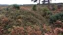
An oval banked enclosure is visible on aerial photographs taken from 1947 to 2010, as an earthwork then dark cropmark, and as a slight ditch on images derived from lidar data captured in 2010. It is tentatively interpreted as a stock enclosure within the 19th-century Upcott Pen, although more work is required to determine its character and origin.
Location
| Grid Reference: | ST 098 062 |
|---|
| Map Sheet: | ST00NE |
|---|
| Admin Area | Devon |
|---|
| Civil Parish | Broadhembury |
|---|
| District | East Devon |
|---|
| Ecclesiastical Parish | BROADHEMBURY |
|---|
Protected Status: none recorded
Other References/Statuses
- Old DCC SMR Ref: ST00NE/80
Monument Type(s) and Dates
- POUND (Post Medieval - 1540 AD to 1750 AD (Between))
Full description
1906, Untitled Source (Migrated Record). SDV136013.
Neat oval earthwork visible on raf 1947 ap. Possibly a modern landscape feature (aph). Not marked on os 6"(1906) map (os).
Untitled Source (Aerial Photograph). SDV136014.
Aph=raf/cpe/uk/1974/4452-3/(11/4/1947).
Untitled Source (Migrated Record). SDV136015.
Des=os 6"(1906)58nw.
Ordnance Survey, 1880-1899, First Edition Ordnance 25 inch map (Cartographic). SDV336179.
No oval feature is depicted, but a large rectangular field parcel here is named 'Upcott Pen'.
Royal Air Force, 1947, RAF/CPE/UK/1974, RAF/CPE/UK/1974 FP 4452-4453 11-APR-1947 (Aerial Photograph). SDV356127.
An oval banked enclosure is visible as an earthwork.
Environment Agency, 2005-2012, LiDAR DTM data JPEG image (1m resolution), LIDAR ST0906 Environment Agency JPEG DTM 05-MAR-2010 (Cartographic). SDV357033.
A slight oval shaped ditch is visible as an earthwork.
Next Perspectives, 2010, Aerial Photography for Great Britain, Next Perspectives PGA Imagery ST0906 22-MAY-2010 (Aerial Photograph). SDV356259.
A dark oval cropmark is visible.
Hegarty, C. + Knight, S. + Sims, R., 2014-2015, East and Mid Devon River Catchments National Mapping Programme Project (Interpretation). SDV356883.
The feature recorded in source SDV136013 is visible on aerial photographs taken from 1947 to 2010, initially as an oval banked enclosure of circa 15 by 25 metres, then as a dark cropmark. A slight ditch is just discernible on images derived from lidar data captured in 2010. It corresponds to the cropmark, suggesting that the bank had been levelled but that some earthwork remains of a narrow surrounding ditch may survive. No earthworks were visible during a site visit undertaken in 2014, but vegetation may have obscured the remains. The feature is not depicted on the available historic maps, but a trapezoidal enclosure named as Upcott Penn is depicted on the late 19th-century mapping, and although now removed it shows clearly as a dark cropmark similar in shade and width to the oval enclosure on aerial photographs taken in 2010. It is possible that the oval earthwork functioned as a stock pen within this larger enclosure. A post-medieval or nineteenth century date would be feasible, although more work is required to determine its character and origin.
Hegarty, C., Knight, S. and Sims, R., 2014-2015, East and Mid Devon River Catchments National Mapping Programme Project Site Visit, 18-DEC-2014 (Site Visit). SDV357653.
No earthwork features were visible during a site visit on 18th December 2014.
Sources / Further Reading
| SDV136013 | Migrated Record: 1906. |
| SDV136014 | Aerial Photograph: |
| |
| | |
| SDV136015 | Migrated Record: |
| SDV336179 | Cartographic: Ordnance Survey. 1880-1899. First Edition Ordnance 25 inch map. First Edition Ordnance Survey 25 inch Map. Map (Digital). |
| |
| | |
| SDV356127 | Aerial Photograph: Royal Air Force. 1947. RAF/CPE/UK/1974. Royal Air Force Aerial Photograph. Photograph (Paper). RAF/CPE/UK/1974 FP 4452-4453 11-APR-1947. [Mapped feature: #93570 ] |
| |
| | |
| SDV356259 | Aerial Photograph: Next Perspectives. 2010. Aerial Photography for Great Britain. Aerial Photography for Great Britain Aerial Photographs. Digital. Next Perspectives PGA Imagery ST0906 22-MAY-2010. |
| |
| | |
| SDV356883 | Interpretation: Hegarty, C. + Knight, S. + Sims, R.. 2014-2015. East and Mid Devon River Catchments National Mapping Programme Project. AC Archaeology Report. Digital. |
| |  |
| | Linked documents:1 |
| SDV357033 | Cartographic: Environment Agency. 2005-2012. LiDAR DTM data JPEG image (1m resolution). Environment Agency LiDAR data. Digital. LIDAR ST0906 Environment Agency JPEG DTM 05-MAR-2010. |
| |
| | |
| SDV357653 | Site Visit: Hegarty, C., Knight, S. and Sims, R.. 2014-2015. East and Mid Devon River Catchments National Mapping Programme Project Site Visit. AC Archaeology. Digital. 18-DEC-2014. |
| |  |
| | Linked images:9 |
Associated Monuments: none recorded
Associated Finds: none recorded
Associated Events
- EDV6530 - The East and Mid-Devon Rivers Catchment NMP project (Ref: ACD613)
| Date Last Edited: | Feb 6 2015 6:21PM |
|---|
Search results generated by the HBSMR Gateway from exeGesIS SDM Ltd.