See important
guidance on the use of this record.
If you have any comments or new information about this record, please email us.
| HER Number: | MDV49987 |
|---|
| Name: | Royal Sands Hotel, Slapton |
|---|
Summary
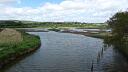
A range of buildings of post-medieval date are depicted on historic maps of approximately the 1880’s-90’s and visible as structures on aerial photographs from 1941 onwards, at the Royal Sands Hotel, Slapton Bridge.
Location
| Grid Reference: | SX 828 442 |
|---|
| Map Sheet: | SX84SW |
|---|
| Admin Area | Devon |
|---|
| Civil Parish | Slapton |
|---|
| District | South Hams |
|---|
| Ecclesiastical Parish | SLAPTON |
|---|
Protected Status: none recorded
Other References/Statuses
- Old DCC SMR Ref: SX84SW/63
Monument Type(s) and Dates
- INN (XVIII to XXI - 1751 AD to 2009 AD)
Full description
1963, Untitled Source (Migrated Record). SDV157725.
"royal sands hotel" marked on os 6" (1907) map. Not on 6" (1963) (os).
APH, Untitled Source (Migrated Record). SDV157726.
Appears as ruins on raf 1946 ap's. Possibly destroyed during wartime (pre-d. Day) manoeuvres or by marine erosion, or both (aph).
Untitled Source (Migrated Record). SDV157727.
Des=os 6" (1907) 133se.
Untitled Source (Aerial Photograph). SDV157728.
Aph=raf/cpe/uk/1890/3044-5/(10/12/1946).
Royal Air Force, 1941, RAF/1416/S314H53, NMR SX 8243/13 RAF 31214/PO-60 10-JUL-1941 (Aerial Photograph). SDV351452.
A range of buildings of the Royal Sands Hotel are visible as structures.
United States Airforce, 1943, US/7PH/GP/LOC133, US/30GR/LOC41 V 039-040 27-APR-1944 (Aerial Photograph). SDV351450.
A range of buildings of the Royal Sands Hotel are visible as structures.
United States Airforce, 1944, US/30GR/LOC41, US/30GR/LOC41 V 039-040 27-APR-1944 (Aerial Photograph). SDV351485.
The former buildings of the Royal Sands Hotel are visible as a range of demolished structures.
Royal Air Force, 1951, RAF/540/497, RAF/540/497 RS 4137-38 12-MAY-1951 (Aerial Photograph). SDV351212.
The former buildings of the Royal Sands Hotel are visible as a range of demolished structures.
Ordnance Survey, 1976, OS/76038, OS/76038 V 016-017 26-APR-1976 (Aerial Photograph). SDV351458.
The site of the former Royal Sands Hotel has been levelled.
Hegarty, C., Knight, S. and Sims, R., 2013 - 2014, South Devon Coast RCZAS National Mapping Programme Project Site Visit, February 2014 (Site Visit). SDV351142.
A wall with a depth of overburden above was visible eroding out of the shoreline at Slapton after storms early in 2014, and is probably part of the remains of the Royal Sands Hotel.
Hegarty, C. + Knight, S. + Sims, R., 2013-2014, South Devon Coast Rapid Coastal Zone Assessment Survey National Mapping Programme Project (Interpretation). SDV351146.
A range of buildings of post-medieval date are visible as structures on historic maps of approximately the 1880’s-90’s and on aerial photographs from 1941 onwards, at the Royal Sands Hotel, Slapton Bridge. The buildings remain intact on aerial photographs of 1943, although by 1944 have been given over for military training purposes in preparation for the Normandy landings where they are visible as a range of demolished structures. The demolished structures are visible on aerial photographs up to 1951 and have been completely levelled by 1976.
Hall, Q., 2019, Royal Sands Hotel (Correspondence). SDV364984.
The hotel was owned by James Thomas Cobley in the late 19th century until his death in 1907. His wife, Maria, continued living at the hotel until her death in 1910. The hotel was sold soon afterwards, passing out of family ownership.
Sources / Further Reading
| SDV157725 | Migrated Record: 1963. |
| SDV157726 | Migrated Record: APH. |
| SDV157727 | Migrated Record: |
| SDV157728 | Aerial Photograph: |
| |
| | |
| SDV351142 | Site Visit: Hegarty, C., Knight, S. and Sims, R.. 2013 - 2014. South Devon Coast RCZAS National Mapping Programme Project Site Visit. AC Archaeology. Digital. February 2014. |
| |  |
| | Linked images:48 |
| SDV351146 | Interpretation: Hegarty, C. + Knight, S. + Sims, R.. 2013-2014. South Devon Coast Rapid Coastal Zone Assessment Survey National Mapping Programme Project. AC Archaeology Report. Digital. |
| |  |
| | Linked documents:1 |
| SDV351212 | Aerial Photograph: Royal Air Force. 1951. RAF/540/497. Royal Air Force Aerial Photograph. Photograph (Paper). RAF/540/497 RS 4137-38 12-MAY-1951. |
| |
| | |
| SDV351450 | Aerial Photograph: United States Airforce. 1943. US/7PH/GP/LOC133. United States Airforce. Photograph (Paper). US/30GR/LOC41 V 039-040 27-APR-1944. |
| |
| | |
| SDV351452 | Aerial Photograph: Royal Air Force. 1941. RAF/1416/S314H53. Royal Air Force Aerial Photograph. Photograph (Paper). NMR SX 8243/13 RAF 31214/PO-60 10-JUL-1941. |
| |
| | |
| SDV351458 | Aerial Photograph: Ordnance Survey. 1976. OS/76038. Ordnance Survey Aerial Photograph. Photograph (Paper). OS/76038 V 016-017 26-APR-1976. |
| |
| | |
| SDV351485 | Aerial Photograph: United States Airforce. 1944. US/30GR/LOC41. United States Airforce. Photograph (Paper). US/30GR/LOC41 V 039-040 27-APR-1944. |
| |
| | |
| SDV364984 | Correspondence: Hall, Q.. 2019. Royal Sands Hotel. Heritage Gateway Feedback. Email. |
Associated Monuments: none recorded
Associated Finds: none recorded
Associated Events
- EDV6127 - Rapid Coastal Zone Assessment Survey National Mapping Programme (NMP) for South-West England - South Coast Devon (Ref: ACD618)
| Date Last Edited: | Aug 26 2022 10:21AM |
|---|
Search results generated by the HBSMR Gateway from exeGesIS SDM Ltd.