See important
guidance on the use of this record.
If you have any comments or new information about this record, please email us.
| HER Number: | MDV50876 |
|---|
| Name: | Pillbox S.AT.601 48 metres south of Bow Bridge, Axminster |
|---|
Summary
Open fronted breeze-block pillbox on east bank of river Axe just south of road bridge. Part of the Axminster fortified area on the Second World War Taunton Stop Line constructed in 1940. It would have covered the fields and road to the west. Visible as a small, octagonal flat-roofed structure on aerial photographs taken from 1948 onwards.
Location
| Grid Reference: | SY 290 981 |
|---|
| Map Sheet: | SY29NE |
|---|
| Admin Area | Devon |
|---|
| Civil Parish | Axminster |
|---|
| District | East Devon |
|---|
| Ecclesiastical Parish | AXMINSTER |
|---|
Protected Status: none recorded
Other References/Statuses
- National Monuments Record: SY29NE88
- National Record of the Historic Environment: 1417425
- Old DCC SMR Ref: SY29NE/198
- Pastscape: 1417425
Monument Type(s) and Dates
- ANTI TANK GUN EMPLACEMENT (Built, World War II - 1940 AD to 1940 AD)
- PILLBOX (Built, World War II - 1940 AD to 1940 AD)
Full description
Royal Air Force, 1948, RAF/CPE/UK/2431, 3199 (Aerial Photograph). SDV356746.
Royal Air Force, 1948, RAF/CPE/UK/2431, RAF/CPE/UK/2431 RP 3198-3199 22-JAN-1948 (Aerial Photograph). SDV359315.
A pale structure is visible.
Wills, H., 1985, Wills, H. 1985 Pillboxes, 74 (Monograph). SDV336210.
Rectangular, concrete, west-facing pillbox listed by Wills at SY290981
Horner, W., 1993, Pillboxes (Personal Comment). SDV109631.
Site visit 4th December 1993. Open fronted breeze-block pillbox on east bank of river Axe just south of road bridge. Covers fields and road to west.
Newbery, J. D., 1996, Gun Emplacement, Bow Bridge (Worksheet). SDV356800.
Gun emplacement south of A35 at Bow Bridge over River Axe, just west of Axminster. On eastern bank of river, approximately 20 yards south of road. Hexagonal block stone gun emplacement with two gun bays facing north-west and south, guarding river.
Dobinson, C. S., 1998, The Taunton Stop Line. Component Listing, 8 (Report - non-specific). SDV109230.
6pdr anti-tank gun emplacement, shell-proof and roofed with a steel pedestal for the gun mounting. Pillbox of type TL55.
THE DEVONSHIRE ASSOCIATION, 2008, WWII Pill Boxes in the Axe Valley, 4, 27 (Report - Survey). SDV347565.
SA/T601. 6 pounder gun emplacement. Octagonal, 20 feet across and faced with concrete blockwork. Other details: Photo and plan.
Passmore, A. + Passmore, M., 2010, Second World War Pillboxes, 3 (Leaflet). SDV345308.
Photograph of an anti-tank gun emplacement at Axminster.
Next Perspectives, 2014, Aerial Photography for Great Britain, Next Perspectives APGB Imagery SY2898 08-SEP-2014 (Aerial Photograph). SDV359479.
A pale structure is visible.
Historic England, 2015-2016, NRHE to HER prototype, 485450 (Website). SDV359652.
Summary description
A Second World War type 28 pillbox situated on the east bank of the River Axe at Bow Bridge. The pillbox was constructed in 1940-41 and constructed of brick, reinforced concrete and stone. A field visit in 2000 found the structure extant and in a fair condition.
Full description
Anti-tank gun emplacement, on E bank of River Axe, approx. 20 yards S of road. Hexagonal stone block gun emplacement with 2 gun bays facing NW and S guarding the crossing of the river.
6 pdr. gun emplacement stone-block shuttered situated on E side of River Axe with field of fire W across river. With PLAN drawn on form.
Anti-tank gun emplacement, with the strange feature of a concrete block that bisects the arc of fire from the massive main embrasure. This block may well represent a later modification.
6pdr anti-tank gun emplacement, one of sixteen on the Taunton Stop Line. The maximum range of the gun was 600 yards.
[Information from David Hunt]. At Bow Bridge (B3261 road) over River Axe, S of western approach to Axminster. (1)
Sources
1 Migrated Defence of Britain Project database record originally compiled from various sources The two databases developed by the Project can be searched on-line through the Archaeology Data Service at http://ads.ahds.ac.uk/catalogue/specColl/dob/index.cfm
Monument types, periods and evidence
Pillbox: Constructed 1940-1, Second World War. Structure
Pillbox (Type FW3/28): Constructed 1940-1, Second World War. Structure
Related monuments: 1423486
Related events: 1444724 THE DEFENCE OF BRITAIN PROJECT Measured Survey
Related archives/objects: DEB01 Defence of Britain
Record created: Prior to 01/04/1999
Ordnance Survey, 2016, MasterMap (Cartographic). SDV359352.
An irregular structure is depicted.
Hegarty, C. + Knight, S. + Sims, R., 2016-2018, The Blackdown Hills AONB and East Devon River Catchments National Mapping Programme Project (Interpretation). SDV359463.
A small octagonal flat-roofed structure, circa 6 metres across, is visible on aerial photographs taken from 1948 onwards. It is in the same location as the 1940-1941 brick, reinforced concrete and stone anti-tank gun emplacement that forms part of the Taunton Stop Line previously recorded by various other sources.
The 1948 RAF prints held by Historic England have been recorded here as an additional source because there is a possibility that the prints may have been processed differently to those held by Devon County Council. This would potentially result in images on which archaeological features show slightly differently.
The structure is depicted on the modern maps but the shape of the structure is clearer on the modern aerial photographs, where four sides of what appear to have originally been an octagonal structure are clearly visible. The north-western corner is less well-defined, perhaps indicating some collapse since 1940s, at which time the structure was more symmetrical in plan.
Hegarty, C., Knight, S. and Sims, R., 2016-2018, The Blackdown Hills AONB and East Devon River Catchments National Mapping Programme Project Site Visit, 19-JAN-2017 (Site Visit). SDV359588.
The west side of the structure appears fairly complete, although slightly eroded.
Google, 2018, Google Streetview (Website). SDV360654.
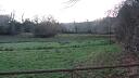
Pillbox visible in field to south of Bow Bridge, close to east bank of river.
Sources / Further Reading
| SDV109230 | Report - non-specific: Dobinson, C. S.. 1998. The Taunton Stop Line. Component Listing. Twentieth Century Fortifications in England. AI/S/3. Photocopy. 8. |
| |
| | |
| SDV109631 | Personal Comment: Horner, W.. 1993. Pillboxes. Not Applicable. |
| SDV336210 | Monograph: Wills, H.. 1985. Wills, H. 1985 Pillboxes. Pillboxes. Unknown. 74. |
| |
| | |
| SDV345308 | Leaflet: Passmore, A. + Passmore, M.. 2010. Second World War Pillboxes. A Brief Introduction to Twentieth Century Military and Civil Defence Archae. 13. A4 Folded. 3. |
| |
| | |
| SDV347565 | Report - Survey: THE DEVONSHIRE ASSOCIATION. 2008. WWII Pill Boxes in the Axe Valley. Devonshire Association. Digital + A4. 4, 27. |
| |
| | |
| SDV356746 | Aerial Photograph: Royal Air Force. 1948. RAF/CPE/UK/2431. Royal Air Force Aerial Photograph. Photograph (Paper). 3199. |
| |
| | |
| SDV356800 | Worksheet: Newbery, J. D.. 1996. Gun Emplacement, Bow Bridge. Defence of Britain Project. Worksheet + Digital. |
| SDV359315 | Aerial Photograph: Royal Air Force. 1948. RAF/CPE/UK/2431. Royal Air Force Aerial Photograph. Photograph (Paper). RAF/CPE/UK/2431 RP 3198-3199 22-JAN-1948. |
| |
| | |
| SDV359352 | Cartographic: Ordnance Survey. 2016. MasterMap. Ordnance Survey Digital Mapping. Digital. |
| |
| | |
| SDV359463 | Interpretation: Hegarty, C. + Knight, S. + Sims, R.. 2016-2018. The Blackdown Hills AONB and East Devon River Catchments National Mapping Programme Project. Historic England Research Report. Digital. |
| |  |
| | Linked documents:2 |
| SDV359479 | Aerial Photograph: Next Perspectives. 2014. Aerial Photography for Great Britain. Digital. Next Perspectives APGB Imagery SY2898 08-SEP-2014. [Mapped feature: #93820 ] |
| |
| | |
| SDV359588 | Site Visit: Hegarty, C., Knight, S. and Sims, R.. 2016-2018. The Blackdown Hills AONB and East Devon River Catchments National Mapping Programme Project Site Visit. AC Archaeology. Photograph (Digital). 19-JAN-2017. |
| |  |
| | Linked images:18 |
| SDV359652 | Website: Historic England. 2015-2016. NRHE to HER prototype. https://nrhe-to-her.esdm.co.uk/home. Website. 485450. |
| |
| | |
| SDV360654 | Website: Google. 2018. Google Streetview. http://maps.google.co.uk. Website. |
| |
| | |
Associated Monuments
| MDV45243 | Part of: Axminster Strong Point on the Taunton Stop Line (Monument) |
| MDV119535 | Part of: Taunton Stop Line (Monument) |
Associated Finds: none recorded
Associated Events
- EDV4919 - Site Visit to Pillboxes and Anti-Tank Obstacles Near Axminster
- EDV5167 - Survey of Pillboxes in the Axe Valley
- EDV7508 - The Blackdown Hills AONB and East Devon River Catchments National Mapping Programme (NMP) project (Ref: ACD1228)
| Date Last Edited: | Aug 17 2018 2:42PM |
|---|
Search results generated by the HBSMR Gateway from exeGesIS SDM Ltd.