See important
guidance on the use of this record.
If you have any comments or new information about this record, please email us.
| HER Number: | MDV55661 |
|---|
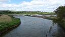
| Name: | D-Day slipways, Torquay New Harbour |
|---|
Summary
Two wide reinforced concrete slipways constructed in 1943 for Operation Overlord and which are visible as structures on aerial photographs taken in 1944. They are considered to be possibly the best surviving example of D-Day fabric in the country.
Location
| Grid Reference: | SX 917 631 |
|---|
| Map Sheet: | SX96SW |
|---|
| Civil Parish | Torbay |
|---|
| District | Torbay |
|---|
| Ecclesiastical Parish | TORMOHAM |
|---|
Protected Status
Other References/Statuses
- National Monuments Record: 1354564
- Old DCC SMR Ref: SX96SW/23/1
- Torbay HER: MTO55661
- Torbay HER: MTO55661
Monument Type(s) and Dates
- DOLPHIN (World War II - 1943 AD to 1943 AD)
- EMBARKATION HARD (Constructed, World War II - 1943 AD to 1943 AD)
- SLIPWAY (Constructed, World War II - 1943 AD to 1943 AD)
Full description
Royal Air Force, 1941, RAF/S455, RAF/S455 V 3-4 29-AUG-1941 (Aerial Photograph). SDV352355.
No slipways are visible.
United States Airforce, 1944, US/7PH/GP/LOC147, RAF/US/7PH/GP/LOC147 F24 5016-5017 20-JAN-1944 (Aerial Photograph). SDV351618.
The embarkation hards and dolphins are visible as structures.
Royal Air Force, 1946, RAF/3G/TUD/UK/223, RAF/3G/TUD/UK223 5095-5096 12-JUL-1946 (Aerial Photograph). SDV352279.
The embarkation hards and dolphins are visible as structures.
Royal Air Force, 1946 - 1949, Royal Air Force Aerial Photographs (Aerial Photograph). SDV342938.
Slipways visible.
Royal Air Force, 1947, RAF/CPE/UK/2105, RAF/CPE/UK/2105 3003-3004 28-MAY-1947 (Aerial Photograph). SDV351151.
Some of the mooring points have gone.
RAF, 1949, RAF/58/209 Vp2, RAF/58/209 5031-5032 15-APR-1949 (Aerial Photograph). SDV352287.
The mooring points are not visible.
Dobinson, C. S., 1996, Twentieth Century Fortifications in England: Volume V (Monograph). SDV362287.
Channel Coast Observatory, 2001-2012, Channel Coast Observatory Aerial Photography, Channel Coastal Observatory SX9163_20120918ortho.ecw 18-SEP-2012 (Aerial Photograph). SDV351226.
The embarkation hards are clearly visible and the harbour area has been redeveloped.
Oliver, G., 2003, Chairman’s Annual Report 2003 (Article in Serial). SDV364246.
The Torquay Harbour D-Day slipways are considered to be of great importance.
Hegarty, C., Knight, S. and Sims, R., 2013 - 2014, South Devon Coast RCZAS National Mapping Programme Project Site Visit, 04-SEP-2013 (Site Visit). SDV351142.
Railings prevent access onto the slipways, which appear intact although in parts the concrete is crumbling and the reinforcing rods have started to rust.
Hegarty, C. + Knight, S. + Sims, R., 2013-2014, South Devon Coast Rapid Coastal Zone Assessment Survey National Mapping Programme Project (Interpretation). SDV351146.
The earliest available aerial photographs on which the embarkation hards and dolphins are visible as structures date to 1944; no slipways of any kind are visible here on aerial photographs taken in 1941. The dolphins do not appear to have been maintained after the war, some mooring points seem to have been removed or collapsed by 1947, and none are visible by 1949. The embarkation hards are clearly visible in 2012, by which date the harbour area to the east had been redeveloped with the ‘vanishing point’ public artwork.
Historic England, 2021, National Heritage List for England, 1382072 (National Heritage List for England). SDV364016.
D-Day embarkation slipways and section of quay wall. 1943. Reinforced concrete. The 2 slipways consist of square columns supporting principal beams, running parallel to the face of the quay, which in turn support secondary beams running out from the quay wall down the slope perpendicular to the quay. The decking running down from the wall to the water consists of pre-cast slabs laid perpendicular to the line of the quay supported on both the primary and secondary beams. The section of the wall between the slipways has a mooring post.
HISTORY. These slipways were constructed running out from the quay wall as part of Operation Overlord, the springboard for the Allied invasion of German-occupied Europe, by Royal Engineers, 931 Port Construction and Repair Company and were completed on 28th May 1943. The American troops of 4th Division of 7 Corps used the slipways to embark for the crossing to 'Utah' beach in Normandy for the D-Day landings. From a string of such embarkation sites between 6th June and 30th June 1944 over 850,000 men were landed on the invasion beach-heads, together with nearly 150,000 vehicles and 570,000 tons of supplies. Extremely rare survivals, these slipways are possibly the best-surviving example of D-Day fabric in the country and form part of a significant group of listed structures.
Date first listed: 6th January 2000
<1> Jury, R., 1995, Torquay D-Day slipways (Worksheet). SDV362301.
Site visit 20th November 1995. Two wide slipways at Torquay New Harbour. Built for embarcation of men and vehicles for D-Day.
Sources / Further Reading
| SDV342938 | Aerial Photograph: Royal Air Force. 1946 - 1949. Royal Air Force Aerial Photographs. Royal Air Force Aerial Photograph. Photograph (Digital). [Mapped feature: #130197 ] |
| |
| | |
| SDV351142 | Site Visit: Hegarty, C., Knight, S. and Sims, R.. 2013 - 2014. South Devon Coast RCZAS National Mapping Programme Project Site Visit. AC Archaeology. Digital. 04-SEP-2013. |
| |  |
| | Linked images:48 |
| SDV351146 | Interpretation: Hegarty, C. + Knight, S. + Sims, R.. 2013-2014. South Devon Coast Rapid Coastal Zone Assessment Survey National Mapping Programme Project. AC Archaeology Report. Digital. |
| |  |
| | Linked documents:1 |
| SDV351151 | Aerial Photograph: Royal Air Force. 1947. RAF/CPE/UK/2105. Royal Air Force Aerial Photograph. Photograph (Paper). RAF/CPE/UK/2105 3003-3004 28-MAY-1947. |
| |
| | |
| SDV351226 | Aerial Photograph: Channel Coast Observatory. 2001-2012. Channel Coast Observatory Aerial Photography. Channel Coast Observatory. Digital. Channel Coastal Observatory SX9163_20120918ortho.ecw 18-SEP-2012. |
| |
| | |
| SDV351618 | Aerial Photograph: United States Airforce. 1944. US/7PH/GP/LOC147. United States Airforce. Photograph (Paper). RAF/US/7PH/GP/LOC147 F24 5016-5017 20-JAN-1944. |
| |
| | |
| SDV352279 | Aerial Photograph: Royal Air Force. 1946. RAF/3G/TUD/UK/223. Royal Air Force Aerial Photograph. Photograph (Paper). RAF/3G/TUD/UK223 5095-5096 12-JUL-1946. |
| |
| | |
| SDV352287 | Aerial Photograph: RAF. 1949. RAF/58/209 Vp2. Royal Air Force Aerial Photograph. Print. RAF/58/209 5031-5032 15-APR-1949. |
| |
| | |
| SDV352355 | Aerial Photograph: Royal Air Force. 1941. RAF/S455. Royal Air Force Aerial Photograph. Photograph (Paper). RAF/S455 V 3-4 29-AUG-1941. |
| |
| | |
| SDV362287 | Monograph: Dobinson, C. S.. 1996. Twentieth Century Fortifications in England: Volume V. Twentieth Century Fortifications in England. Volume V: Operation Overlord. |
| |
| | |
| SDV364016 | National Heritage List for England: Historic England. 2021. National Heritage List for England. Digital. 1382072. |
| |
| | |
| SDV364246 | Article in Serial: Oliver, G.. 2003. Chairman’s Annual Report 2003. Devon Historic Buildings Trust . Annual Report 2002/2003. A4 Stapled + Digital. |
| |
| | |
| SDV362301 | Worksheet: Jury, R.. 1995. Torquay D-Day slipways. Defence of Britain Project. Worksheet. |
Associated Monuments
| MDV9761 | Part of: New Harbour, Beacon Quay, Torquay (Monument) |
Associated Finds: none recorded
Associated Events
- EDV6127 - Rapid Coastal Zone Assessment Survey National Mapping Programme (NMP) for South-West England - South Coast Devon (Ref: ACD618)
- EDV7755 - Defence of Britain site visits
- EDV7855 - Archaeological Assessment by EA - May 1999
| Date Last Edited: | May 7 2021 3:27PM |
|---|
Search results generated by the HBSMR Gateway from exeGesIS SDM Ltd.