| Name: | Radar Tower, Coalhouse Point |
|---|
| SMR Number: | 10296 |
|---|
| Type of record: | Monument |
|---|
| Grid Reference: | TQ 689 762 |
|---|
| Map Sheet: | TQ67NE |
|---|
| Parish: | THURROCK, ESSEX |
|---|
Summary
Hexagonal radar tower standing on the N bank of the River Thames.
Full description
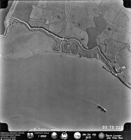
1994: Massive radar tower standing on the N bank of the River Thames. It is hexagonal, approximately 30' wide x 60' high and comprises three levels. The ground level is brick-built with two entrances leading to five rooms. The middle level comprises criss-crossed girders and an iron staircase leading to the third level which is constructed of concrete and once housed the aerial array. At the time of the site visit this level was inaccessible. <1> The site was, apparently, manned by naval personnel during WWII - possibly with a type N.T. 284 instrument which is described in War Office records as having been established for minefield observation. <2> Three photos of site. <3>
Site Assessment = The second and third levels are inaccessible without a ladder.
2011: In 2010, two similar naval radar towers were surveyed and recorded at Tollesbury (EHER 10726) and Beacon Hill, Harwich (EHER 55). Each is hexagonal, three-storey, on an estuary, but not entirely the same pattern. See the individual records for more details. Each is variously stated as anti-shipping, Radar Direction Finding or radar site, probably built in 1940 / 41, manned by Royal Navy personnel, with a Type 284 or 287 RDF set. Twenty-two photographs were taken of the Tollesbury tower in June 2010. <5> Twenty-three photographs were taken of the Beacon Hill tower in July 2010. <6>
August 2012: A low-level, oblique aerial photograph at the National Monument Record shows the radar tower apparently newly-built. The date is 18 August 1941. <8>
<1> Smith, VTC, unknown, Coalhouse Fort & the Artillery Defences at East Tilbury, pp35,37 (DESC TEXT). SEX31823.
<2> Smith, VTC, unknown, Coalhouse Fort & the Artillery Defences at East Tilbury, p30 (DESC TEXT). SEX31823.
<3> Nash, Fred, 1996, WWII defences, three frames June 1994 (Photograph). SEX31461.
<4> unknown, 1975, 223 (AP). SEX58328.
<5> Nash, Fred, 2010, Tollesbury Watch Tower, June 2010 (Photograph). SEX70034.
<6> Nash, Fred, 2010, Harwich Radar tower, July 2010 (Photograph). SEX70035.
<7> Smith, Joanna, 2007, East Tilbury, Essex - Historic Area Appraisal, mentioned in appraisal (DESC TEXT). SEX70042.
<8> RAF, 1941, BR82-07543, August 1941 (AP). SEX71267.
Monument Types
- RADAR STATION (WWII, Modern - 1939 AD to 1945 AD)
Associated Events
- Thurrock Unitary Authority WWII site survey by Fred Nash August 2012 (Ref: Nash THU Aug 2012)
Protected Status
- Scheduled Monument () 1013943: Coalhouse Fort battery and artillery defences
- Historic Environment Character Zone: Thames Gateway 117_1
- Historic Environment Character Area: Thames Gateway 117
Sources and further reading
| <1> | DESC TEXT: Smith, VTC. unknown. Coalhouse Fort & the Artillery Defences at East Tilbury. pp35,37. |
| <2> | DESC TEXT: Smith, VTC. unknown. Coalhouse Fort & the Artillery Defences at East Tilbury. p30. |
| <3> | Photograph: Nash, Fred. 1996. WWII defences. three frames June 1994. |
| <4> | AP: unknown. 1975. 223. |
| <5> | Photograph: Nash, Fred. 2010. Tollesbury Watch Tower. June 2010. |
| <6> | Photograph: Nash, Fred. 2010. Harwich Radar tower. July 2010. |
| <7> | DESC TEXT: Smith, Joanna. 2007. East Tilbury, Essex - Historic Area Appraisal. mentioned in appraisal. |
| <8> | AP: RAF. 1941. BR82-07543. August 1941. |
Related records
| 55 | Related to: Beacon Hill Fort (Monument) |
| 45786 | Related to: Coalhouse Wharf and Coastguard Station (Monument) |
| 1757 | Related to: East Tilbury - Coalhouse Point, Site of 1540 blockhouse (Monument) |
| 10726 | Related to: Naval Watchtower, Tollesbury (Monument) |
Images
 Radar Tower, Coalhouse Point © Essex County Council | |
Search results generated by the HBSMR Gateway from exeGesIS SDM Ltd.