| Name: | East Tilbury - Coalhouse Fort |
|---|
| SMR Number: | 1761 |
|---|
| Type of record: | Monument |
|---|
| Grid Reference: | TQ 569 176 |
|---|
| Map Sheet: | TQ51NE |
|---|
| Parish: | East Tilbury, THURROCK, ESSEX |
|---|
| THURROCK, ESSEX |
|---|
Summary
By 1903 part of the casemated front was earthed up in an effort to disguise the stark profile and 4 x Mk.7 6-in.
Full description
1962: The site of Coalhouse Fort was first designated a scheduled monument on 9 Auust 1962. Reference EX128. <18>
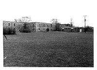
1985: "By 1903 part of the casemated front was earthed up in an effort to disguise the stark profile and 4 x Mk.7 6-in. B.L. guns (range 7 miles) and 4 x 12- pdr. B.L. (Q.F.) (range 4.5 miles) were added in concrete emplacements on the roof". <1> During WWII the fort was designated an examination battery to check incoming vessels. <2> "Although Coalhouse Fort seems to have retained its 6-in. guns in the 1930s and there is a suggestion of a 6-in. high-angle gun (capable of 70 degree elevation) having been temporarily mounted there, in July 1940 2 x 5.5-in. former naval guns were provided in their place. These guns, ex HMS Hood, had a range of 12,500 yards and were mounted in shelters on the roof of the casemates, utilizing the right-hand pair of the older 6-in. emplacements." "To permit night firing, there were two…..remotely-controlled 120cm searchlights…..on the north caponier" "Two light anti-aircraft guns were mounted on the roof of the casemates, one of these being a Bofors 40-mm. emplaced in August 1943. The perimeter of the fort was prepared for defence against ground assault by the provision of belts of barbed wire, trenches and, at the gorge, two spigot mortar positions (these were probably placed here from different locations in the 1960's, see EHER 10297). A nearby electrically-fired minefield in the river was apparently controlled from the still surviving detached concrete observation tower built to the front of the casemates (see SMR 10299)" "For a while during the war, the fort had an additional role as a naval monitoring station to check that the electronic countermeasures of outgoing ships against German magnetic mines remained effective. Shipping passed over submerged sensors in the river which were linked by cables to the monitoring station in the brick building on the roof of the fort between the two 5.5-in. emplacements. Detection equipment within this building revealed whether they were within safe limits". <4> Other ref: <5> - <11>
SITE ASSESSMENT
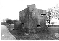
1985: This source recommended demolition of the 20th century gun emplacements from the top of the casemates as they are "both unsightly and incongruous with the style of the moated area". The external pillbox was recommended for retention as these defences are fast disappearing. <3> With other sites in the neighbourhood "Coalhouse Fort, the Quick-firing Battery and the 1940 Radar Tower give the whole area great potential for development as a major study centre for the history of the defence of the Thames from 1860 to World War II". <12> Clearing-up and restoration work began in 1983, an MSC scheme was started to help in restoration in 1984. <12> <5>
12 September 1995: The scheduling was revised. English Heritage Reference 12707 now 1013943. Coalhouse Fort is scheduled because it "is a remarkably well preserved late 19th century fort built on the recommendation of the Royal Commission on the Defence of the UK in 1860. It is one of the finest examples of an armoured casemate fort in England and is well documented historically. The jetty and railway line are an integral part of the fort. The Henrician blockhouse is well documented historically and has high archaeological potential due to waterlogging. Such a site adds to the knowledge of the coastal fortifications made by Henry VIII. The Quick-Firer battery, built in 1893, is the sole surviving purpose-built battery of its type in the Thames basin. The rifle range is an unusual survival which adds to the known range of earthwork monuments and is closely associated with the fort. Virtually intact World War II radar installations of the type at East Tilbury are known at only two other places in England, making this an extremely rare survivor of a once widespread system. The group of structures demonstrate the former strategic importance of Coalhouse Point and demonstrate the changing approaches to defence over 400 years. Furthermore the sites formed elements of wider defence systems designed to protect the Thames Estuary and especially London." <18>
Visit 2013: A website, with photographs dated 2004, details the WWII features along the rooftop. The text starts at the north end of the fort and proceeds south around the east side <16> :
"1. Loopholed wall firing position
This structure is built on the far end of the north caponier. The roof of the caponier has been formed into a 'Rifle Section Support Trench'. The outer (east) edge of the roof has been widened to 8ft and has been built up with granite blocks. Walking through the trench leads to a substructure that is approx 6ft 6" high, 7ft deep and 12ft 6" wide. Built directly on top is a superstructure which in effect is a doubled tiered, loopholed wall. It has return flanks either side of 45 degrees and stands 6ft in height. There are two rows of loopholes, 6 for standing positions and 6 for prone positions. It would be impossible to man all of the loopholes at the same time, in fact manning the standing positions could result in being shot in the foot! There is no access to the firing positions now, but the remains of a ladder were found in the 'trench' in the 1970's.
2. Depression Position Finder (DPF) position
This is the WWI battery observation post (BOP) that was later updated during WWII. It is accessed from the rear via a flight of steps. The BOP is divided into two rooms by a stud wall, one for the gunnery direction officer and the other for the searchlight controller. Above the observation slit are remains of a wooden pelmate on which a panorama would have been hung giving details of features of land and seascape with ranges on particular objects. Stencilled onto the partition wall and on the sidewalls are 'datum boards' giving information such as height (above sea level) and normal opening bearings (NOB), relating to searchlights or gunfire. Externally, remains of splinter proof, shutter type shields remain. On the floor of the BOP some elements of the pillars for the range finding equipment can be seen in the right hand corner. The rear (west) wall has a large window overlooking the parade area. Below, in the space between the floor of the BOP and the original roof of the fort would have been batteries and cables etc.
3. Gun house 1B
Gun house number 1/B. For a description please go to picture 5, gunhouse 1/A. This only differs from 1/A in a few details. On the southern side of this structure is a lookout position accessed via a 16 runged ladder. This leads to the steel two man "Air Sentry's Post". Since the majority of the observation posts on the roof look towards the Thames, this position was intended to observe any low level raiders approaching form the south or west, as well as indicating where incendiary bombs fell either in or close to the fort. This gunhouse is slightly wider to accommodate a "Dummy Loader" in the northern quarter of the floor area. A notice still shows that the Dummy Loader was Sgt Milligan S and his Limber Gunner was Gnr Wingfield H.
4. Degausing monitoring position
Degausing Control Tower. Sited between the two gunhouses and occupying a Victorian gun position (unused) is a two storie brick building. This is the Degausing Control Tower, originally (March/April 1940) this had been a small wooden shed. As winter 1940/41 approached the shed was built over by a brick structure, and the upper floor became a Visual Reporting Position. There are no remains of the stairs that joined the floors, being wood they rotted away years ago. The lower floor held a switchboard (PBX), a small library of ship data books, a teleprinter and small electric hob. The upper floor contained a wall chart of the estuary, 3 pen recorders (one for each offshore cable) a pintle for heavy binoculars, an Aldis Lamp and other signal equipment. The occupants were mostly Wrens who, in conjunction with the detachment at Cliff Fort on the opposite (Kent) bank, controlled the "Degausing loop" cables laid on the river bed. These cables indicated the effectivness of the anti-magnetic mine countermeasures. In the occasional event of vessels readings on the pen recorder indicating innsufficient anti-magnetic protection then that vessel would be ordered to the nearest degausing station for rectification.
5. Gun house 1A
Gunhouse 1A. Battery 1 (in the 1940 scheme) position A was designed to be a small fortification in its own right. Its walls are at least 15 inches thick with a reinforced concrete base that overlaps the Victorian casemates below and therefore has to supported to the rear by 7 brick and reinforced concrete pillars. The gun house is basically a retangular building with small wings either side and a sloping roof towards the rear. It has a canopy or pelmate of steel plate hung on the front face which is painted two-tone wavy deep (north sea) grey-green and light sea grey. To enclose the gun, several more sheets were hung, arranged so that they could be slid to one side as required. Into the brick walls 4 precast concrete loopholes for rifles or light machine guns were inserted during building. One to fire north, one south and a pair west into and over the fort. These loopholes could also be used for observation and sentries would be posted behind each. This gunhouse is built on the site of the WWI, 6" emplacement. During WWII a 5.5" naval gun from HMS Hood was installed, while another was placed in gunhouse 1B.
6. 1943 Bofors position
1943 Bofors emplacement. During the Second World War, the fort was equipped with two Bofors Anti-Aircraft guns. (The Bofors that is mounted on the roof) although dated 1943 has been modified in later years and is fitted on an electrically operated mounting probably from a warship. It was donated by the Gunnery School at Shoeburyness and was flown to the fort below a Chinhook helicopter a number of years ago." <16>
West of the Bofors emplacement, on the south shoulder of the fort, there is what appears to be an observation post in addition to two Coastal Artillery Searchlight Emplacements. One of these is equipped with steel shutters to enclose the searchlight aperture; the other has been converted by the addition of semi-circular brick walling around the lower part of the aperture leaving a c. 15" high slot between the top of the wall and the roof.
29 photos of site. <17>
<1> Smith, VTC, 1985, Coalhouse Fort & the Artillery Defences at East Tilbury, p21 (DESC TEXT). SEX6379.
<2> Smith, VTC, 1985, Defending London's River, p39 (DESC TEXT). SEX6380.
<3> Thurrock Local History Society, unknown, Coalhouse Fort restoration (DESC TEXT). SEX6381.
<4> Smith, VTC, 1985, Coalhouse Fort and the Artillery Defences at East Tilbury, pp26,27 (DESC TEXT). SEX6382.
<5> Priddy, DA, 1986, Excavations in Essex, 1983-4 Part of Essex Archaeology and History Volume 16, p.127, Catton, JPJ (EXCAV REPORT). SEX25466.
<6> unknown, 1975, 217, Date 1975:1 (AP). SEX6366.
<7> English Heritage, 2011-2020, National Heritage List for England, Heritage Asset 1013943 (Digital archive). SEX71357.
<8> Hedges, John D, 1976, TQ67-051, various (Photograph). SEX6384.
<9> Hedges, John D, unknown, TQ67-051, various (Photograph). SEX6368.
<10> unknown, unknown, TQ67-051, various (Photograph). SEX6369.
<11> unknown, 1984, TQ67-051, various (Photograph). SEX6370.
<12> Saunders, A, 1985, Coalhouse Fort, East Tilbury. 1861 Folly?-1985 Museum Vol 20, No 1, pp3-7 (DESC TEXT). SEX6385.
<13> Bennett, D, 1977, Handbook of Kent's Defences 1540-1945 (DESC TEXT). SEX6365.
<14> Catton, JPJ, 1988, Coalhouse Fort Project (DESC TEXT). SEX63768.
<15> Smith, Joanna, 2007, East Tilbury, Essex - Historic Area Appraisal, mentioned in appraisal (DESC TEXT). SEX70042.
<16> unknown, 2006-2009, http://coalhousefort-gallery.com/Pictures-of-Coalhouse-Fort (Digital archive). SEX71331.
<17> Nash, Fred, 2013, WWII features at Coalhouse Fort, 29 frames, May 2013 (Photograph). SEX71332.
<18> Saunders, Helen, 2016, EX16/03/054-066 (AP (Digital)). SEX73037.
<19> Saunders, Helen, 2023, EX23/01/020 (AP (Digital)). SEX74682.
<20> Saunders, Helen, 2022, EX22/07/032-033 (AP (Digital)). SEX74862.
Monument Types
- BATTERY (1895-1905, Post Medieval to Edwardian - 1895 AD to 1905 AD)
- COASTAL BATTERY (WWII, Second World War - 1939 AD to 1945 AD)
- GUN EMPLACEMENT (WWII, Second World War - 1939 AD to 1945 AD)
- PILLBOX (WWII, Second World War - 1939 AD to 1945 AD)
- SEARCHLIGHT BATTERY (WWII, Second World War - 1939 AD to 1945 AD)
Associated Events
- PART EXCAV by Catton, JPJ, 1984 (Ref: ?)
- Field visit to 1761 by Paterson, H, FMW on NOV-198 (Ref: FMW)
- Field visit to 1761 by Chant, K, FMW on OCT-1983 (Ref: FMW)
- Field visit to 1761 by Hedges, JD, CAO on JUN-1976 (Ref: ?)
- Thurrock Unitary Authority WWII site survey by Fred Nash May to June 2013 (Ref: Nash THU May-Jun 2013)
Protected Status
- Historic Environment Character Area: Thames Gateway 3
- Scheduled Monument () 1013943: Coalhouse Fort battery and artillery defences
- Historic Environment Character Area: Thames Gateway 117
- Historic Environment Character Zone: Thames Gateway 117_1
- Historic Environment Character Zone: Thames Gateway 117_2
- Historic Environment Character Zone: Thames Gateway 110_2
- Historic Environment Character Area: Thames Gateway 110
Sources and further reading
| <1> | DESC TEXT: Smith, VTC. 1985. Coalhouse Fort & the Artillery Defences at East Tilbury. p21. |
| <2> | DESC TEXT: Smith, VTC. 1985. Defending London's River. p39. |
| <3> | DESC TEXT: Thurrock Local History Society. unknown. Coalhouse Fort restoration. |
| <4> | DESC TEXT: Smith, VTC. 1985. Coalhouse Fort and the Artillery Defences at East Tilbury. pp26,27. |
| <5> | EXCAV REPORT: Priddy, DA. 1986. Excavations in Essex, 1983-4 Part of Essex Archaeology and History Volume 16. p.127, Catton, JPJ. |
| <6> | AP: unknown. 1975. 217. Date 1975:1. |
| <7> | Digital archive: English Heritage. 2011-2020. National Heritage List for England. Heritage Asset 1013943. |
| <8> | Photograph: Hedges, John D. 1976. TQ67-051. various. |
| <9> | Photograph: Hedges, John D. unknown. TQ67-051. various. |
| <10> | Photograph: unknown. unknown. TQ67-051. various. |
| <11> | Photograph: unknown. 1984. TQ67-051. various. |
| <12> | DESC TEXT: Saunders, A. 1985. Coalhouse Fort, East Tilbury. 1861 Folly?-1985 Museum Vol 20, No 1, pp3-7. |
| <13> | DESC TEXT: Bennett, D. 1977. Handbook of Kent's Defences 1540-1945. |
| <14> | DESC TEXT: Catton, JPJ. 1988. Coalhouse Fort Project. |
| <15> | DESC TEXT: Smith, Joanna. 2007. East Tilbury, Essex - Historic Area Appraisal. mentioned in appraisal. |
| <16> | Digital archive: unknown. 2006-2009. http://coalhousefort-gallery.com/Pictures-of-Coalhouse-Fort. |
| <17> | Photograph: Nash, Fred. 2013. WWII features at Coalhouse Fort. 29 frames, May 2013. |
| <18> | AP (Digital): Saunders, Helen. 2016. EX16/03/054-066. |
| <19> | AP (Digital): Saunders, Helen. 2023. EX23/01/020. |
| <20> | AP (Digital): Saunders, Helen. 2022. EX22/07/032-033. |
Related records
| 9011 | Related to: Church Green, East Tilbury (Monument) |
| 10300 | Related to: Concrete Building, Coalhouse Fort (Monument) |
| 1760 | Related to: East Tilbury - Coalhouse Fort (Monument) |
| 1758 | Related to: East Tilbury - Coalhouse Fort, Quick Firing Battery (Monument) |
| 1759 | Related to: East Tilbury - Coalhouse Fort, Quick Firing Battery (Monument) |
| 1757 | Related to: East Tilbury - Coalhouse Point, Site of 1540 blockhouse (Monument) |
| 10299 | Related to: Minefield Control Tower at Coalhouse Fort (Monument) |
| 10297 | Related to: Spigot Mortar Pedestals (2) at Coalhouse Fort (Monument) |
| 10298 | Related to: Tett Turret (destroyed), Coalhouse Fort (Monument) |
Images
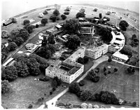 Coalhouse Fort, East Tilbury, Thurrock © Essex County Council | 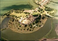 Coalhouse Fort, East Tilbury, Thurrock © Essex County Council |
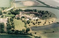 Coalhouse Fort, East Tilbury, Thurrock © Essex County Council | 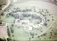 Coalhouse Fort, East Tilbury, Thurrock © Essex County Council |
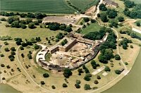 Coalhouse Fort, East Tilbury, Thurrock © Essex County Council | 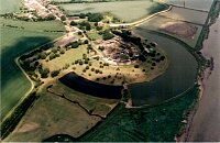 Coalhouse Fort, East Tilbury, Thurrock © Essex County Council |
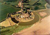 Coalhouse Fort, East Tilbury, Thurrock © Essex County Council | 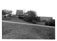 Coalhouse Fort, East Tilbury, Thurrock © Essex County Council |
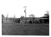 Coalhouse Fort, East Tilbury, Thurrock © Essex County Council | 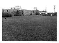 Coalhouse Fort, East Tilbury, Thurrock © Essex County Council |
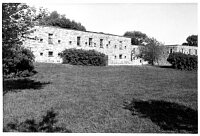 Coalhouse Fort, East Tilbury, Thurrock © Essex County Council | 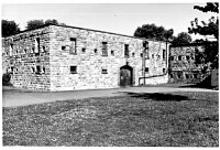 Coalhouse Fort, East Tilbury, Thurrock © Essex County Council |
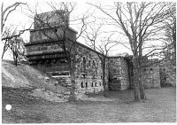 Coalhouse Fort, East Tilbury, Thurrock © Essex County Council | 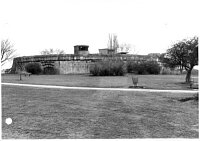 Coalhouse Fort, East Tilbury, Thurrock © Essex County Council |
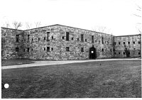 Coalhouse Fort, East Tilbury, Thurrock © Essex County Council | 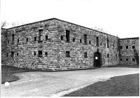 Coalhouse Fort, East Tilbury, Thurrock © Essex County Council |
 Coalhouse Fort, East Tilbury, Thurrock © Essex County Council | 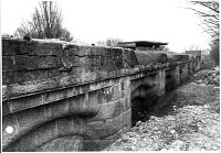 Coalhouse Fort, East Tilbury, Thurrock © Essex County Council |
 Coalhouse Fort, East Tilbury, Thurrock © Essex County Council |  Coalhouse Fort, East Tilbury, Thurrock © Essex County Council |
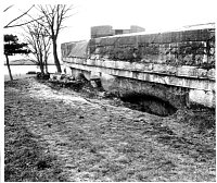 Coalhouse Fort, East Tilbury, Thurrock © Essex County Council | 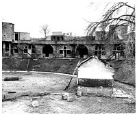 Coalhouse Fort, East Tilbury, Thurrock © Essex County Council |
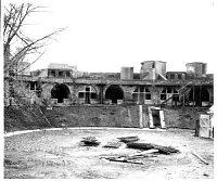 Coalhouse Fort, East Tilbury, Thurrock © Essex County Council | 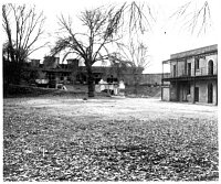 Coalhouse Fort, East Tilbury, Thurrock © Essex County Council |
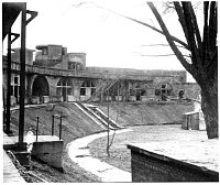 Coalhouse Fort, East Tilbury, Thurrock © Essex County Council | 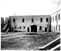 Coalhouse Fort, East Tilbury, Thurrock © Essex County Council |
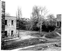 Coalhouse Fort, East Tilbury, Thurrock © Essex County Council | 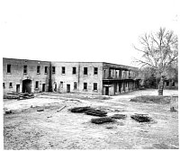 Coalhouse Fort, East Tilbury, Thurrock © Essex County Council |
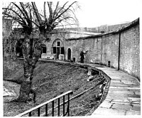 Coalhouse Fort, East Tilbury, Thurrock © Essex County Council | 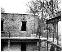 Coalhouse Fort, East Tilbury, Thurrock © Essex County Council |
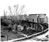 Coalhouse Fort, East Tilbury, Thurrock © Essex County Council | 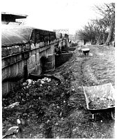 Coalhouse Fort, East Tilbury, Thurrock © Essex County Council |
 Coalhouse Fort, East Tilbury, Thurrock © Essex County Council |  Coalhouse Fort, East Tilbury, Thurrock © Essex County Council |
 Coalhouse Fort, East Tilbury, Thurrock © Essex County Council |  Coalhouse Fort, East Tilbury, Thurrock © Essex County Council |
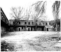 Coalhouse Fort, East Tilbury, Thurrock © Essex County Council | 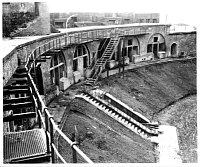 Coalhouse Fort, East Tilbury, Thurrock © Essex County Council |
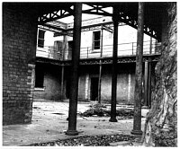 Coalhouse Fort, East Tilbury, Thurrock © Essex County Council | 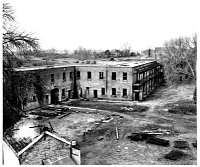 Coalhouse Fort, East Tilbury, Thurrock © Essex County Council |
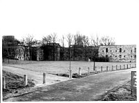 Coalhouse Fort, East Tilbury, Thurrock © Essex County Council | 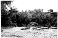 Coalhouse Fort, East Tilbury, Thurrock © Essex County Council |
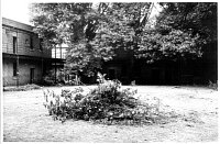 Coalhouse Fort, East Tilbury, Thurrock © Essex County Council | 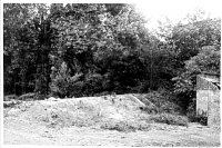 Coalhouse Fort, East Tilbury, Thurrock © Essex County Council |
 Coalhouse Fort, East Tilbury, Thurrock © Essex County Council |  Coalhouse Fort, East Tilbury, Thurrock © Essex County Council |
 Coalhouse Fort, East Tilbury, Thurrock © Essex County Council |  Coalhouse Fort, East Tilbury, Thurrock © Essex County Council |
 Coalhouse Fort, East Tilbury, Thurrock © Essex County Council |  Coalhouse Fort, East Tilbury, Thurrock © Essex County Council |
 Coalhouse Fort, East Tilbury, Thurrock © Essex County Council |  Coalhouse Fort, East Tilbury, Thurrock © Essex County Council |
 Coalhouse Fort, East Tilbury, Thurrock © Essex County Council |  Coalhouse Fort, East Tilbury, Thurrock © Essex County Council |
 Coalhouse Fort, East Tilbury, Thurrock © Essex County Council |  Coalhouse Fort, East Tilbury, Thurrock © Essex County Council |
 Coalhouse Fort, East Tilbury, Thurrock © Essex County Council |  Coalhouse Fort, East Tilbury, Thurrock © Essex County Council |
 Coalhouse Fort, East Tilbury, Thurrock © Essex County Council |  Coalhouse Fort, East Tilbury, Thurrock © Essex County Council |
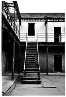 Coalhouse Fort, East Tilbury, Thurrock © Essex County Council | 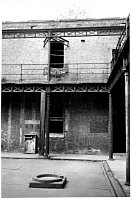 Coalhouse Fort, East Tilbury, Thurrock © Essex County Council |
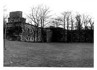 Coalhouse Fort, East Tilbury, Thurrock © Essex County Council | 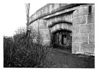 Coalhouse Fort, East Tilbury, Thurrock © Essex County Council |
 Coalhouse Fort, East Tilbury, Thurrock © Essex County Council | 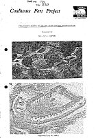 No image description available © Essex County Council |
Search results generated by the HBSMR Gateway from exeGesIS SDM Ltd.