If you think this information is inaccurate please e-mail corrections to
Hertfordshire HER
.
| HHER Number: | 1743 |
|---|
| Type of record: | Monument |
|---|
| Name: | ANTI-TANK OBSTACLES AND PARISH BOUNDARY EARTHWORK, NORTHAW |
|---|
Summary - not yet available
Images
 No image caption available © Hertfordshire County Council | |
Monument Types
- PARISH BOUNDARY (Historic: period uncertain - 410 AD to 1900 AD)
- TANK TRAP (World War II - 1939 AD to 1945 AD)
Full description
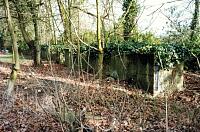
A single line of 27 concrete anti-tank obstacles (3' 6" cube-type <1>) along the west boundary of Woodlands. The line is continued to the N by a bank and ditched earthwork, apparently contemporary. Perhaps originally constructed as a defensive line to prevent tanks approaching from the W breaking through to the open grounds of Woodlands Estate and taking the Ridgeway positions at TL 2770 0384 (see [1793]) in the rear. This is the third best surviving group of anti-tank blocks in the county <2>.
Remains as described above, November 2001 <3>, and in October 2002 <4>.
The bank and ditch earthwork in fact marks the line of the parish boundary between Northaw and North Mymms. The line was disputed, and settled by Act of Parliament, in 1757 <5, 6>.
<1> Wills, Henry, 1985, Pillboxes, - p41 (Bibliographic reference). SHT4015.
<2> Fred Nash (HCC), site visit and photographs, 12.2.1992 (Unpublished document). SHT3718.
<3> Jim Apps, site visit, 25.11.2001 (Verbal communication). SHT5651.
<4> John Donovan, Correspondence, 1.10.2002 (Unpublished document). SHT2734.
<5> Information from Brian Warren, 27.10.2005 (Unpublished document). SHT5070.
<6> Map of Northaw and North Mimms boundary, 1757 (HCRO 63799) (Cartographic material). SHT4297.
Sources and further reading
| <1> | Bibliographic reference: Wills, Henry. 1985. Pillboxes. - p41. |
| <2> | Unpublished document: Fred Nash (HCC), site visit and photographs. 12.2.1992. |
| <3> | Verbal communication: Jim Apps, site visit. 25.11.2001. |
| <4> | Unpublished document: John Donovan. Correspondence. 1.10.2002. |
| <5> | Unpublished document: Information from Brian Warren. 27.10.2005. |
| <6> | Cartographic material: Map of Northaw and North Mimms boundary, 1757 (HCRO 63799). |
Search results generated by the HBSMR Gateway from exeGesIS SDM Ltd.