If you think this information is inaccurate please e-mail corrections to
Hertfordshire HER
.
| HHER Number: | 32 |
|---|
| Type of record: | Monument |
|---|
| Name: | TOOT HILL MOTTE AND BAILEY CASTLE, PIRTON |
|---|
Summary
12th century earthwork castle, which may disguise a late Saxon fortified enclosure
Images
 No image caption available © Hertfordshire County Council |  No image caption available © Hertfordshire County Council |
Monument Types
- MOTTE AND BAILEY (Medieval - 1066 AD to 1500 AD)
Protected Status
- SHINE: Pirton motte-and-bailey castle
- Scheduled Ancient Monument 13612: TOOT HILL MOTTE AND BAILEY CASTLE AND SHRUNKEN MEDIEVAL VILLAGE AT PIRTON
- Area of Archaeological Significance 21
Full description
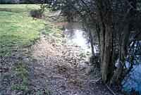
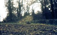
Motte 100m x 6.7m high. Summit mutilated by quarrying giving a false impression of 'breastwork' around the rim. Surrounded by a ditch c.2.5m deep, filled in to NE <1>, wet in south <2>. Trial excavation produced Saxo-Norman bowls <1>. See [1487] for the manor; the castle was put up by Ralph de Limesi or his father.
'The village lies in the middle of the parish, and is of particular interest, as it was at an early date, possibly before the Conquest, fortified by a ditch. The area inclosed, about 10 acres, was utilized later for a mount and bailey castle, the mount or 'motte' standing about 25 ft. high above the bottom of the surrounding ditch in the north-west corner of the inclosure, and the remainder of the area divided into three baileys, the largest stretching along the north side and including the church and the other two on the south. The ditches are well marked, and there is still at times a good deal of water in parts of them. This castle, unfortunately, has no history. It was probably made in the 12th century, perhaps during the anarchy of Stephen's reign, by Alan or Gerard de Limesi. There is little probability that it was ever defended by masonry walls. On the mount probably stood a timber tower, approached by a steep narrow bridge of timber from the bailey below over the ditch or moat which surrounds it. Timber palisades may have defended the surrounding outer banks of the baileys. We can only conjecture that it was dismantled by Henry II as an adulterine or unlicensed castle, hundreds of which he is said to have destroyed. When the site was abandoned by the Limesis the mount was probably used as a look-out and meetingplace of the villagers, and so came to be called Toot Hill' <3>.
It is interesting that even in 1912 it was acknowledged that the earthworks may have a pre-Norman origin; but see [16620].
The late Saxon topography has been disguised by the Norman motte and bailey; see also [746, 1487, 16620, 12426]. For a different view, see <4>: 'the surviving greens at either end of the castle enclosure - which, to judge from the configuration of building lines and property boundaries, were once significantly larger - are clearly fragments of a once much more extensive common: the lord of the manor would, of necessity, have chosen a piece of open ground as the location for the castle, rather than taking up valuable land already cultivated or occupied by houses'.
EHAS newsl 1954,n4 (Bibliographic reference). SHT11299.
Page, W (ed.), 1908, VCH Hertfordshire vol.2, - p117 (Bibliographic reference). SHT9314.
Renn, Derek, 1971, Medieval castles in Hertfordshire, - p22 (Bibliographic reference). SHT9405.
Letchworth Museum, 1988, Survey of earthworks at Great Bury, Pirton (Cartographic material). SHT6552.
Air Photo Services, 1995, Motte & bailey castle, Toot Hill, Pirton, PNO 8413 (Aerial Photograph). SHT15694.
Air Photo Services, 1995, Toot Hill castle, Pirton, PNO 8412 (Aerial Photograph). SHT15693.
Shire Consultancy (HCC), 1996, Contour plans of area of proposed moat at Pirtonbury; scale 1:200 (Cartographic material). SHT1709.
HCC (General/Archaeology), 1998, St Mary's church & Toot Hill castle, Pirton, PNO 20279 (Photograph). SHT16499.
HCC (General/Archaeology), 1998, St Mary's church & Toot Hill castle, Pirton, PNO 20280 (Photograph). SHT16500.
HCC (General/Archaeology), 1998, St Mary's church & Toot Hill castle, Pirton, PNO 20281 (Photograph). SHT16501.
Holt, Janet, 2006, What features and sites in the early landscape could have influenced the later siting of a Norman motte and bailey castle with medieval church in close proximity? (R1780), Photos (Unpublished document). SHT16872.
<1> OS Records (Index). SHT8223.
<2> Cave-Penny, Helena (HCC) site report, Site report 21.1.86 (Unpublished document). SHT4214.
<3> Page, W (ed.), 1912, VCH Hertfordshire vol.3, - p44 (Bibliographic reference). SHT2329.
<4> Rowe, Anne, & Williamson, Tom, 2013, Hertfordshire: a landscape history, - p42-3 (Bibliographic reference). SHT7337.
Sources and further reading
| --- | Bibliographic reference: EHAS newsl 1954,n4. |
| --- | Aerial Photograph: Air Photo Services. 1995. Toot Hill castle, Pirton. PNO 8412. |
| --- | Aerial Photograph: Air Photo Services. 1995. Motte & bailey castle, Toot Hill, Pirton. PNO 8413. |
| --- | Photograph: HCC (General/Archaeology). 1998. St Mary's church & Toot Hill castle, Pirton. PNO 20279. |
| --- | Photograph: HCC (General/Archaeology). 1998. St Mary's church & Toot Hill castle, Pirton. PNO 20280. |
| --- | Photograph: HCC (General/Archaeology). 1998. St Mary's church & Toot Hill castle, Pirton. PNO 20281. |
| --- | Unpublished document: Holt, Janet. 2006. What features and sites in the early landscape could have influenced the later siting of a Norman motte and bailey castle with medieval church in close proximity? (R1780). Photos. |
| --- | Cartographic material: Shire Consultancy (HCC). 1996. Contour plans of area of proposed moat at Pirtonbury; scale 1:200. |
| --- | Cartographic material: Letchworth Museum. 1988. Survey of earthworks at Great Bury, Pirton. |
| --- | Bibliographic reference: Page, W (ed.). 1908. VCH Hertfordshire vol.2. - p117. |
| --- | Bibliographic reference: Renn, Derek. 1971. Medieval castles in Hertfordshire. - p22. |
| <1> | Index: OS Records. |
| <2> | Unpublished document: Cave-Penny, Helena (HCC) site report. Site report 21.1.86. |
| <3> | Bibliographic reference: Page, W (ed.). 1912. VCH Hertfordshire vol.3. - p44. |
| <4> | Bibliographic reference: Rowe, Anne, & Williamson, Tom. 2013. Hertfordshire: a landscape history. - p42-3. |
Related records
| 12426 | Parent of: BLACKSMITH'S POND (COMMON), PIRTON (Monument) |
| 746 | Parent of: SHRUNKEN VILLAGE AND DEFENSIVE EARTHWORKS, THE BURY FIELD, PIRTON (Monument) |
Search results generated by the HBSMR Gateway from exeGesIS SDM Ltd.