If you have any comments or new information about this record, please email us.
| NT HBSMR Number: | 60342 |
|---|
| Type of Record: | Monument |
|---|
| Name: | Shrunken Village near Bratoft, Gunby Hall Estate |
|---|
Summary
This possible medieval shrunken village is situated near to the present village of Bratoft.
| Grid Reference: | TF 475 649 |
|---|
| Civil Parish: | Bratoft; East Lindsey; Lincolnshire |
|---|
| County: | Lincolnshire |
|---|
| District: | East Lindsey; Lincolnshire |
|---|
| NT Property: | Gunby Hall Estate; Midlands |
|---|
| Map: |
All our Monument records are mapped in
NT Heritage Records Online.
|
|---|
Protected Status: none recorded
Other References/Statuses
- National Monuments Record Reference: TF46NE16
Monument Types
- EARTHWORK (Medieval - 1066 AD to 1539 AD)
- SHRUNKEN VILLAGE (Medieval - 1066 AD to 1539 AD)
Full description
Possible remains of a medieval shrunken village situated near to the present village of Bratoft.
(1) The present village of Bratoft consists of sparsely-scattered farms and cottages. Two main areas of grass-covered earthworks survive at TF 474 653 and TF 476 650. The first are enigmatic and unusual, consisting of a series of interconnecting channels with material heaped on both banks. The channels are flat-bottomed, 1-1.5m deep and 3-4m wide.
Ridge and furrow (60343) runs up the bank of the westernmost channel on the west side of the field. It seems likely that these earthworks are of an industrial origin rather than domestic although the remains at TF 476 650 are more in keeping with the conventional idea of village remains. A number of ploughed fields must, by their proximity to those containing earthworks, have once contained them or ridge and furrow (Smith, 1986 - SZE5826)
(3) The site of the shrunken medieval village is visble as earthworks on aerial imagery (Air Photo Services, 2019 - SNA68204).
Sources / Further Reading
| [1] | SZE5826 - Unpublished document: L Smith. 1986. National Trust Archaeological Survey Report: Gunby Hall. p.17. |
| [2] | SNA65272 - National Trust Report: Northern Archaeological Associates. 2012. Gunby Parkland Landscape Management Plan: Plan Pre-1700 Archaeological Assessment. |
| [3] | SNA68204 - Report: Air Photo Services Ltd. 2019. Assessment of Aerial Imagery for Archaeology, Gunby Estate. APS_Site_8. |
Associated Finds: none recorded
Associated Events
- ENA6823 - Gunby Parkland Landscape Management Plan, Gunby Estate, 2012
- ENA8188 - NT Archaeological Survey of Gunby Hall Estate, Lincolnshire
- ENA9485 - Assessment of Aerial photography and Lidar across the Gunby Hall estate
Related records: none recorded
Images
All full size images can be viewed in
NT Heritage Records Online.
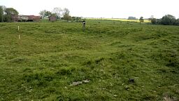 Shrunken Village near Bratoft, Gunby Hall Estate © Northern Archaeological Associates Ltd. | 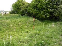 Shrunken Village near Bratoft, Gunby Hall Estate © Northern Archaeological Associates Ltd. |
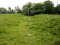 Shrunken Village near Bratoft, Gunby Hall Estate © Northern Archaeological Associates Ltd. | 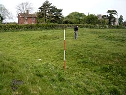 Shrunken Village near Bratoft, Gunby Hall Estate © Northern Archaeological Associates Ltd. |
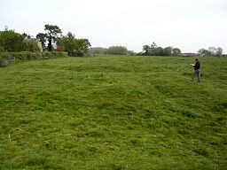 Shrunken Village near Bratoft, Gunby Hall Estate © Northern Archaeological Associates Ltd. | 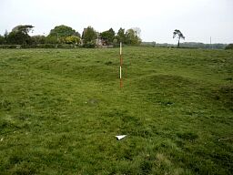 Shrunken Village near Bratoft, Gunby Hall Estate © Northern Archaeological Associates Ltd. |
Search results generated by the HBSMR Gateway from exeGesIS SDM Ltd.