HeritageGateway - Home
Site Map
Text size: A A A
You are here: Home > > > > Southampton HER Result
Southampton HERPrintable version | About Southampton HER | Visit Southampton HER online...

If you have any feedback or new information about this record, please email the Southampton HER (her@southampton.gov.uk).
Data derived from Heritage Gateway will not be acceptable for any use associated with development proposals and other planning matters.

For important guidance on the use of this record, please click here . © Southampton City Council


HER Number:MSH1013
Type of Record:Monument
Name:Town Defences - town wall between the fifth tower south of Eastgate and the Reredorter Tower
Grid Reference:SU 4211 1113
Map:Show location on Streetmap

Summary

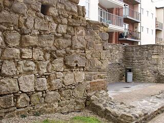
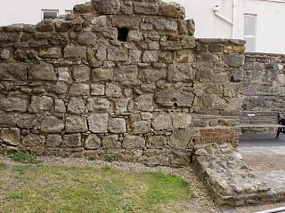
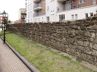
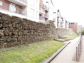
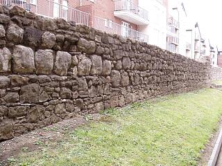
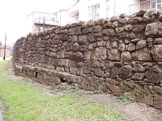
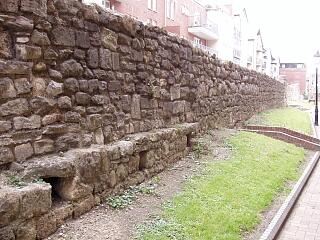
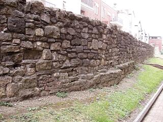
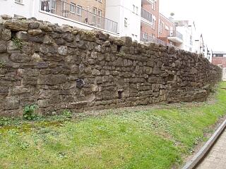
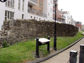
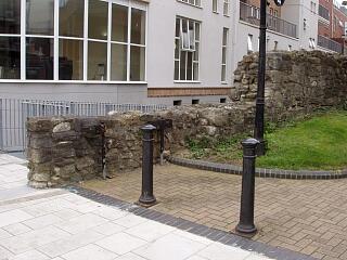
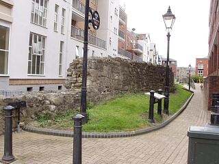
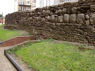
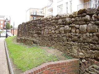
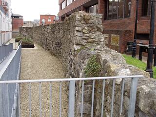
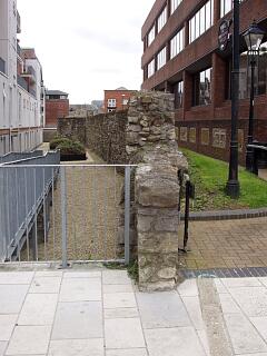
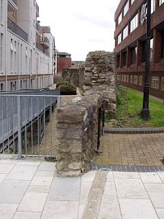
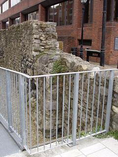
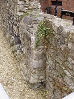
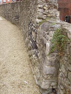
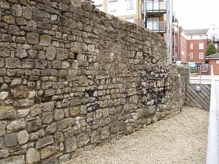
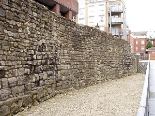
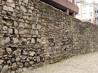
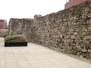
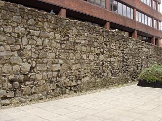
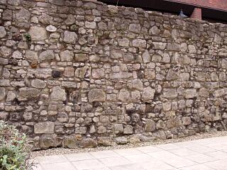
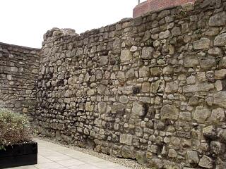
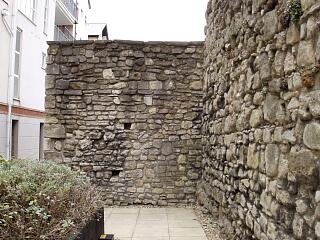
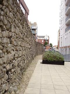
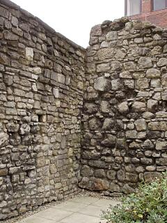
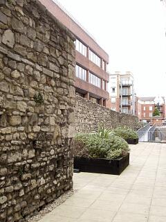
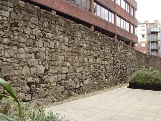
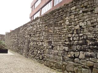
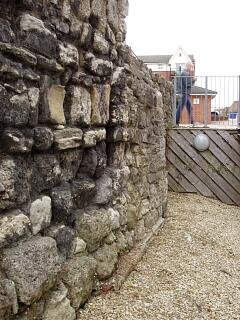
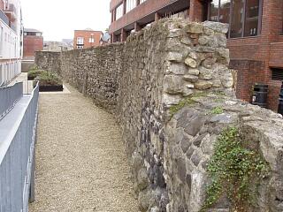
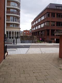
The part of the eastern town wall between the fifth tower south of Eastgate and the Reredorter Tower was an unusually long section of town wall, apparently unbroken by a tower. Much of it has been demolished above-ground, although a section survives south of the modern Briton Street. It would appear though that the line of the wall incorporates two distinct kinks, shown on Speed’s 1611 map; the possible significance of this is currently uncertain.

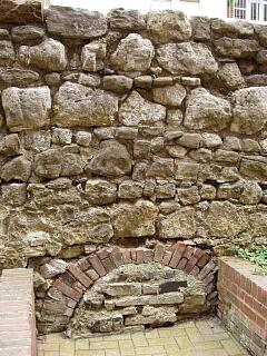
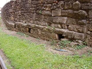
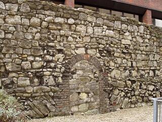
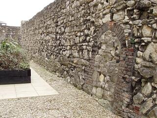
North of Briton Street, the demolished part of the wall has been revealed in a number of watching briefs and excavations (SOU 689, SOU 355, SOU 934, SOU 1061). South of Briton Street, archaeological excavations between 1986 and 1989 (SOU 267, SOU 327, SOU 413) yielded evidence relating to this section of the town wall. The remains of three earlier stone walls were found incorporated into the town wall. A low, blocked arch was found in the base of the wall. The foundations were investigated, and in places incorporated an offset. The ground level may have been made up/levelled off in preparation for the building of the town wall. The rampart bank against the inner, west face of the town wall was contemporary with the wall and probably used as a building platform.

The date of the eastern town wall is uncertain, although the combined archaeological and documentary evidence suggests that the part between Briton Street and God's House Tower dates to the mid-to-late 14th century, before 1373.

The surviving above-ground remains are listed and scheduled.

Protected Status

  • Listed Building (II) 1179291: TOWN WALLS: SECTION OF WALL RUNNING ALONG BACK OF THE WALLS JUST NORTH OF THE WALLS FROM JUST NORTH OF NO 39 TO BRITON STREET
  • Scheduled Monument 1001931: Town wall: remains of East side of town wall South of East Street and North of God’s House Tower

Other References/Statuses

  • HER backup file (new series): SOU 355  (paper & digital)
  • Old Southampton SMR No/Backup file: SU 4211 SW 7  

Monument Type(s):

Full description

Records for the town defences are currently being enhanced and it is intended that further details will be added to this description at a later date. (SCC HER 4/12/09)
------------------------------------------------------------------------------------------
[6]: Listed Building Description. TOWN WALLS. Section of wall running along back of the Walls from just north of No 39 to Briton Street (formerly listed as section of Town Wall in back of the Walls running south from Raleigh House until it joins the south Gate or God's House). Grade II.
- Remains of mediaeval city walls. Rubble walls from 5 to 8 feet in height. Scheduled as an ancient monument.
[Derived from English Heritage LBS download dated 19/08/2005. Crown Copyright. Reproduced under the terms of the Open Government Licence.]
--------------------------------------------------------------------------------------------
SOU 689 (watching brief on pipe laying along Back of the Walls in 1956):
IP 22/12/97: One photographic print in [9] was supposedly taken at a point 330' south of the junction between Back of the Walls and Bernard Street, although the photograph clearly shows a location further north on a stretch of the town wall covered by a different monument record. One of the four prints in [9] probably does show this stretch of the town wall, but which isn't known (see [10]).

SOU 355 (watching brief in Back of the Walls in 1957):
[7][8]: A cut through the town wall at Back of the Walls (location shown on sketch plan) was observed and a sketch section through the town wall drawn. The wall was 4' 5" (1.45m - IP) thick. The top of the wall was at 1' 9" (0.53m - IP) BGS. The cut was 6' to 7' (about 2m - IP) deep and did not reach the bottom of the wall. The sketch section shows a well-faced ?east face marked as "uncoursed rough rubble", the ?west face being of "loose rubble and mortar", abutted by "black earth" (the orientation of the drawing is not given).

SOU 267 (Excavation at the Reredorter, Back of the Walls in 1986)
SOU 327 (Excavations on Back of the Walls, between the Reredorter Tower and Briton Street, in 1988)
SOU 413 (Watching Brief on Back of the Walls in 1989):
[1]: (This report covers the medieval, not the post-medieval, archaeology.)
-- The town wall to the north and south of the Reredorter Tower butted against the tower, so was later than the tower (SOU 267).
-- Four trenches were excavated against the west face of the town wall north of the Reredorter Tower (SOU 327) and further evidence for this area was found during the later watching brief (SOU 413).
The town wall and its foundations were investigated. They were found to incorporate the remains of three earlier stone walls – 327/0510, 327/0540 and 413/unnumbered (see elsewhere). The northernmost of these, 327/0540, had 3 beam slots in its western face. (The number 327/0540 was also used for part of the town wall, and the wall seems to have effectively formed part of the town wall; there may even have been some doubt that it was an earlier structure. Also, see [4] below. IP)
The orientation of the town wall changed slightly towards the northeast to the north of wall 327/0540. The relationship between these two stretches of wall was not investigated, however it is likely that the town wall butted wall 327/0540 (more in [1]).
There was a substantial low, blocked arch 327/0080 in the base of the wall, of uncertain purpose although perhaps a relieving arch or associated with a drainage feature. It was blocked up at an unknown date. (See fig 2)
A narrow foundation offset was found on the western face of the town wall where revealed (as elsewhere along Back of the Walls). There was no offset adjacent to arch 327/0080 (fig 2). The construction trench was investigated. (It is suggested on page 8 that earlier deposits in the area may have been laid down to build up or level off the ground surface in preparation for the building of the town wall.)
The remains of the rampart bank (here observed only in section – fig 2) were found against the inner, west face of the town wall, both along this stretch of wall and elsewhere. The rampart was contemporary with the town wall and was probably used as a building platform.
-- The combined evidence of all the investigations along Back of the Walls south of Briton Street, together with the documentary evidence for the construction of the Reredorter and Friars’ Gate, suggest that the town wall between Briton Street and God's House Tower was built in the mid to late 14th century, but before 1373 (see page 21).

[4] (earlier report on SOU 327 work, by same author as [1]): Some evidence for a rampart existing before the town wall was built. Stretch of earlier wall, north of which the orientation of the town wall changed and the building method altered. “The town wall itself provided evidence that a wooden structure had been hung off the wall. This was perhaps a timber wall walk.”
(NB. Evidence of a timber wall walk is not mentioned in [1]; [4] is perhaps referring to the beam slots found in wall 327/0540, later reinterpreted. Also, [1] suggests there was no earlier rampart. IP)

See also [2][3] (SOU 267) and [5] (SOU 413).
--------------
SOU 934 (Evaluation Excavation at 66 High Street in 1998):
[11]: The medieval town wall was located near the west end of Trench 3, at the east end of the site. Remains of its internal rampart and the intra-mural road known as Back of the Walls, were found to the west of the town wall.

SOU 1061 (watching brief during groundworks for the construction of Guild House and Chandlers Court in 2000):
[12]: A service trench dug across Back of the Walls was observed (Trench 2A, fig 2). All observation and recording took place from the trench edge. A section of the eastern town wall (wall 215, described) with its associated internal rampart (layer 217) was found under Back of the Walls (fig 2 and fig 3). Only the western face of the town wall was exposed. The method of construction in this area, with an internal rampart built against the west face of the wall, was the same as that found on other excavations to the south of Briton Street and on SOU 934. A post-medieval soil horizon (216) overlay rampart layer 217 (see separate record).

Sources / Further Reading

---SSH3063 - Unpublished document: Ancient Monument File AM11 - Gods House Tower and Gate.
[1]SSH3 - Archaeological Report: MP Smith. 1994. Report on the archaeological excavations at Back of the Walls, Southampton.. SOUs 252, 253, 267, 327, 395, 406, 413, 433. All
[2]SSH520 - Serial: The Society for Medieval Archaeology. 1987. Medieval Archaeology, Vol 31, 1987 (for 1986). pp134, 136
[3]SSH521 - Serial: Morton, AD (ed), SCC. 1991. Annual Report of the Southampton Archaeological & Heritage Management Section for 1990-1991. pp32-33
[4]SSH521 - Serial: Morton, AD (ed), SCC. 1991. Annual Report of the Southampton Archaeological & Heritage Management Section for 1990-1991. p32
[5]SSH835 - Excavation archive: Watching Brief Archive for SOU 413. SOU 413. SMART 7 (written in 1992)
[6]SSH2888 - Digital archive: English Heritage. 2005. Listed Buildings System dataset for Southampton.
[7]SSH572 - Excavation archive: Friends of Old Southampton Survey Section (FOOSSS). Friends of Old Southampton Survey Section Watching Brief Records.
[8]SSH555 - Excavation archive: Friends of Old Southampton Survey Section (FOOSSS). 1957. Friends of Old Southampton Survey Section Notes - *Chief Surveyor's Report to Friends of Old Southampton upon the Acivities of the Survey Section (Excavations Observed Since Las
[9]SSH1056 - Excavation archive: Watching Brief Archive for SOU 689.. 4 photographs
[10]SSH1057 - Map: I Peckham. 1997/2003. Photocopy of OS SU 41/4211 SW 1948, annotated re SOU 689.. Paper.
[11]SSH452 - Archaeological Report: MP Smith. 1998. Report on the archaeological evaluation excavation at 66 High Street (Pouparts), Southampton.. SOU 934. All
[12]SSH2113 - Archaeological Report: MP Smith. 2001. Report on the archaeological watching brief at the site of the former head Post Office, 57 - 58 High Street, Southampton.. SOU 1061.

Associated Finds: None recorded

Associated Events

  • ESH1061 - Watching Brief at 57 - 59 High Street in 2000 (Ref: SOU 1061)
  • ESH267 - Excavation in the Reredorter on Back of the Walls in 1986 (Ref: SOU 267)
  • ESH327 - Excavations on Back of the Walls in 1988 (Ref: SOU 327)
  • ESH355 - Watching Brief in Back of the Walls in 1957 (Ref: SOU 355)
  • ESH413 - Watching Brief on Back of the Walls in 1989 (Ref: SOU 413)
  • ESH689 - Watching Brief on Back of the Walls in 1956 (Ref: SOU 689)
  • ESH934 - Evaluation Excavation at 66 High Street (Pouparts) in 1998 (Ref: SOU 934)

Related records

MSH14Child of: Town Defences - town wall, towers and gates

Associated Links: None recorded

Images

Town wall and Reredorter Tower, Back of the Walls, 6/9/09,  © I Peckham

Town wall and Reredorter Tower, Back of the Walls, 6/9/09, © I Peckham

Reredorter Tower, Back of the Walls, 6/9/09,  © I Peckham

Reredorter Tower, Back of the Walls, 6/9/09, © I Peckham

Reredorter Tower, Back of the Walls, 6/9/09,  © I Peckham

Reredorter Tower, Back of the Walls, 6/9/09, © I Peckham

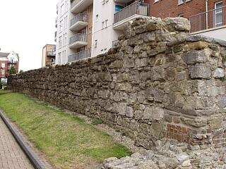
Town wall north of Reredorter Tower, Back of the Walls, 6/9/09,  © I Peckham

Town wall north of Reredorter Tower, Back of the Walls, 6/9/09, © I Peckham

Town wall and Reredorter Tower, Back of the Walls, 6/9/09,  © I Peckham

Town wall and Reredorter Tower, Back of the Walls, 6/9/09, © I Peckham

Town wall north of Reredorter Tower, Back of the Walls, 6/9/09,  © I Peckham

Town wall north of Reredorter Tower, Back of the Walls, 6/9/09, © I Peckham

Town wall north of Reredorter Tower, Back of the Walls, 6/9/09,  © I Peckham

Town wall north of Reredorter Tower, Back of the Walls, 6/9/09, © I Peckham

Town wall north of Reredorter Tower, Back of the Walls, 6/9/09,  © I Peckham

Town wall north of Reredorter Tower, Back of the Walls, 6/9/09, © I Peckham

Town wall north of Reredorter Tower, Back of the Walls, 6/9/09,  © I Peckham

Town wall north of Reredorter Tower, Back of the Walls, 6/9/09, © I Peckham

Town wall north of Reredorter Tower, Back of the Walls, 6/9/09,  © I Peckham

Town wall north of Reredorter Tower, Back of the Walls, 6/9/09, © I Peckham

Town wall north of Reredorter Tower, Back of the Walls, 6/9/09,  © I Peckham

Town wall north of Reredorter Tower, Back of the Walls, 6/9/09, © I Peckham

Town wall north of Reredorter Tower, Back of the Walls, 6/9/09,  © I Peckham

Town wall north of Reredorter Tower, Back of the Walls, 6/9/09, © I Peckham

Town wall north of Reredorter Tower, Back of the Walls, 6/9/09,  © I Peckham

Town wall north of Reredorter Tower, Back of the Walls, 6/9/09, © I Peckham

Town wall north of Reredorter Tower, Back of the Walls, 6/9/09,  © I Peckham

Town wall north of Reredorter Tower, Back of the Walls, 6/9/09, © I Peckham

Town wall north of Reredorter Tower, Back of the Walls, 6/9/09,  © I Peckham

Town wall north of Reredorter Tower, Back of the Walls, 6/9/09, © I Peckham

Town wall north of Reredorter Tower, Back of the Walls, 6/9/09,  © I Peckham

Town wall north of Reredorter Tower, Back of the Walls, 6/9/09, © I Peckham

Town wall north of Reredorter Tower, Back of the Walls, 6/9/09,  © I Peckham

Town wall north of Reredorter Tower, Back of the Walls, 6/9/09, © I Peckham

Town wall north of Reredorter Tower, Back of the Walls, 6/9/09,  © I Peckham

Town wall north of Reredorter Tower, Back of the Walls, 6/9/09, © I Peckham

Town wall north of Reredorter Tower, Lower Canal Walk, 6/9/09,  © I Peckham

Town wall north of Reredorter Tower, Lower Canal Walk, 6/9/09, © I Peckham

Town wall north of Reredorter Tower, Lower Canal Walk, 6/9/09,  © I Peckham

Town wall north of Reredorter Tower, Lower Canal Walk, 6/9/09, © I Peckham

Town wall north of Reredorter Tower, Lower Canal Walk, 6/9/09,  © I Peckham

Town wall north of Reredorter Tower, Lower Canal Walk, 6/9/09, © I Peckham

Town wall north of Reredorter Tower, Lower Canal Walk, 6/9/09,  © I Peckham

Town wall north of Reredorter Tower, Lower Canal Walk, 6/9/09, © I Peckham

Town wall north of Reredorter Tower, Lower Canal Walk, 6/9/09,  © I Peckham

Town wall north of Reredorter Tower, Lower Canal Walk, 6/9/09, © I Peckham

Town wall north of Reredorter Tower, Lower Canal Walk, 6/9/09,  © I Peckham

Town wall north of Reredorter Tower, Lower Canal Walk, 6/9/09, © I Peckham

Town wall north of Reredorter Tower, Lower Canal Walk, 6/9/09,  © I Peckham

Town wall north of Reredorter Tower, Lower Canal Walk, 6/9/09, © I Peckham

Town wall north of Reredorter Tower, Lower Canal Walk, 6/9/09,  © I Peckham

Town wall north of Reredorter Tower, Lower Canal Walk, 6/9/09, © I Peckham

Town wall north of Reredorter Tower, Lower Canal Walk, 6/9/09,  © I Peckham

Town wall north of Reredorter Tower, Lower Canal Walk, 6/9/09, © I Peckham

Town wall north of Reredorter Tower, Lower Canal Walk, 6/9/09,  © I Peckham

Town wall north of Reredorter Tower, Lower Canal Walk, 6/9/09, © I Peckham

Town wall and Reredorter Tower, Lower Canal Walk, 6/9/09,  © I Peckham

Town wall and Reredorter Tower, Lower Canal Walk, 6/9/09, © I Peckham

Town wall north of Reredorter Tower, Lower Canal Walk, 6/9/09,  © I Peckham

Town wall north of Reredorter Tower, Lower Canal Walk, 6/9/09, © I Peckham

Town wall north of Reredorter Tower, Lower Canal Walk, 6/9/09,  © I Peckham

Town wall north of Reredorter Tower, Lower Canal Walk, 6/9/09, © I Peckham

Town wall north of Reredorter Tower, Lower Canal Walk, 6/9/09,  © I Peckham

Town wall north of Reredorter Tower, Lower Canal Walk, 6/9/09, © I Peckham

Reredorter Tower, Lower Canal Walk, 6/9/09,  © I Peckham

Reredorter Tower, Lower Canal Walk, 6/9/09, © I Peckham

Town wall north of Reredorter Tower, Lower Canal Walk, 6/9/09,  © I Peckham

Town wall north of Reredorter Tower, Lower Canal Walk, 6/9/09, © I Peckham

Reredorter Tower, Lower Canal Walk, 6/9/09,  © I Peckham

Reredorter Tower, Lower Canal Walk, 6/9/09, © I Peckham

Reredorter Tower and town wall, Lower Canal Walk, 6/9/09,  © I Peckham

Reredorter Tower and town wall, Lower Canal Walk, 6/9/09, © I Peckham

Town wall north of Reredorter Tower, Lower Canal Walk, 6/9/09,  © I Peckham

Town wall north of Reredorter Tower, Lower Canal Walk, 6/9/09, © I Peckham

Town wall north of Reredorter Tower, Lower Canal Walk, 6/9/09,  © I Peckham

Town wall north of Reredorter Tower, Lower Canal Walk, 6/9/09, © I Peckham

Town wall north of Reredorter Tower, Lower Canal Walk, 6/9/09,  © I Peckham

Town wall north of Reredorter Tower, Lower Canal Walk, 6/9/09, © I Peckham

Town wall north of Reredorter Tower, Lower Canal Walk, 6/9/09,  © I Peckham

Town wall north of Reredorter Tower, Lower Canal Walk, 6/9/09, © I Peckham

Town wall north of Reredorter Tower, Lower Canal Walk, 6/9/09,  © I Peckham

Town wall north of Reredorter Tower, Lower Canal Walk, 6/9/09, © I Peckham

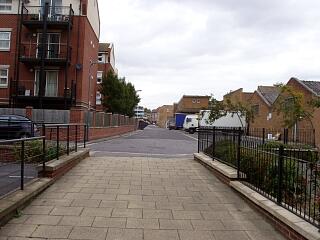
Line of demolished east town wall across Briton Street, looking south, 6/9/09,  © I Peckham

Line of demolished east town wall across Briton Street, looking south, 6/9/09, © I Peckham

Line of demolished east town wall along Back of the Walls, north of Briton Street, looking north, 6/9/09,  © I Peckham

Line of demolished east town wall along Back of the Walls, north of Briton Street, looking north, 6/9/09, © I Peckham

If you have any feedback or new information about this record, please email the Southampton HER (her@southampton.gov.uk).