HeritageGateway - Home
Site Map
Text size: A A A
You are here: Home > > > > Southampton HER Result
Southampton HERPrintable version | About Southampton HER | Visit Southampton HER online...

If you have any feedback or new information about this record, please email the Southampton HER (her@southampton.gov.uk).
Data derived from Heritage Gateway will not be acceptable for any use associated with development proposals and other planning matters.

For important guidance on the use of this record, please click here . © Southampton City Council


HER Number:MSH1014
Type of Record:Monument
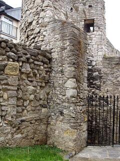
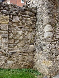
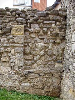
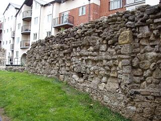
Name:Town Defences - town wall between Friary Gate and the Dovecote Tower
Grid Reference:SU 4210 1100
Map:Show location on Streetmap

Summary

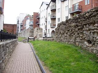
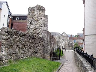
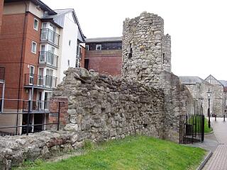
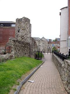
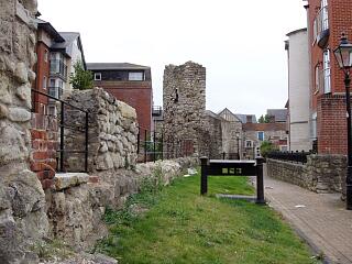
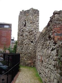
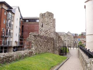
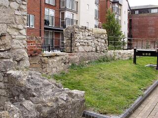
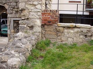
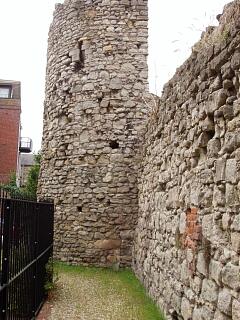
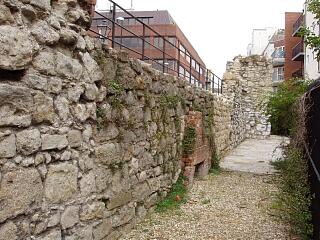
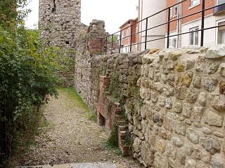
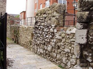
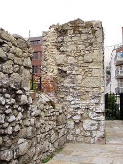
This part of the eastern town wall, between Friary Gate and the half-round tower (Dovecote tower), partly survives above-ground. A programme of archaeological excavations took place along Back of the Walls in the 1980s and 1990s (SOU 252, SOU 253, SOU 395, SOU 406, SOU 433); the west side of the town wall was investigated during this work. Further archaeological work took place in 2006/7 (SOU 1395) prior to and during repair work on Friary Gate and the adjacent town walls and the raising of the ground level east of the walls for a new housing scheme; the east face of a 9.8m long section of town wall south of Friary Gate was recorded.

About 2m north of the dovecote tower, the town wall had a double offset foundation on the west side whereas about 2m further north again, no offset was present. The offset could have been strengthening of the wall adjacent to the tower, or due to a rebuilding of the wall, though there was no other sign of rebuilding. The offset was in a wide construction trench. The construction trench fills were sealed by a dump of soils which butted against the west face of the town wall. This consisted of alternating thick layers of brickearth with mortar spreads between them. It is interpreted as a rampart bank which was raised as the wall was built and served as a building platform (there are no putlog holes for scaffolding along this stretch of wall).

The combined archaeological and documentary evidence suggests that this stretch of town wall, along with the rest of the town wall between Briton Street and God's House Tower, was originally built in the mid to late 14th century, before 1373. At the south end, the relationship of the town wall to the dovecote tower doesn’t appear to have been established. At the north end, the town wall was almost certainly rebuilt when Friary Gate was inserted in or just after 1373; the very short length of rebuilt wall butted against the south wall of the gatehouse. The town wall had been severely truncated by later alterations, probably associated with structures built against the wall in the early modern period. The 2006/7 work included the partial rebuilding of the above-ground part of the town wall across the former Gloucester Passage right of way.

Protected Status

  • Listed Building (I) 1091982: TOWN WALLS: SECTION OF WALL RUNNING NORTH FROM GOD'S HOUSE ALONG BACK OF THE WALLS TO ROUND TOWER ADJACENT TO NO 15
  • Scheduled Monument 1001931: Town wall: remains of East side of town wall South of East Street and North of God’s House Tower

Other Statuses/Codes: None Recorded

Monument Type(s):

  • CURTAIN WALL (Built, Medieval - 1325 AD to 1373 AD)
  • TOWN WALL (Built, Medieval - 1325 AD to 1373 AD)
  • CURTAIN WALL (Partly rebuilt, Medieval - 1373 AD to 1380 AD)
  • TOWN WALL (part rebuilt, Medieval - 1373 AD to 1380 AD)

Full description

Records for the town defences are currently being enhanced and it is intended that further details will be added to this description at a later date. (SCC HER 4/12/09)
-----------------------------------------------------------
[14]: Listed Building Description. TOWN WALLS. Section of wall running north from God's House along back of the Walls to Round Tower adjacent to No 15 (formerly listed as section of Town Wall in back of the Walls running south from Raleigh House until it joins the South Gate or God's House). Grade I.
- Remains of mediaeval city walls. Wall of stone rubble incorporating a C13 half drum tower. Scheduled as an ancient monument.
[Derived from English Heritage LBS download dated 19/08/2005. Crown Copyright. Reproduced under the terms of the Open Government Licence.]

(It is unclear from the legal description whether the section of town wall between the Round Tower and Gloucester Square is incluced in the listing. IP 20/2/06)
-----------------------------------------------------------------------------
SOU 252 (Excavation at Friars' Gate, Back of the Walls in 1986):
[1]: (This report covers the medieval, not the post-medieval, archaeology.) A portion of the town wall had been demolished when Friar's Gate was built (SOU 252).
(See also [2] - [6].)

SOU 253 (Excavation at the Dovecote Tower, Back of the Walls in 1986)
[1][7]: (Trench location plan suggests the SOU 253 work included part of the town wall north of the dovecote tower, although no further details concerning the town wall are given in the text. [1] implies that the town wall was contemporary with the rebuilding of the dovecote as a tower – see elsewhere – although the actual join is not described. [7] (page 42) states that it was not clear whether the tower was originally free-standing or joined to the wall. IP)
(See also [2][5][6].)

SOU 395 (Excavation on Back of the Walls in 1989):
[1]: The west side of the town wall was investigated. A stretch of wall foundation 395/0168 was exposed about 2m north of the SOU 433 slot trench (see below); this foundation had no offset. (Other context numbers were allocated for “upstanding” parts of this section of town wall between Friary Gate and the dovecote tower, although no further details are given, and the implication is that excavation was not carried out to sufficient depth to reveal foundations. IP)
[13]: Also mentions the SOU 395 section excavated about 2m north of the SOU 433 slot trench, where the town wall foundation had no offset.
[7]: The footings of the town wall were exposed in Trench 3. The rampart was exposed in Trenches 3 and 4. (The plan on page 43 shows Trench 3 to the south of Friar's Gate, and Trench 4 further south towards the dovecote tower). The rampart was made up of thick layers of soil separated by thin mortar spreads. It butted the town wall (etc). In Trench 3 there were several areas of disturbance probably resulting from repair work to the town wall.
SCC HER: [1][13] and [7] appear to give contradictory details. According to [1], the SOU 395 section was 2m north of the SOU 433 slot trench. The SOU 433 slot trench was about 2m north of the dovecote tower [1] and “narrow” [13]. This places the SOU 395 section in the southern part of the area – that shown as Trench 4 rather than Trench 3 on the plan in [7].)
(See also [8].)

SOU 406 (Watching Brief at Gloucester Passage and Back of the Walls in 1988):
[1][10]:
- ?Undated gravelly brickearth was found to the east of town wall.
- Town wall found below Gloucester Passage, where it does not survive above ground level.
- North face of southern revetment wall to Gloucester Passage observed to butt against the east face of the town wall.*
* No date given in [10] and not mentioned in [1]; as [1] covers only medieval contexts, the wall is probably post-medieval or later. IP 1995.

SOU 433 (Investigations at Back of the Walls between 1990 and 1992):
[1]: An E/W slot trench was dug through deposits west of the town wall to the north of the Dovecote Tower (page 5, see also page 6). (The precise location of the slot trench is not given in [1] and it is not shown on the plan.) This gave the best excavated sequence through deposits along Back of the Walls (see fig 3, pp18-20). In this slot trench, the town wall foundation had a double offset (elsewhere, to the north, the offset was single). The offset was built in a construction trench 1.30m wide at the top. The nine fills contained few datable finds. The construction trench fills were overlain by a dump of soils which butted against the west face of the town wall. The dump (as elsewhere to the north – see MSH 1013 – or renumbered) consisted of alternating thick layers of brickearth with mortar spreads between them. The dump is interpreted as the rampart bank. It was 4.05m wide and 0.88m high at the east end against the wall. It may have acted as an internal reinforcement to the wall. However the presence of mortar suggests that the bank was raised as the wall was built and served as a building platform. A relatively small finds assemblage was recovered from these layers, the pottery assemblage dated to the high-to-late medieval periods, so possibly mid-to-late 14th century (this detail refers to all excavations through the rampart bank along Back of the Walls).

[13]: On SOU 433, a narrow trench (p45) was dug across Back of the Walls about 2m north of the dovecote tower (p47) (which must be the slot trench of [1]). The wall here had a double offset foundation. The wall revealed in this section differed from one excavated about 2m further north (SOU 395) where no offset was present (see above). The offset could have been strengthening of the wall adjacent to the tower, or be due to a rebuilding of the wall, though there was no other sign of rebuilding.
(See also [12],[14][15][16][17] for SOU 433.)

[1]: The combined evidence of all the investigations along Back of the Walls south of Briton Street (including the SOUs listed above), together with the documentary evidence for the construction of certain structures along the wall, suggest that the town wall between Briton Street and God's House Tower was built in the mid to late 14th century, but before 1373 (see page 21).

SOU 1395 (archaeological investigations associated with repairs and alterations to Friary Gate and adjacent town walls in 2006/7):
[19]: Documentary summary (p12, 14-15).
Town wall south of Friary Gate: A 9.8m long section of town wall south of the gate was recorded (to the south end of the former Gloucester Passage). Five construction phases were identified in the east face of this wall (description and photos in report).
The original structure was probably of 14th century construction. Much of up-standing fabric was probably original, but the surviving structure had been severely truncated by later alterations, probably associated with structures built against the exterior (east face) of the wall in the early modern period (map evidence). The town wall was almost certainly rebuilt on either side of Friary Gate, when the gate was inserted in or just after 1373. A short length of rebuild to the south of the gate butted against the south wall of the gate.
Following the SOU 1395 survey, repairs were carried out on the structures (see Appendix 3 for a schedule of works and a photographic survey of the finished works). The work included the rebuilding of the wall across the former Gloucester Passage right of way. The ground level outside/east of the walls was raised, associated with a housing development.

Sources / Further Reading

---SSH3063 - Unpublished document: Ancient Monument File AM11 - Gods House Tower and Gate.
---SSH3067 - Unpublished document: Ancient Monument File AM16 - Mural (half-drum) Tower (Eastern Town Walls).
---SSH3152 - Unpublished document: Ancient Monument File AM96 - Back of the Walls (Eastern Town Walls).
[1]SSH3 - Archaeological Report: MP Smith. 1994. Report on the archaeological excavations at Back of the Walls, Southampton.. SOUs 252, 253, 267, 327, 395, 406, 413, 433. All
[2]SSH521 - Serial: Morton, AD (ed), SCC. 1991. Annual Report of the Southampton Archaeological & Heritage Management Section for 1990-1991. pp33-34
[3]SSH832 - Excavation archive: Excavation Archive for SOU 252. SOU 252.
[4]SSH739 - Serial: M Hughes (ed), Hampshire County Council. 1993. Archaeology in Hampshire Annual Report for 1992. pp52-53
[5]SSH833 - Serial: M Hughes (ed), Hampshire County Council. 1986. Archaeology in Hampshire Annual Report for 1984/5. pp44/45
[6]SSH520 - Serial: The Society for Medieval Archaeology. 1987. Medieval Archaeology, Vol 31, 1987 (for 1986). pp134, 136
[7]SSH712 - Serial: Morton, AD (ed), SCC. 1990. Annual Report of the Southampton Archaeological & Heritage Management Section 1990. pp40-45
[8]SSH828 - Serial: The Society for Medieval Archaeology. 1990. Medieval Archaeology, Vol 34, 1990 (for 1989). p 186-7
[9]SSH521 - Serial: Morton, AD (ed), SCC. 1991. Annual Report of the Southampton Archaeological & Heritage Management Section for 1990-1991. p45
[10]SSH834 - Excavation archive: Watching Brief Archive for SOU 406. SOU 406. SMART 7 (written in 1992)
[11]SSH521 - Serial: Morton, AD (ed), SCC. 1991. Annual Report of the Southampton Archaeological & Heritage Management Section for 1990-1991. p33
[12]SSH831 - Excavation archive: Excavation archive for SOU 433. SOU 433. SMART 7
[13]SSH521 - Serial: Morton, AD (ed), SCC. 1991. Annual Report of the Southampton Archaeological & Heritage Management Section for 1990-1991. pp45-48
[14]SSH678 - Serial: M Hughes (ed), Hampshire County Council. 1991. Archaeology in Hampshire Annual Report for 1990. pp43-44, 51-52
[15]SSH713 - Serial: The Society for Medieval Archaeology. 1991. Medieval Archaeology, Vol 35, 1991 (for 1990). pp158-9
[16]SSH677 - Serial: The Society for Post-Medieval Archaeology. 1991. Post-Medieval Archaeology (for 1990). pp134-5
[17]SSH739 - Serial: M Hughes (ed), Hampshire County Council. 1993. Archaeology in Hampshire Annual Report for 1992. p26
[18]SSH2888 - Digital archive: English Heritage. 2005. Listed Buildings System dataset for Southampton.
[19]SSH2966 - Archaeological Report: MP Smith. 2007. Archaeological investigations associated with repairs and alterations at Friary Gate, Back of the Walls, Southampton.. SOU 1395.

Associated Finds: None recorded

Associated Events

  • ESH1743 - Archaeological Investigations and Building Record at Friary Gate, Back of the Walls/Lower Canal Walk in 2006/2007 (Ref: SOU 1395)
  • ESH252 - Excavation at Friar's Gate, Back of the Walls in 1986 (Ref: SOU 252)
  • ESH253 - Excavation at the Dovecote Tower, Back of the Walls in 1986 (Ref: SOU 253)
  • ESH395 - Excavation on Back of the Walls in 1989 (Ref: SOU 395)
  • ESH406 - Watching Brief at Gloucester Passage and Back of the Walls in 1988 (Ref: SOU 406)
  • ESH433 - Investigations at Back of the Walls between 1990 and 1992 (Ref: SOU 433)

Related records

MSH14Child of: Town Defences - town wall, towers and gates

Associated Links: None recorded

Images

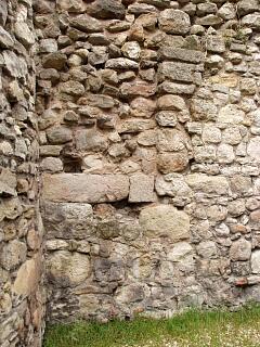
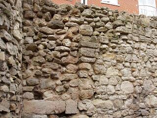
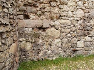
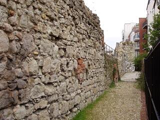
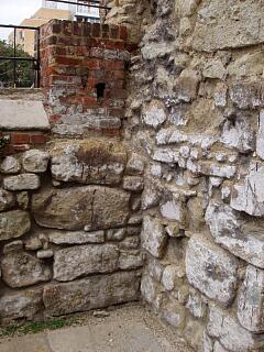
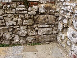
Town wall, Back of the Walls, 30.8.09 (camera date not set),  © I Peckham

Town wall, Back of the Walls, 30.8.09 (camera date not set), © I Peckham

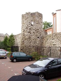
Dovecote Tower, Back of the Walls, 30.8.09 (camera date not set),  © I Peckham

Dovecote Tower, Back of the Walls, 30.8.09 (camera date not set), © I Peckham

Dovecote Tower, Back of the Walls, 30.8.09 (camera date not set),  © I Peckham

Dovecote Tower, Back of the Walls, 30.8.09 (camera date not set), © I Peckham

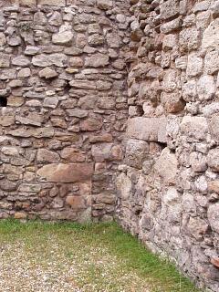
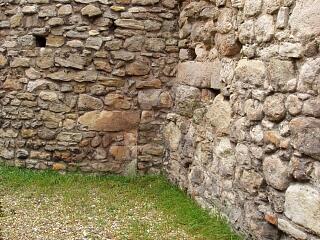
Town wall north of Dovecote Tower, Back of the Walls, 30.8.09 (camera date not set),  © I Peckham

Town wall north of Dovecote Tower, Back of the Walls, 30.8.09 (camera date not set), © I Peckham

Town wall north of Dovecote Tower, Back of the Walls, 30.8.09 (camera date not set),  © I Peckham

Town wall north of Dovecote Tower, Back of the Walls, 30.8.09 (camera date not set), © I Peckham

Town wall north of Dovecote Tower, Back of the Walls, 30.8.09 (camera date not set),  © I Peckham

Town wall north of Dovecote Tower, Back of the Walls, 30.8.09 (camera date not set), © I Peckham

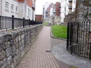
Dovecote Tower and town wall, looking south along Back of the Walls, 30.8.09 (camera date not set),  © I Peckham

Dovecote Tower and town wall, looking south along Back of the Walls, 30.8.09 (camera date not set), © I Peckham

Dovecote Tower and town walls, Back of the Walls, 30.8.09 (camera date not set),  © I Peckham

Dovecote Tower and town walls, Back of the Walls, 30.8.09 (camera date not set), © I Peckham

Dovecote Tower and town walls, looking south along Back of the Walls, 30.8.09 (camera date not set),  © I Peckham

Dovecote Tower and town walls, looking south along Back of the Walls, 30.8.09 (camera date not set), © I Peckham

Dovecote Tower and town walls, looking south along Back of the Walls, 30.8.09 (camera date not set),  © I Peckham

Dovecote Tower and town walls, looking south along Back of the Walls, 30.8.09 (camera date not set), © I Peckham

Dovecote Tower, Lower Canal Walk, 30.8.09 (camera date not set),  © I Peckham

Dovecote Tower, Lower Canal Walk, 30.8.09 (camera date not set), © I Peckham

Dovecote Tower and town wall, Back of the Walls, 6/9/09,  © I Peckham

Dovecote Tower and town wall, Back of the Walls, 6/9/09, © I Peckham

Town wall near Friary Gate, Back of the Walls, 6/9/09,  © I Peckham

Town wall near Friary Gate, Back of the Walls, 6/9/09, © I Peckham

Friary Gate and town wall, Back of the Walls, 6/9/09,  © I Peckham

Friary Gate and town wall, Back of the Walls, 6/9/09, © I Peckham

Dovecote Tower, Lower Canal Walk, 6/9/09,  © I Peckham

Dovecote Tower, Lower Canal Walk, 6/9/09, © I Peckham

Dovecote Tower, Lower Canal Walk, 6/9/09,  © I Peckham

Dovecote Tower, Lower Canal Walk, 6/9/09, © I Peckham

Dovecote Tower and town wall, Lower Canal Walk, 6/9/09,  © I Peckham

Dovecote Tower and town wall, Lower Canal Walk, 6/9/09, © I Peckham

Dovecote Tower and town wall, Lower Canal Walk, 6/9/09,  © I Peckham

Dovecote Tower and town wall, Lower Canal Walk, 6/9/09, © I Peckham

Dovecote Tower and town wall, Lower Canal Walk, 6/9/09,  © I Peckham

Dovecote Tower and town wall, Lower Canal Walk, 6/9/09, © I Peckham

Dovecote Tower and town wall, Lower Canal Walk, 6/9/09,  © I Peckham

Dovecote Tower and town wall, Lower Canal Walk, 6/9/09, © I Peckham

Town wall and Friary Gate, Lower Canal Walk, 6/9/09,  © I Peckham

Town wall and Friary Gate, Lower Canal Walk, 6/9/09, © I Peckham

Town wall and Friary Gate, Lower Canal Walk, 6/9/09,  © I Peckham

Town wall and Friary Gate, Lower Canal Walk, 6/9/09, © I Peckham

Town wall and Dovecote Tower, Lower Canal Walk, 6/9/09,  © I Peckham

Town wall and Dovecote Tower, Lower Canal Walk, 6/9/09, © I Peckham

Town wall between Dovecote Tower and Friary Gate, Lower Canal Walk, 6/9/09,  © I Peckham

Town wall between Dovecote Tower and Friary Gate, Lower Canal Walk, 6/9/09, © I Peckham

Friary Gate and town wall, Lower Canal Walk, 6/9/09,  © I Peckham

Friary Gate and town wall, Lower Canal Walk, 6/9/09, © I Peckham

Friary Gate and town wall, Lower Canal Walk, 6/9/09,  © I Peckham

Friary Gate and town wall, Lower Canal Walk, 6/9/09, © I Peckham

Friary Gate and town wall, Lower Canal Walk, 6/9/09,  © I Peckham

Friary Gate and town wall, Lower Canal Walk, 6/9/09, © I Peckham

Dovecote Tower, Lower Canal Walk, 6/9/09,  © I Peckham

Dovecote Tower, Lower Canal Walk, 6/9/09, © I Peckham

If you have any feedback or new information about this record, please email the Southampton HER (her@southampton.gov.uk).