If you have any feedback or new information about this record, please email the Southampton HER (her@southampton.gov.uk).
Data derived from Heritage Gateway will not be acceptable for any use associated with development proposals and other planning matters.
For important guidance on the use of this record, please click
here
. © Southampton City Council
| HER Number: | MSH2258 |
|---|
| Type of Record: | Monument |
|---|
| Name: | King John's Palace, Blue Anchor Lane |
|---|
| Grid Reference: | SU 4182 1128 |
|---|
| Map: | Show location on Streetmap |
|---|
Summary
The building now known as King John's Palace is a stone-built medieval merchant's house, one of the most complete of the larger 12th century town houses surviving in the country. Built in about 1170, it fronted onto the quay on the western side of the town. The ground floor was used as a warehouse opening onto the quay, with a hall and chambers above. The building was altered in the early 14th century. In the late 14th century, after 1360 and probably in about 1380, the west wall was incorporated into the town wall (the part known as the Arcades); the doors and windows were blocked, gunports inserted and an arcade built against the outer face. The building seems to have remained in use after the town wall was built, although direct access to the quay was cut off. Some alterations were made in the post-medieval period. Probably in the 19th century, a stone and brick arcade was built against the south wall, supporting a walkway from the garden of the house to the east, now Tudor House Museum on Bugle Street. The ruined building is now displayed as a monument in the grounds of Tudor House Museum. After the Second World War, a fireplace and chimney stack was brought from 79 1/2 High Street and rebuilt against the east wall. The ruin is now used as an occasional public art gallery, part of the ArtsVaults scheme (2009). (See separate records for details relating to the town wall.)
Archaeological excavations in the plot of land to the south (now a Masons' Yard) in 1963/1965 revealed the exterior footings of the south wall of the building (SOU 100). The foundations of the west wall and town wall were partially excavated in the late 1980s (SOU 242, SOU 301). In 1994/1995, building recording, observations and excavation work took place inside the building during conservation work (SOU 681).
Protected Status
- Scheduled Monument 1001887
- Listed Building (I) 1339942: KING JOHN'S PALACE (SITUATED TO WEST OF TUDOR HOUSE MUSEUM)
Other References/Statuses
- HER backup file (new series): SOU 681 Paper and digital - not yet LibraryLinked
- National Monuments Record (ex OS Antiquity Record): SU 41 SW 4 Medieval Southampton record
- Old Southampton SMR No/Backup file: SU 4111 SE 130
Monument Type(s):
- BUILDING (extant as building, Medieval to Post Medieval - 1150 AD? to 1900 AD?)
Full description
[7]: Listed Building Description. BLUE ANCHOR LANE - King John's Palace (situated to west of Tudor House Museum) (formerly listed under Bugle Street) (Grade I).
- Circa 1170. Early C14 and mid-C14. Remains of a merchant's house, the ground floor originally used for storage and the upper floor as living quarters. It originally stood on the quayside. The west wall was incorporated in the city defences after the French raid of 1338. The roof was removed in the early C20. Two storeys stone. North and west arcades have original C12 windows of 2 round-headed lights in round-arched frames. The west facade also has the blocked archways which led directly on to the quays, one C12 round-headed arch and 2 early C14 segmental-headed arches. Within these blocked arches are 2 vertical defensive slits of the C14 defences which may be the earliest surviving gunports in Britain. Parts of the original stone fireplace on the north side of the first floor survive, including both jambs, with inset shafts and scalloped capitals. Against the east wall is a late Norman chimney of circa 1200, removed from No 79A High Street, in the form of a long round stone shaft rising from a square base. This house is one of the most complete of the larger C12 town houses surviving in the country. Scheduled as an ancient monument.
[Derived from English Heritage LBS download dated 19/08/2005. Crown Copyright. Reproduced under the terms of the Open Government Licence.]
-----------------------------------------------------------------------------
[6]: A description of KJP, dating to 1865. Includes reference to four high arches on the south side of the building, which support a causeway over them, leading from the adjoining garden to a summer house.
[10]: King John's House or Norman house, 12th century. Still extant but un-roofed. (Citing [11][12].)
SOU 100 (Excavation at Raffo's Yard/Rear of Tudor House Museum between 1963 and 1965):
[3]: The exterior footings of the south wall of King John's Palace were exposed.
IP 19/5/04: No further details in SOU 100 sources consulted, although site archive has not been consulted. See Monument Record SH777 for all results of SOU 100.
Detailed building description, including plans, of King John's Palace, published 1975:
[8] in [9]: One of the most complete surviving larger 12th century house in the country. Two-storied. Originally built on the quayside, against a low cliff to the east. Its north wall faces Blue Anchor Lane. It may have adjoined another house to the south. The upper floor was probably the dwelling house, with a warehouse below. The western wall was later incorporated into the town wall and shows three main building periods: second half of 12th century, early 14th century and mid-14th century when the town wall was added to the outer face. The construction of the town wall involved blocking the openings, inserting gunports and constructing an arched wall-walk against the west face. Traces can be seen of an east-west spine wall that divided the building. The hall, on the upper north side of the building, had a fireplace in the north wall. The upper floor to the south of the east-west spine must have been divided, perhaps by timber partitions, into chambers. There is evidence that the house remained in use after the town wall was built, although warehouse access to the quay must have been restricted. Negative evidence suggests that access to the house was through the east wall at "cliff" level. There are some post-16th century alterations. In the NE corner is a modern stairway to Tudor House Museum gardens. The east wall includes a reset fireplace and chimney stack brought from 79 1/2 High Street. The south wall has against it four arches carried on five stone piers which support a walk from Tudor House Museum gardens; there are bricks in the arches. The arches must have been built after occupation of the building ceased and they are probably no earlier than the 18th century in date. (Much more in source.) ([8] doesn't mention the ?19th century entrance at the southern end of this wall, now blocked up. SCC HER)
SOU 242 and SOU 301 (archaeological investigations at the Arcades, Western Esplanade, 1985 - 1988):
IP 15/3/04: During archaeological investigations at The Arcades, Western Esplanade in 1985 (SOU 242) and in 1987/1988 (SOU 301), the foundations of the west wall of King John's Palace were revealed, and the relationship between King John's Palace and the later town wall investigated. King John's Palace is not specifically mentioned in the published sources for these sites (all interim reports), and the site archives have not been checked for evidence relating to King John's Palace. According to [1][2], the merchant houses in the area were built between about 1150 AD and c1250 AD to the rear of a "quay". The town wall was built in c1380 AD and incorporated some house-fronts.
SOU 681 (Archaeological building recording, observations and excavation during conservation work at King John's Palace in 1994/1995):
[4]: (This source does not give a detailed analysis of the results of the work.) The interior faces of the north, west and east walls, and the exterior face of the north wall were examined. The earliest work seemed to be of Quarr stone, with Caen stone architectural details. Later alterations (the last in the 20th century) used a wider range of stone, brick and tile. (Mortar types were examined - see archive.) Gunports in the medieval town wall, doorways, windows, were noted. Drawn elevations were made of the central pillar in the Romanesque window in the north wall.
[4]: The soil overburden above the brick arcade along the south wall was archaeologically excavated. It contained 17th and 18th century clay pipes and late medieval, post-medieval and early modern pottery; the soil was probably of early 19th century date, the likely date for the construction of the brick arcade. The arcade formed the base for a raised walkway serving Tudor House garden.
[5]: A watching brief took place on a trench dug in the south-west corner of KJP (see figure 1 and 2). Two sections of stone wall, probably forming one north-south wall, were partly exposed. This wall was undated, but was probably part of the original west wall of KJP, or strengthening associated with the later town wall (the above-ground west wall of KJP at this point is a 20th century rebuild). An undated, stone-lined drain, probably of 19th century date, was uncovered. This had been backfilled and a brick-lined drain (bricks probably 19th century) built above it. Neither drain pierced the town wall/west wall of KJP however, so it seems they were never completed, despite the map evidence that shows a drain flowing through the footings of the town wall.
[4]: The 1994/5 conservation work on King John's Palace included repointing of the interior face of the north, west and east walls, and the exterior face of the north wall. The masons also dismantled and reconstructed two areas of the north wall (after the stones had been numbered by the archaeologists). The first area was located near the west end of the north (external) face. The second involved the dismantling of the entire top of the chimney stack. Two steel rings were inserted between courses in the latter area. (No event record yet. IP 28/7/04)
SCC HER 26/2/09: Since 2005, King John's Palace has been one of the vaults used as an occasional public art gallery, part of the ArtsVaults scheme (http://www.artvaults.org.uk/).
SCC HER 20/8/09: Documentary evidence shows that work did not begin on the town wall in this area until after 1360, possibly not until c1380, so late 14th century. Documentary evidence for the medieval and post-medieval periods has not yet been added to this record.
Sources / Further Reading
| --- | SSH3052 - Article in serial: ?. 1894. The Norman House; Or "King John's Palace," at Southampton.. PHFC&AS Vol II Part 3, 1894, 365 (facing page) - 367. |
| --- | SSH3056 - Unpublished document: Ancient Monument File AM14 - King John's Palace. not yet checked |
| --- | SSH3085 - Unpublished document: Ancient Monument File AM33 - West Walls (Town Walls). |
| --- | SSH3086 - Unpublished document: Ancient Monument File AM34 - Western Arcades (Town Walls). |
| --- | SSH3091 - Unpublished document: Ancient Monument File AM4 - Blue Anchor Lane. drawings and photos |
| --- | SSH3195 - Bibliographic reference: Southampton City Museums. 1960. Historic Buildings of Southampton - Illustrated Guide. |
| --- | SSH3573 - Unpublished document: W Dale. c1900. The Story of some of the Historic Buildings of Southampton.. |
| --- | SSH3661 - Article in serial: RG Thomson (Ancient Monuments Officer, Southampton City Council). 1986. Visit to Southampton, 14 September1986.. Soc Architectural Historians Great Britain, Annual Conf 1986, pp 49-59. |
| --- | SSH4841 - Article in serial: Echo Staff Reporter. 1957. Hampshire Field Club our Soton: Historic buildings are visited.. Southern Daily Echo, 1 June 1957. |
| [1] | SSH871 - Serial: The Society for Medieval Archaeology. 1989. Medieval Archaeology, Vol 33, 1989 (for 1988). p 192 |
| [2] | SSH869 - Serial: M Hughes (ed), Hampshire County Council. 1989. Archaeology in Hampshire Annual Report for 1988. p 25 |
| [3] | SSH1930 - Excavation archive: SOU 100. Large phase plan dated 1965 |
| [4] | SSH1983 - Archaeological Report: MP Smith. 1995. Detailed archive guide to the archaeological observations at King John's Palace, Blue Anchor Lane, Southampton.. SOU 681. |
| [5] | SSH256 - Archaeological Report: MP Smith. 1995. Report on the archaeological watching brief at King John's Palace, Blue Anchor Lane, Southampton.. SOU 681. All |
| [6] | SSH1105 - Article in serial: Rev E Kell. 1865. On the Castle and Other Ancient Remains at Southampton. JBAA, Vol XXI or XXII, 1865, 1-21 (or 197-293). pp 19 - 21 |
| [7] | SSH2888 - Digital archive: English Heritage. 2005. Listed Buildings System dataset for Southampton. |
| [8] | SSH563 - Article in monograph: PA Faulkner. 1975. The Surviving Medieval Buildings. P&CS: Excavs in Med Soton 1953-69, Vol 1, 56-124. pp 83-85, including fig 15 |
| [9] | SSH508 - Monograph: C Platt and R Coleman-Smith et al. 1975. Excavations in Medieval Southampton 1953 - 1969, Vol 1: The Excavation Reports. |
| [10] | SSH2624 - Unpublished document: NMR/OS. 1969-1982. NMR/OS Antiquity Record SU 41 SW 4. |
| [11] | SSH915 - Bibliographic reference: N Pevsner and D Lloyd. 1967. The Buildings of England - Hampshire and the Isle of Wight. pp 539 - 540 |
| [12] | SSH2723 - Bibliographic reference: EM Sandell. 1947. Story of Old Southampton. |
Associated Finds: None recorded
Associated Events
- ESH100 - Excavation at Raffo's Yard/Rear of Tudor House Museum between 1963 and 1965 (Ref: SOU 100)
- ESH1550 - Excavation at The Arcades, Western Esplanade in 1987/1988 (part of Phase 2 of work on The Arcades) (Ref: SOU 301)
- ESH1561 - Building Recording at King John's Palace, Blue Anchor Lane in 1994/1995 (Ref: SOU 681)
- ESH242 - Watching Brief on Test Pits at The Arcades, Western Esplanade in 1985 (Phase 1 of work on The Arcades) (Ref: SOU 242)
- ESH301 - Evaluation Excavation at The Arcades, Western Esplanade in 1987 (first part of Phase 2 of work on The Arcades) (Ref: SOU 301)
- ESH681 - Watching Brief and Excavation at King John's Palace, Blue Anchor Lane in 1994/1995 (Ref: SOU 681)
Related records: None recorded
Associated Links
Images
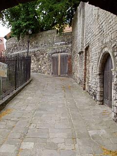 View up Blue Anchor Lane from postern gate, 21.6.09, © I Peckham | 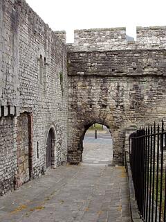 Interior of Blue Anchor postern gate and town wall, etc, from Blue Anchor Lane, 21.6.09, © I Peckham |
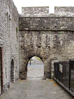 Interior of Blue Anchor postern gate and town wall, etc, from Blue Anchor Lane, 21.6.09, © I Peckham | 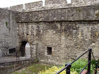 Inside of town wall north of King John's Palace, 21.6.09, © I Peckham |
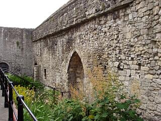 Inside of town wall north of King John's Palace, 21.6.09, © I Peckham | 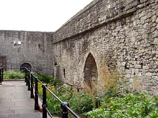 Inside of town wall north of King John's Palace, 21.6.09, © I Peckham |
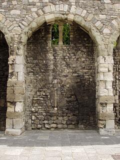 The Arcades, Western Esplanade - 17th arcade (working southwards), part of wall of King John's Palace, 21.6.09, © I Peckham | 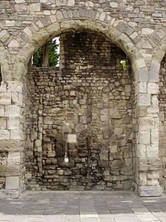 The Arcades, Western Esplanade - 18th arcade (working southwards), part of wall of King John's Palace, 21.6.09, © I Peckham |
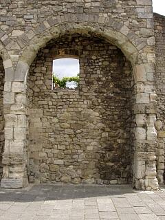 The Arcades, Western Esplanade - 19th arcade (working southwards), part of wall of King John's Palace, 21.6.09, © I Peckham | 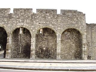 The Arcades, Western Esplanade - arcade and west wall of King John's Palace, 21.6.09, © I Peckham |
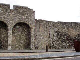 The Arcades, Western Esplanade - south end and town wall to south, 21.6.09, © I Peckham | 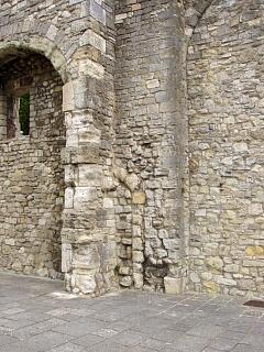 The Arcades, Western Esplanade - detail of join between south end of Arcades and town wall to south, 21.6.09, © I Peckham |
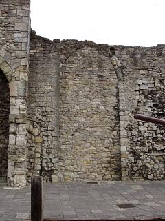 The Arcades, Western Esplanade - south end of arcades and town wall to south, 21.6.09, © I Peckham | 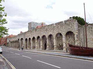 The Arcades, Western Esplanade, 21.6.09, © I Peckham |
If you have any feedback or new information about this record, please email the Southampton HER (her@southampton.gov.uk).
Search results generated by the HBSMR Gateway from exeGesIS SDM Ltd.