List Entry Summary
This monument is scheduled under the Ancient Monuments and Archaeological Areas Act 1979 as amended as it appears to the Secretary of State to be of national importance. This entry is a copy, the original is held by the Department for Culture, Media and Sport.
Name: Moated site of Handsacre Hall.
List Entry Number: 1012430
Location
The monument may lie within the boundary of more than one authority.
County: Staffordshire
District: Lichfield
District Type: District Authority
Parish: Armitage with Handsacre
National Park: Not applicable to this List entry.
Grade: Not applicable to this List entry.
Date first scheduled: 28-Feb-1974
Date of most recent amendment: 30-Dec-1992
Legacy System Information
The contents of this record have been generated from a legacy data system.
Legacy System: RSM
UID: 13506
Asset Groupings
This List entry does not comprise part of an Asset Grouping. Asset Groupings are not part of the official record but are added later for information.
List Entry Description
Summary of Monument
Legacy Record - This information may be included in the List Entry Details.
Reasons for Designation
Around 6,000 moated sites are known in England. They consist of wide ditches,
often or seasonally water-filled, partly or completely enclosing one or more
islands of dry ground on which stood domestic or religious buildings. In some
cases the islands were used for horticulture. The majority of moated sites
served as prestigious aristocratic and seigneurial residences with the
provision of a moat intended as a status symbol rather than a practical
military defence. The peak period during which moated sites were built was
between about 1250 and 1350 and by far the greatest concentration lies in
central and eastern parts of England. However, moated sites were built
throughout the medieval period, are widely scattered throughout England and
exhibit a high level of diversity in their forms and sizes. They form a
significant class of medieval monument and are important for the understanding
of the distribution of wealth and status in the countryside. Many examples
provide conditions favourable to the survival of organic remains.
The monument survives well and remains unencumbered by modern development.
Evidence of the original medieval structure that occupied the site will exist
on the island and beneath the brick and sandstone building remains.
Additionally organic material will survive within the waterlogged moat.
History
Legacy Record - This information may be included in the List Entry Details.
Details
The monument is the moated site of Handsacre Hall. The site includes an
island measuring c.54m by 53m that contains brick and sandstone structural
remains of Handsacre Hall protruding above the surface. The island is
surrounded by a substantial moat 8-10m wide and 4m deep that remains
waterlogged in its eastern and southern arms and at the south-western corner.
The western half of the northern arm has been infilled. Elsewhere the moat is
dry. Flanking the moat's western arm is an outer bank measuring up to 7m wide
by 1m high.
The Handsacre family lived in Handsacre prior to the Norman Conquest. During
the 14th century a cruck hall occupied the island. Handsacre Hall was rebuilt
at an unspecified date and latterly became a farm. The building was
demolished during the mid 1960s.
All fences are excluded from the scheduling; the ground beneath them,
however, is included. The ruins of the brick and sandstone building phase of
Handsacre Hall are also included in the scheduling because any disturbance to
them is likely to damage underlying medieval remains.
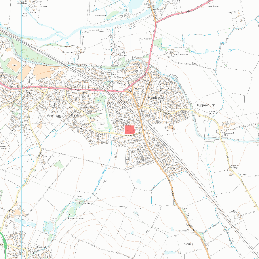
MAP EXTRACT
The site of the monument is shown on the attached map extract.
It includes a 2 metre boundary around the archaeological features,
considered to be essential for the monument's support and preservation.
Selected Sources
OtherDarvill, T., MPP Single Monument Class Description - Moats, (1988)
SMR No. 220, Staffs SMR, Handsacre Hall: Armitage with Handsacre,
Map
National Grid Reference: SK 08993 15649
The below map is for quick reference purposes only and may not be to scale. For a copy of the full scale map, please see the attached PDF - 1012430.pdf - Please be aware that it may take a few minutes for the download to complete.
© Crown Copyright and database right 2018. All rights reserved. Ordnance Survey Licence number 100024900.
© British Crown and SeaZone Solutions Limited 2018. All rights reserved. Licence number 102006.006.
This copy shows the entry on 12-Jul-2025 at 01:01:58.


