List Entry Summary
This monument is scheduled under the Ancient Monuments and Archaeological Areas Act 1979 as amended as it appears to the Secretary of State to be of national importance. This entry is a copy, the original is held by the Department for Culture, Media and Sport.
Name: Stanwardine moated site and associated fishpond
List Entry Number: 1017240
Location
The monument may lie within the boundary of more than one authority.
County:
District: Shropshire
District Type: Unitary Authority
Parish: Baschurch
National Park: Not applicable to this List entry.
Grade: Not applicable to this List entry.
Date first scheduled: 02-Aug-1971
Date of most recent amendment: 07-Jul-2000
Legacy System Information
The contents of this record have been generated from a legacy data system.
Legacy System: RSM
UID: 32317
Asset Groupings
This List entry does not comprise part of an Asset Grouping. Asset Groupings are not part of the official record but are added later for information.
List Entry Description
Summary of Monument
Legacy Record - This information may be included in the List Entry Details.
Reasons for Designation
Around 6,000 moated sites are known in England. They consist of wide ditches,
often or seasonally water-filled, partly or completely enclosing one or more
islands of dry ground on which stood domestic or religious buildings. In some
cases the islands were used for horticulture. The majority of moated sites
served as prestigious aristocratic and seigneurial residences with the
provision of a moat intended as a status symbol rather than a practical
military defence. The peak period during which moated sites were built was
between about 1250 and 1350 and by far the greatest concentration lies in
central and eastern parts of England. However, moated sites were built
throughout the medieval period, are widely scattered throughout England and
exhibit a high level of diversity in their forms and sizes. They form a
significant class of medieval monument and are important for the understanding
of the distribution of wealth and status in the countryside. Many examples
provide conditions favourable to the survival of organic remains.
Stanwardine moated site and the adjoining fishpond survive well despite some
modification and disturbance to the moated site. The form of the moated site
is unusual. Sub-circular examples are relatively uncommon nationally, and such
sites are thought to date to the early medieval period. The moated island will
retain structural and artefactual evidence of the buildings that once stood on
the site, which together with the artefacts and organic remains existing in
the moat will provide valuable evidence about the occupation and social status
of the inhabitants. Organic remains surviving in the moat will also provide
information about the changes to the local environment and use of the land.
The visible remnants of the medieval footbridge is a rare example of this type
of structure.
Fishponds were constructed throughout the medieval period with many dating to
the 12th century. The direct association of the moated site and the fishpond
provides further evidence about the economy and lifestyle of the occupants of
this site during the medieval period. The importance of the site is also
enhanced by documentary sources providing ownership information.
History
Legacy Record - This information may be included in the List Entry Details.
Details
The monument includes the earthwork, buried and standing structural remains of
Stanwardine moated site and an associated fishpond. The moated site is
considered to be the centre of the manor of Stanwardine, which was in the
estate of the Fitz Alans and held by the Richard de Stanwardine in the late
12th century. In 1307 the manor was sold by Philp de Stanwardine to Richard
Hord, and in the 16th century it passed from the Hords to the Kynaston family.
In 1555 Stanwardine Hall was built for Richard Corbett. This house occupies
an elevated position 90m to the north of the moated site and is not included
in the scheduling.
The moated site is situated at the base of a slope with land rising to the
north and east. The water-filled moat defines an oval shaped island which
measures approximately 42m east-west and 38m north-south. The arms of the
moat are between 10m and 16m wide. Material excavated from the moat has been
used to raise the surface of the island by about 0.5m on the eastern side and
1.5m on the western side. In addition, material dug from the moat has been
deposited along the outer edge of the western arm in order to form a bank 5m
wide and up to 0.8m high. A modern breach through the south western corner of
the moat has truncated this earthwork. At the western end of the northern arm
there are the remains of two bridge abutments, 2m wide, and constructed of
red sandstone blocks. This footbridge is probably medieval in date and is
included in the scheduling. Bricks and sandstone blocks embedded in the sides
of the island give further indications of the nature of the buildings that
once occupied the site and which survive as buried features.
To the south of the moated site there are the remains of a rectangular shaped
fishpond which retains water. It is 30m-50m wide and about 95m long. A dam,
18m wide and 1m high defines its southern end. At the northern end it is
connected to the moat by a channel or leat. The pond was constructed for
breeding and storing fish in order to provide a sustainable supply of food.
The waste water collection tank and associated pumping houses which are
constructed over the moat, all modern field boundaries and fences and gates
are excluded from the scheduling, although the ground beneath these features
is included.
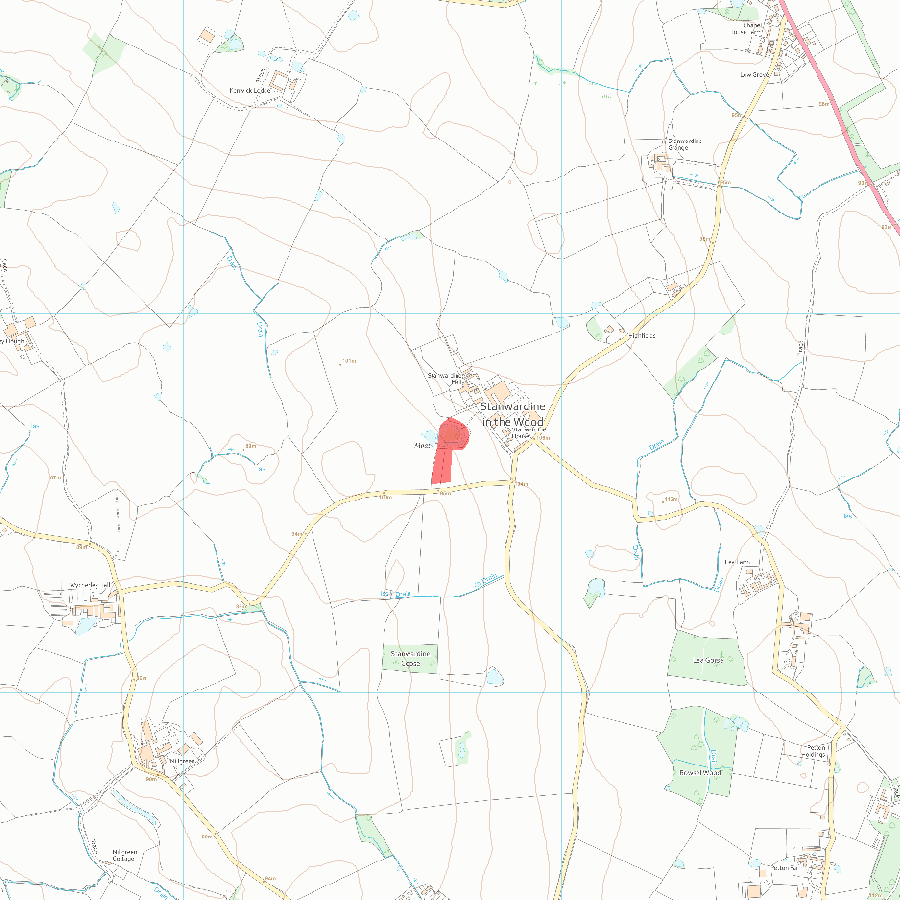
MAP EXTRACT
The site of the monument is shown on the attached map extract.
It includes a 2 metre boundary around the archaeological features,
considered to be essential for the monument's support and preservation.
Selected Sources
Books and journals'Transactions of the Shropshire Archaeological Society' in Ellesmere and Stanwardine-in-the-Wood, , Vol. 4series3, (1913), XV
OtherBridge, W, History of Stanwardine in the Wood, 1997, Privately circulated booklet
Map
National Grid Reference: SJ 42704 27642
The below map is for quick reference purposes only and may not be to scale. For a copy of the full scale map, please see the attached PDF - 1017240.pdf - Please be aware that it may take a few minutes for the download to complete.
© Crown Copyright and database right 2018. All rights reserved. Ordnance Survey Licence number 100024900.
© British Crown and SeaZone Solutions Limited 2018. All rights reserved. Licence number 102006.006.
This copy shows the entry on 12-Jul-2025 at 10:09:54.


