See important
guidance on the use of this record.
If you have any comments or new information about this record, please email us.
| HER Number: | MDV109450 |
|---|
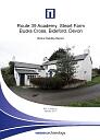
| Name: | Hay Barn, Steart Farmstead, Bideford |
|---|
Summary
Former farm building, probable hay barn with possible stable at north end. In 2016 the building was ina ruined state.
Location
| Grid Reference: | SS 356 228 |
|---|
| Map Sheet: | SS32SE |
|---|
| Admin Area | Devon |
|---|
| Civil Parish | Parkham |
|---|
| District | Torridge |
|---|
| Ecclesiastical Parish | PARKHAM |
|---|
Protected Status: none recorded
Other References/Statuses: none recorded
Monument Type(s) and Dates
- HAY BARN (Ruined, XVII to XXI - 1650 AD to 2016 AD (Between))
- STABLE? (XVII to XIX - 1650 AD to 1900 AD (Between))
Full description
Jones Lang Lasalle, 08/02/2014, Route 39 Academy, Steart Farm, Bucks Cross, Bideford (Report - Assessment). SDV357827.
This building is located to the south of the farmhouse, at the eastern side of the drive leading to the farmstead. This structure is shown on the 1840 Tithe Map and is in the north-western corner of a small enclosure. The accompanying apportionment gives the name ‘Mowhays’ to this enclosure, suggesting a storage area for hay. The building appears to be a barn, although it is in poor condition and internal examination has not been possible. Some stability is provided by the addition of a block wall either just within or directly replacing the main stone wall and this later addition supports the roof. The available sequence of historic maps indicates that this building has not changed in size since at least 1840.
Ordnance Survey, 2015, MasterMap (Cartographic). SDV357601.
Wessex Archaeology, 2017, Route 39 Academy, Steart Farm, Bucks Cross, Bideford, Devon: Historic Building Record (Report - Survey). SDV363518.
At the time of the survey the building had collapsed and was inaccessible. Observations were only available from a barrier as the building had been fenced off for safety purposes.
The building may have originally been a former barn, probably an open hay barn which had been altered at the south end creating a gable in order to insert a hay loft door. A South West Archaeology Report from 2015 states that the roof is pitched and half-hipped. The roof appears to be of similar in design to the roof of the farmhouse suggesting they are contemporary in date.
The west wall is constructed of Devonian slate stone laid in random courses. The presence of ventilation slots in one of the walls strongly suggests that the north end of the building was meant to be occupied by animals. There is evidence of a stone dividing wall on the ground floor indicating a possible stable at the north end. Photographs of the east side of the barn indicate that the north end of the east wall was rebuilt in concrete blocks indicating it may have originally been cob walling. The first floor of the building appeared to be a later insertion suggesting that the building was originally open along its entire length.
Sources / Further Reading
| SDV357601 | Cartographic: Ordnance Survey. 2015. MasterMap. Ordnance Survey Digital Mapping. Digital. [Mapped feature: #68859 ] |
| |
| | |
| SDV357827 | Report - Assessment: Jones Lang Lasalle. 08/02/2014. Route 39 Academy, Steart Farm, Bucks Cross, Bideford. Jones Lang Lasalle. Digital. |
| |
| | |
| SDV363518 | Report - Survey: Wessex Archaeology. 2017. Route 39 Academy, Steart Farm, Bucks Cross, Bideford, Devon: Historic Building Record. Wessex Archaeology. 115060.02. Digital. |
| |  |
| | Linked documents:1 |
Associated Monuments: none recorded
Associated Finds: none recorded
Associated Events
- EDV6685 - Environmental Impact Assessment, Route 39 Academy, Steart Farm, Bucks Cross, Bideford
- EDV8269 - Historic Building Record at Route 39 Academy, Steart Farm, Bucks Cross, Bideford (Ref: 115060.02)
| Date Last Edited: | Apr 22 2020 3:42PM |
|---|
Search results generated by the HBSMR Gateway from exeGesIS SDM Ltd.