See important
guidance on the use of this record.
If you have any comments or new information about this record, please email us.
| HER Number: | MDV109456 |
|---|
| Name: | Building, Steart Farmstead, Bideford |
|---|
Summary
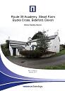
Building, Steart Farmstead, present on the 1886 Ordnance Survey map
Location
| Grid Reference: | SS 356 228 |
|---|
| Map Sheet: | SS32SE |
|---|
| Admin Area | Devon |
|---|
| Civil Parish | Parkham |
|---|
| District | Torridge |
|---|
| Ecclesiastical Parish | PARKHAM |
|---|
Protected Status: none recorded
Other References/Statuses: none recorded
Monument Type(s) and Dates
- CART SHED (XIX - 1840 AD to 1879 AD (Between))
Full description
Jones Lang Lasalle, 08/02/2014, Route 39 Academy, Steart Farm, Bucks Cross, Bideford (Report - Assessment). SDV357827.
This building is not shown on the 1840 Tithe Map but is present on the 1886 OS map. This later 19th century date is supported by documents in the possession of the current owners, which provide details of the contractor responsible for the construction of the building. Its purpose is not clear – perhaps a general farm equipment store – but is now lacking a roof and any part of the eastern wall, although this may have been open with occasional pillars rather than a fully enclosing wall.
Ordnance Survey, 2015, MasterMap (Cartographic). SDV357601.
Wessex Archaeology, 2017, Route 39 Academy, Steart Farm, Bucks Cross, Bideford, Devon: Historic Building Record (Report - Survey). SDV363518.
The building is likely to have been constructed between 1840 and 1879 and may have formed part of the Mark Rolle improvement to the farm. The south gable of this building likely housed a commemorative plaque (now situated in the farmhouse). The building was probably used as an open-fronted cart-shed as evidenced by a photograph of an open-fronted shed in 1995. The walls are constructed from Devonian slate stone and characteristic red brick dressings characteristic of Mark Rolle improvements. It is thought there would have been four internal bays.
Sources / Further Reading
| SDV357601 | Cartographic: Ordnance Survey. 2015. MasterMap. Ordnance Survey Digital Mapping. Digital. [Mapped feature: #68865 ] |
| |
| | |
| SDV357827 | Report - Assessment: Jones Lang Lasalle. 08/02/2014. Route 39 Academy, Steart Farm, Bucks Cross, Bideford. Jones Lang Lasalle. Digital. |
| |
| | |
| SDV363518 | Report - Survey: Wessex Archaeology. 2017. Route 39 Academy, Steart Farm, Bucks Cross, Bideford, Devon: Historic Building Record. Wessex Archaeology. 115060.02. Digital. |
| |  |
| | Linked documents:1 |
Associated Monuments: none recorded
Associated Finds: none recorded
Associated Events
- EDV6685 - Environmental Impact Assessment, Route 39 Academy, Steart Farm, Bucks Cross, Bideford
- EDV8269 - Historic Building Record at Route 39 Academy, Steart Farm, Bucks Cross, Bideford (Ref: 115060.02)
| Date Last Edited: | Apr 22 2020 9:21AM |
|---|
Search results generated by the HBSMR Gateway from exeGesIS SDM Ltd.