See important
guidance on the use of this record.
If you have any comments or new information about this record, please email us.
| HER Number: | MDV128935 |
|---|
| Name: | Prehistoric trackway to the north of Digby Drive, Exeter |
|---|
Summary
Excavations in advance of the construction of Clyst Heath Primary School revealed the remains of a small settlement of 3rd-1st century BC across which two parallel ditches ran north-east to south-west. The ditches, circa 4 metres apart, may represent the edges of a track or drove way providing access between the ridge and lower ground to the east. Very little dating evidence was recovered from the ditches suggesting the track may have predated the settlement.
Location
| Grid Reference: | SX 957 913 |
|---|
| Map Sheet: | SX99SE |
|---|
| Admin Area | Devon |
|---|
| Civil Parish | Exeter |
|---|
| District | Exeter |
|---|
| Ecclesiastical Parish | HEAVITREE |
|---|
Protected Status: none recorded
Other References/Statuses: none recorded
Monument Type(s) and Dates
- TRACKWAY (Constructed, Early Bronze Age to Middle Iron Age - 2200 BC to 101 BC (Between))
Full description
Gent, T. + Goodwin, N., 2008, Archaeological Monitoring and Recording of a Housing Development at Digby Drive, Exeter (Report - Watching Brief). SDV363887.
Extension of the trackway seen in excavation along the line of Royal Crescent.
Clyst Heath Community Primary School, 2008, Under Our School (Un-published). SDV352560.
The remains of a Bronze Age trackway and four Iron Age round houses were revealed during excavations on the site of the school.
Best, J. E., 2009, Archaeological Excavation at Clyst Heath Primary School, Exeter (Report - Excavation). SDV342737.
Excavations revealed the remains of a small settlement of 3rd-1st century BC across which two parallel ditches ran north-east to south-west. The ditches,circa 4 metres apart, may represent the edges of a track or drove way providing access between the ridge and lower ground to the east. Very little dating evidence was recovered from the ditches suggesting the track may have predated the settlement.
Quinnell, H. + Farnell, A., 2016, Prehistoric Sites in the Digby Area of Exeter, 91-110, fig 23-37 (Article in Serial). SDV363832.
Pair of parallel linear ditches approximately 3m apart, aligned north-east by south-west. Northern ditch was 1m wide, 0.4m deep with irregular profile. Southern ditch 0.4 - 1.8m wide, 0.6m deep with V-shaped profile. A Middle Iron Age sherd (probably intrusive) was recovered from the former. These ditches are a continuation of those underlying the Iron Age houses in Site 4.
Sources / Further Reading
| SDV342737 | Report - Excavation: Best, J. E.. 2009. Archaeological Excavation at Clyst Heath Primary School, Exeter. Exeter Archaeology Report. 09.21. A4 Stapled + Digital. |
| |
| | |
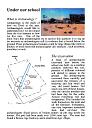
| SDV352560 | Un-published: Clyst Heath Community Primary School. 2008. Under Our School. A4 Stapled + Digital. |
| |  |
| | Linked documents:2 |
| SDV363832 | Article in Serial: Quinnell, H. + Farnell, A.. 2016. Prehistoric Sites in the Digby Area of Exeter. Proceedings of the Devon Archaeological Exploration Society. 74. Paperback Volume. 91-110, fig 23-37. [Mapped features: #127038 Scanned version of Fig 23 used to digitise feature, ; #127088 Scanned version of Fig 23 used to digitise feature, ] |
| |
| | |
Associated Monuments
| MDV128966 | Related to: Iron Age ovens excavated, Digby Drive (Monument) |
| MDV75660 | Related to: Iron Age Settlement to north of Digby Drive, Exeter (Monument) |
| MDV128965 | Related to: Middle Neolithic pit off Digby Drive (Monument) |
| MDV128964 | Related to: Ring ditch off Digby Drive (Monument) |
Associated Finds: none recorded
Associated Events
- EDV4537 - Excavation at Clyst Heath Primary School
- EDV8336 - Monitoring and Recording of a Housing Development at Digby Drive (Ref: 08.06)
| Date Last Edited: | Oct 14 2020 2:33PM |
|---|
Search results generated by the HBSMR Gateway from exeGesIS SDM Ltd.