See important
guidance on the use of this record.
If you have any comments or new information about this record, please email us.
| HER Number: | MDV129563 |
|---|
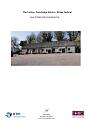
| Name: | Linhay at Sandridge Barton, Stoke Gabriel |
|---|
Summary
Eight bay stone-built linhay dating to the late 18th-early 19th century. The original open front, the bays of which are divided by round rubble stone pillars, was subsequently infilled. The roof covering is also modern but the original roof trusses survive.
Location
| Grid Reference: | SX 861 565 |
|---|
| Map Sheet: | SX85NE |
|---|
| Admin Area | Devon |
|---|
| Civil Parish | Stoke Gabriel |
|---|
| District | South Hams |
|---|
| Ecclesiastical Parish | STOKE GABRIEL |
|---|
Protected Status: none recorded
Other References/Statuses: none recorded
Monument Type(s) and Dates
- LINHAY (Built, XVIII to XIX - 1772 AD (Between) to 1840 AD (Between))
Full description
Child, P, Sandridge Barton, Stoke Gabriel (DRAFT) (Report - Survey). SDV363973.
An eight bay linhay of Alcock's Type 2. The bays are divided at the front by round rubble stone pillars. The rear and side walls are also of rubble stone and it is built into the bank behind it. The south gable is fully hipped, the north half-hipped over a large loading door. The original open front has been infilled to form a fully enclosed building. In this case, the infilling took place in two phases. Firstly, in the 19th century, the southern three and a half bays were infilled and a cross wall inserted to create what appears to have been a stable. The remaining bays were infilled to form a cattle shed, now a workshop, probably after the Second World War to judge by the use of earthenware drain pipes for ventilators through the rear wall. The roof is clad with modern sheeting but all the original roof trusses remain.
The linhay is not shown on an estate map of 1772 but is shown on the 1840 Tithe Map. The fact that the roof trusses are pegged together rather that bolted suggests it was built earlier in that period.
See report for further details.
Devon County Council, 1838-1848, Tithe Mosaic, approximately 1838-1848 (Cartographic). SDV349431.
Linhay depicted.
Ordnance Survey, 2020, MasterMap 2020 (Cartographic). SDV363413.
Long linhay, aligned broadly north-south.
White, N. + Mcilwaine, S., 2021, The Linhay, Sandridge Barton, Stoke Gabriel: Level 2 Historic Building Recording (Report - Survey). SDV364279.
Historic building recording undertaken of the linhay prior to repair works. The linhay forms the west side of a farmyard, the other buildings around which have now mostly been demolished.
The linhay is a large but typical example of a Devon linhay, built between 1772 and 1840. It is not shown on an estate map thought to have been drawn in 1772 but is depicted on the 1840 Stoke Gabriel Tithe Map. Sandridge Barton is thought to date from the early 19th century, built as the home farm for Sandridge Park which was newly built in 1805 and it is possible that the linhay and other farm buildings date from this time. However, it has been suggested that the construction methods indicate an earlier date.
The linhay is an eight bay structure built of rubble stone with a pitched roof, the original trusses of which survive. The roof is now covered with corrugated sheet roof but was originally thatched. The west side is built into the bank and the formerly open, east side has round stone piers. The open front was subsequently infilled and windows and doors inserted. This occured in two phases. The southern three and a half bays with rubble stone in the late 18th or early 19th century, perhaps to form a stable and the northern four and a half bays with concrete blocks to form a cattle shed probably after the Second World War. The floor has been relaid with concrete. Most of the joists supporting the first floor have also been replaced.
Despite the later alterations the linhay is a good example of its type and its rubble stone construction built into the hillside are characteristic of the South Hams. The building also retains several features of architectural interest such as the pegged trusses and surviving original floor joists.
See report for full details.
Sources / Further Reading
| SDV349431 | Cartographic: Devon County Council. 1838-1848. Tithe Mosaic, approximately 1838-1848. Digitised Tithe Map. Digital. |
| |
| | |
| SDV363413 | Cartographic: Ordnance Survey. 2020. MasterMap 2020. Ordnance Survey Digital Mapping. Digital. [Mapped feature: #128020 ] |
| |
| | |
| SDV363973 | Report - Survey: Child, P. Sandridge Barton, Stoke Gabriel (DRAFT). Digital. |
| SDV364279 | Report - Survey: White, N. + Mcilwaine, S.. 2021. The Linhay, Sandridge Barton, Stoke Gabriel: Level 2 Historic Building Recording. Nils White Heritage Conservation Consultant. 210101. Digital. |
| |  |
| | Linked documents:1 |
Associated Monuments
| MDV15736 | Part of: Sandridge Barton, Stoke Gabriel (Monument) |
Associated Finds: none recorded
Associated Events
- EDV8355 - Appraisal of Sandridge Barton, Stoke Gabriel
- EDV8754 - Historic building recording of the linhay at Sandridge Barton, Stoke Gabriel
| Date Last Edited: | Dec 2 2021 10:40AM |
|---|
Search results generated by the HBSMR Gateway from exeGesIS SDM Ltd.