See important
guidance on the use of this record.
If you have any comments or new information about this record, please email us.
| HER Number: | MDV17618 |
|---|
| Name: | The Glen, Seaton |
|---|
Summary
The Glen, formerly known as White Cliff Glen, is depicted on late-19th century maps but not on the Tithe map. Documentary evidence indicates a construction date of 1867-8. Local tradition has it that the house had a military use during the Second World War.
Location
| Grid Reference: | SY 233 896 |
|---|
| Map Sheet: | SY28NW |
|---|
| Admin Area | Devon |
|---|
| Civil Parish | Seaton |
|---|
| District | East Devon |
|---|
| Ecclesiastical Parish | SEATON |
|---|
Protected Status: none recorded
Other References/Statuses
- Old DCC SMR Ref: SY28NW/21
Monument Type(s) and Dates
- MANSION HOUSE (XIX - 1841 AD (Between) to 1890 AD (Between))
Full description
Devon County Council, 1838-1848, Tithe Mosaic, approximately 1838-1848 (Cartographic). SDV349431.
No building is depicted in this location on the Tithe map.
Ordnance Survey, 1880-1899, First Edition Ordnance 25 inch map (Cartographic). SDV336179.
Large house and garden named as White Cliff Glen on 1880s-1890s 25 inch Ordnance Survey map.
Gosney, E., 1968, Seaton, 1785-1842, 354 (Article in Serial). SDV348469.
Gosney records that the Mansion House, later known as Whitecliffe, was built in 1806. This is likely to refer to the White Cliff, formerly The Mansion House (MDV42533), not the Glen.
Ordnance Survey, 2011, MasterMap (Cartographic). SDV346129.
Marked as The Glen on current mapping.
Philpott, A., 2022, The Glen, Seaton Hole area (Personal Comment). SDV364991.
The Glen probably dates to 1867- 1868, when Thomas Fox Alexander Byles, a brewer of Henley, took on a 99 year lease of the house and land soon after the opening of the Seaton and Beer Railway, as the town of Seaton started to expand along 'Old Beer Road'. It was built in a corner of the meadow named Beer Brooks (plot 918 on the Tithe map). Farmer Thomas Aplin at Couchill had previously been leasing the land from the Rolle/Clinton estate, and received compensation.
There is a local 'legend' that The Glen was used by the Admiralty during WW2, possibly for storing explosives, because of the type of building materials discovered during conversion. No documentary evidence for this has yet been found, and it seems unlikely given that between 1943 and 1945 a speculator divided the original 'mansion' into a block of 9 flats. Perhaps it served as accommodation for officers attached to the nearby camp on Beer's New Road (MDV106474).
Sources / Further Reading
| SDV336179 | Cartographic: Ordnance Survey. 1880-1899. First Edition Ordnance 25 inch map. First Edition Ordnance Survey 25 inch Map. Map (Digital). |
| |
| | |
| SDV346129 | Cartographic: Ordnance Survey. 2011. MasterMap. Ordnance Survey. Map (Digital). [Mapped feature: #82064 ] |
| |
| | |
| SDV348469 | Article in Serial: Gosney, E.. 1968. Seaton, 1785-1842. Transactions of the Devonshire Association. 100. Hardback Volume. 354. |
| |
| | |
| SDV349431 | Cartographic: Devon County Council. 1838-1848. Tithe Mosaic, approximately 1838-1848. Digitised Tithe Map. Digital. |
| |
| | |
| SDV364991 | Personal Comment: Philpott, A.. 2022. The Glen, Seaton Hole area. Email. |
| |  |
| | Linked images:1 |
Associated Monuments
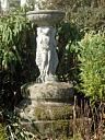
| MDV80932 | Related to: Fountain at The Glen, Seaton (Monument) |
Associated Finds: none recorded
Associated Events: none recorded
| Date Last Edited: | Nov 8 2022 5:17PM |
|---|
Search results generated by the HBSMR Gateway from exeGesIS SDM Ltd.