See important
guidance on the use of this record.
If you have any comments or new information about this record, please email us.
| HER Number: | MDV19999 |
|---|
| Name: | Barnstaple Castle Motte |
|---|
Summary
The motte is the earliest feature of the castle dating to about 1068-9 which still stands about 14 metres high by 60 metres diameter. It was originally surrounded by a wet moat. It was topped by a shell keep comprising two concentric walls which was built probably not long after 1136.
Location
| Grid Reference: | SS 555 333 |
|---|
| Map Sheet: | SS53SE |
|---|
| Admin Area | Devon |
|---|
| Civil Parish | Barnstaple |
|---|
| District | North Devon |
|---|
| Ecclesiastical Parish | BARNSTAPLE |
|---|
Protected Status
Other References/Statuses
- National Monuments Record: SS53SE14
- North Devon District Council Rescue Archaeology Unit Site Code: ND118
- North Devon District Council Rescue Archaeology Unit Site Code: ND25
- Old DCC SMR Ref: SS53SE/43/1
- Old SAM County Ref: 255
- Old SAM Ref: 33062
- Ordnance Survey Archaeology Division: SS53SE14
- Pastscape: 33893
Monument Type(s) and Dates
- MOTTE (XI - 1066 AD to 1086 AD (Between))
Full description
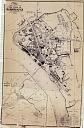
Wood, J., 1843, Plan of the Town of Barnstaple from Actual Survey (Cartographic). SDV91852.
Amery, P. F. S., 1900-1901, A Tour across Dartmoor into North Devon by the Rev. John Swete 1789, 171 (Article in Serial). SDV18670.
Seen by Swete in 1789.
Oliver, B. W., 1928, The Castle of Barnstaple, 215-223, Plan (Article in Serial). SDV73002.
Barnstaple Castle. Motte and shell keep. The motte is the earliest feature dating to about 1068-1069. Surrounded by a wet moat. Excavation in 1927 revealed the foundations of a masonry (sandstone and limestone) shell keep with wing walls descending the motte. Some sections of the keep wall survived to a height of over 2.4 metres. In plan it was roughly circular, consisting of two concentric walls; the inner had a 13.7 metres internal diameter, 19.8 metres external, and there was evidence of a garderobe, and eastern entrance. Bounding the extreme edge of the top of the motte were the remains of another wall 1 metre thick. The keep was probably built shortly after 1136. A document of 1274 mentions a 'motte on which there is a certain hall, chamber, kitchen and other houses closely built'. There was a chapel in the keep.
Unknown, 1929, Unknown, 75 (Article in Serial). SDV90015.
In 1929 the town council are recorded as having preserved the castle mound site to form part of the pleasure grounds.
Ministry of Works, 1950, Barnstaple Castle (Schedule Document). SDV73985.
Barnstaple Castle motte and bailey. The motte impinges on the town wall and the bailey extends away from the town. The motte is well preserved with the stone foundations of a shell keep.
Devon County Council, 1975, Barnstaple Town Trail, 17-18 (Article in Monograph). SDV352446.
Higham, R. A., 1979, The Castles of Medieval Devon, 75-79 (Post-Graduate Thesis). SDV336189.
The structure on the motte was probably a shell keep and enclosed tower as at Launceston or Plympton.
Markuson, K. W., 1980, Barnstaple Survey (Un-published). SDV356766.
Department of Environment, 1983, Barnstaple Castle (Schedule Document). SDV344491.
The scheduled area of Barnstaple Castle was extended in 1983.
Andrews, G., 1985, Castle Mound to get Face Lift (Article in Serial). SDV361450.
Barnstaple's ancient castle mound, where men were hanged in the Middle Ages looks like getting a 20th century style new lease of life.
Branded as very neglected and poorly presented, the 900 year old landmark is to be turned into a focal point and a major attraction. The mound or ancient motte is a scheduled monument of national importance. Among ideas to restore the mound is a nine-point plan. It includes: turning it into a focal point, removing all dead, dying or dangerous trees, stabilising eroded areas, reinstating the footpath and providing more seats, encouraging wild flowers to grow and carrying out a careful programme of tree husbandry.
Western Morning News, 1985, Town's Ancient Mound is Set for Face Lift (Article in Serial). SDV361449.
Castle Mound, in Barnstaple, the town's most important historic monument is in line for a major restoration operation.
The Mound which is at least 900 years old, is a tree-covered hillock next to the town's cattle market which covers the site of an ancient castle. The hillock is choked by trees and shrubs which have grown rapidly over the past 50 years to shoud the landmark. Suggestions to remove shrubs, untidy sycamores and dying elms. Footpaths can be repaired and grass planted on imported topsoil. Despite the loss of the structure the motte itself convincingkly demonstrates the oppressive and commanding character of the castle over the town.
North Devon District Council Rescue Archaeology Unit, 1991, North Devon Archaeological Site Code Index, Site Code ND25, ND118 (Report - non-specific). SDV63429.
Trial excavation undertaken in castle ditch in 1985.
Scarping of castle ditch monitored in 1987.
Higham, R. A. + Freeman, J. P., 1996, Devon Castles (Draft Text), Gazetteer (Monograph). SDV354350.
The motte is over 14 metres high. Excavation on the top has revealed a stone perimeter wall surrounding a circular building, probably a keep.
Exeter Archaeology, 2001, Archaeological Assessment and Building Recording at Commercial Road, Barnstaple, 2 (Report - Assessment). SDV73888.
Department for Culture, Media and Sport, 2002, Barnstaple Castle (Schedule Document). SDV342276.
Barnstaple Castle with a Norman motte and bailey. The earth and stone built motte stands about 14 metres high by 60 metres diameter and retains masonry fragments of a stone defensive wall and an inner circular tower known as a donjon or shell keep with wing walls descending the slopes of the motte. In plan it was roughly circular and comprised two concentric walls. Another wall 1 metre thick bounded the edge of the flat top of the motte. A document of 1274 indicates the presence of a hall, chamber and kitchen on the motte.
Exeter Archaeology, 2003, Barnstaple Castle Car Park Scheme: Phase 1: Archaeological Assessment, 15, Fig. 11 (Report - Assessment). SDV319631.
National Monuments Record, 2010, 33893 (National Monuments Record Database). SDV73999.
Remains of a Norman motte and bailey. Known from the early 12th century, when it is associated with Judhael, Lord of Barnstaple. In 1228 the walls were reduced to a height of 10 feet on royal orders. In a state of disrepair in 1328, it was a ruin in Leland's time. The castle mound and vestiges of its ditch are all that now survives. The mound is approximately 60 metres in diameter at its base, 20 metres across at its top and 14 metres high. The level grass covered top has two small, 0.5 metres high, banks on the north side. There are two lengths of walling. The bailey lay to the north west and was originally enclosed by a bank and moat.
Southwest Archaeology, 2013, Greater Barnstaple Area Project Database, Mapping Area 16, 108 (Un-published). SDV351581.
Ordnance Survey, 2013, MasterMap (Cartographic). SDV350786.
Dean, R., 2017, Barnstaple Castle, Barnstaple: Geophysics (Report - Survey). SDV360284.
This report was commissioned by North Devon Council. Magnetometer, resistance and ground penetrating radar (GPR) surveys were completed to inform upon the buried remains at Barnstaple Castle. The outer and inner castle baileys are now mainly urban parkland and were subject to magnetometer and resistance surveys. The tarmac carpark, which includes part of the former outer bailey and areas out with the scheduled monument, was subject to a ground penetrating radar (GPR) survey. The top of the motte was subject to surveys using all three techniques. The parkland, formerly parts of the inner and outer baileys and part of the moat, was the subject of magnetometer and resistance surveys (Figures 3 and 4). Evidence for the location, structure and demolition of Castle House, situated in this area between at least 1684 to 1976, was recorded in both surveys. The resistance survey highlighted anomalies likely to represent wall footings and floors. Both surveys recorded anomaly groups that may reflect the archaeological excavation that took place in this area between 1972 and 1975.
The grass covered Motte top was the subject of magnetometer, resistance and ground GPR surveys (Figures 3, 4 and 5). The GPR survey data implied a relatively deeply buried subcircular structure. Given the depth, the structure may be part of the former inner circular tower (known as a donjon or shell keep). Other radar reflections and resistance anomalies possibly representing several phases of building were recorded on the keep top. The complexity of the data sets meant that it was difficult to ascertain whether they related to 19th century landscaping or to defensive structures such as the donjon and both are very likely represented.
Timms, S. C., 21/10/1982, Barnstaple Castle Motte (Personal Comment). SDV90020.
Site visit 21st October 1982. Sides of motte are covered with trees, many in poor condition. Path around sides leads to top which is flat and grassed over. This landscaping is clearly shown on Wood's plan of 1843. Remains of masonry walls, presumably exposed by Oliver in 1927, are visible on top of motte. A small brick structure set into base of mound on the south-west side is said to have been built to store documents during World War II. The District Council are considering possible landscaping improvements to the motte.
Timms, S., Oct 1979, Barnstaple Castle (Ground Photograph). SDV357356.
View of castle from civic centre.
Ordnance Survey Archaeology Division, Unknown, SS53SE14 (Ordnance Survey Archaeology Division Card). SDV350797.
Site visit 7th April 1976. The motte is 9.5 metres high. The level grass-covered top has two small 0.5 metre banks on the north side. A scarp 0.5 metres high to the north of the mound appears to be a landscape feature.
Sources / Further Reading
| SDV18670 | Article in Serial: Amery, P. F. S.. 1900-1901. A Tour across Dartmoor into North Devon by the Rev. John Swete 1789. Devon and Cornwall Notes and Queries. 1. Unknown. 171. |
| |
| | |
| SDV319631 | Report - Assessment: Exeter Archaeology. 2003. Barnstaple Castle Car Park Scheme: Phase 1: Archaeological Assessment. Exeter Archaeology Report. 03.62. A4 Stapled + Digital. 15, Fig. 11. |
| |
| | |
| SDV336189 | Post-Graduate Thesis: Higham, R. A.. 1979. The Castles of Medieval Devon. University of Exeter Thesis. Unknown. 75-79. |
| |
| | |
| SDV342276 | Schedule Document: Department for Culture, Media and Sport. 2002. Barnstaple Castle. The Schedule of Monuments. A4 Stapled. |
| |
| | |
| SDV344491 | Schedule Document: Department of Environment. 1983. Barnstaple Castle. The Schedule of Monuments. Foolscap. |
| |
| | |
| SDV350786 | Cartographic: Ordnance Survey. 2013. MasterMap. Ordnance Survey Digital Mapping. Digital. [Mapped feature: #82648 ] |
| |
| | |
| SDV350797 | Ordnance Survey Archaeology Division Card: Ordnance Survey Archaeology Division. Unknown. SS53SE14. Ordnance Survey Archaeology Division Card. Card Index. |
| |
| | |
| SDV351581 | Un-published: Southwest Archaeology. 2013. Greater Barnstaple Area Project Database. Greater Barnstaple Area Project. Digital. Mapping Area 16, 108. |
| |
| | |
| SDV352446 | Article in Monograph: Devon County Council. 1975. Barnstaple Town Trail. Devon Town Trails: European Architectural Heritage Year. Paperback Volume. 17-18. |
| |
| | |
| SDV354350 | Monograph: Higham, R. A. + Freeman, J. P.. 1996. Devon Castles (Draft Text). Devon Castles. A4 Unbound + Digital. Gazetteer. |
| |
| | |
| SDV356766 | Un-published: Markuson, K. W.. 1980. Barnstaple Survey. A4 Stapled + Digital. |
| |
| | |
| SDV357356 | Ground Photograph: Timms, S.. Oct 1979. Barnstaple Castle. Devon County Council Conservation Section Photo Archive. Photograph (Paper) + Digital. |
| |
| | |
| SDV360284 | Report - Survey: Dean, R.. 2017. Barnstaple Castle, Barnstaple: Geophysics. Substrata. 1702BAR-R-1. Digital. |
| |
| | |
| SDV361449 | Article in Serial: Western Morning News. 1985. Town's Ancient Mound is Set for Face Lift. Western Morning News. 07/03/1985. Photocopy + Digital. |
| |
| | |
| SDV361450 | Article in Serial: Andrews, G.. 1985. Castle Mound to get Face Lift. North Devon Journal. 07/03/1985. Photocopy + Digital. |
| |
| | |
| SDV63429 | Report - non-specific: North Devon District Council Rescue Archaeology Unit. 1991. North Devon Archaeological Site Code Index. North Devon District Council Report. A4 Stapled + Digital. Site Code ND25, ND118. |
| |
| | |
| SDV73002 | Article in Serial: Oliver, B. W.. 1928. The Castle of Barnstaple. Transactions of the Devonshire Association. 60. A5 Hardback. 215-223, Plan. |
| |
| | |
| SDV73888 | Report - Assessment: Exeter Archaeology. 2001. Archaeological Assessment and Building Recording at Commercial Road, Barnstaple. Exeter Archaeology Report. 01.28. A4 Stapled + Digital. 2. |
| |
| | |
| SDV73985 | Schedule Document: Ministry of Works. 1950. Barnstaple Castle. The Schedule of Monuments. Foolscap. |
| |
| | |
| SDV73999 | National Monuments Record Database: National Monuments Record. 2010. 33893. National Monuments Record Index. Website. |
| |
| | |
| SDV90015 | Article in Serial: Unknown. 1929. Unknown. Transactions of the Devonshire Association. 61. A5 Hardback. 75. |
| |
| | |
| SDV90020 | Personal Comment: Timms, S. C.. 21/10/1982. Barnstaple Castle Motte. Not Applicable. |
| SDV91852 | Cartographic: Wood, J.. 1843. Plan of the Town of Barnstaple from Actual Survey. Unknown. |
| |  |
| | Linked images:1 |
Associated Monuments
| MDV14592 | Part of: Barnstaple Castle (Monument) |
| MDV14594 | Related to: Barnstaple Castle Inner Bailey (Monument) |
| MDV14593 | Related to: Barnstaple Castle Moat (Monument) |
Associated Finds: none recorded
Associated Events
- EDV1378 - Barnstaple Castle Car Park Scheme Archaeological Assessment
- EDV7313 - Geophysics: Barnstaple Castle, Barnstaple (Ref: 1702BAR-R-1)
| Date Last Edited: | Jun 14 2018 2:47PM |
|---|
Search results generated by the HBSMR Gateway from exeGesIS SDM Ltd.