| Name: | Mining Chambers (destroyed), The Weir |
|---|
| SMR Number: | 20145 |
|---|
| Type of record: | Monument |
|---|
| Grid Reference: | TQ 780 946 |
|---|
| Map Sheet: | TQ79SE |
|---|
| Parish: | RAWRETH, ROCHFORD, ESSEX |
|---|
| RETTENDON, CHELMSFORD, ESSEX |
|---|
Summary
Demolition chambers at the weir Battlesbridge.
Full description
Contemporary records state, "Preparation of demolition chambers. The Weir, Battlesbridge. Map ref. 225132" <Mil. Ed.> <1>.
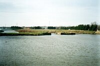
Approx. 80 yards W of the road bridge is the remains of an earthen and concrete barrier across the R. Crouch. This once had lock gates, now gone, and a water wheel, still extant. Although now crumbling and partly collapsing, aerial photographs from 1960 show this to have once been a sophisticated structure across the river. A map dated 1943 shows it as Floodgates. It is not known where the chambers might have been located. Although presumed to be demolished, it is possible that they still remain within the surviving portion of the structure. <2> <3>
One photo of site <4>
<1> unknown, 1968, War Time Contraventions 1968, Rettendon (LIST). SEX31436.
<2> Hunting Surveys Limited, 1960, Run 32-034 (AP). SEX62110.
<3> Ordnance Survey, 1940s, Military Edition 2 and a half inch, Sheet 62-20 NW (Map). SEX32966.
<4> Nash, Fred, 1998, Mining Chambers (destroyed) The Weir, Battlesbridge (Photograph). SEX62116.
Monument Types
- DEMOLITION CHAMBER (WWII, Modern - 1939 AD to 1945 AD)
Associated Events
- Survey of defences in East Hanningfield,Rettendon and Runwell (Ref: ?)
Protected Status
- Historic Environment Character Area: Thames Gateway 102
- Historic Environment Character Zone: Chelmsford 9.2
- Conservation Area: Battlesbridge
- Historic Environment Character Area: Chelmsford 9
Sources and further reading
| <1> | LIST: unknown. 1968. War Time Contraventions 1968. Rettendon. |
| <2> | AP: Hunting Surveys Limited. 1960. Run 32-034. |
| <3> | Map: Ordnance Survey. 1940s. Military Edition 2 and a half inch. 1:25,000. Sheet 62-20 NW. |
| <4> | Photograph: Nash, Fred. 1998. Mining Chambers (destroyed) The Weir, Battlesbridge. |
Images
 Mining Chambers (destroyed), The Weir © Essex County Council | |
Search results generated by the HBSMR Gateway from exeGesIS SDM Ltd.