| Name: | Chipping Hill Camp |
|---|
| SMR Number: | 8108 |
|---|
| Type of record: | Monument |
|---|
| Grid Reference: | TL 819 151 |
|---|
| Map Sheet: | TL81NW |
|---|
| Parish: | WITHAM, BRAINTREE, ESSEX |
|---|
Summary
Earthworks on supposed site of Saxon burh built by Edward the Elder.
Full description
Earthworks on supposed site of Saxon burh built by Edward the Elder; now thought to be of Iron Age date. <1>-<13>. Two concentric lines of eathworks in irregular oval plan. RCHM reported these to be represented by scarps and depressions, mostly slight, except on the west where there is a well-marked rampart and scarp dropping sharply to the marshy ground near the river Brain. The inner work stood at a higher level than the outer and covered c.9.5 acres; the outer work c. 26.25 acres. Earliest references to the earthworks occur in the 17th century. 19th century saw rapid destruction. The railway cut through the middle of the site in a deep cutting in 1844. The earliest plan is by William Holman c.1720; the first detailed description of the camp was by Essex antiquary Joseph Strutt in 1774 who also produced a perspective view. The first attempt at a scaled plan was by Spurrell in 1885 when the earthworks were in a very depleted state but could be traced around almost the entire circuit. The Royal Commissions Plan of 1914 shows what then remained of the earthworks. Since then the site has been overwhelmed by housing development. Excavations 1933-35, directed by G.F. Cottrill, were not written up and records became scattered or lost; a few site notes, plans and phtographs were deposited in Colchester Museum; one interim report appeared. <2>.
The excavations showed that the inner defences took the form of a timber-framed rampart; the outer ditches showed several phases of re-cutting. Most of the pottery recovered from the outer defences can now be dated to the Middle Iron Age. No reliable dating evidence was recovered for any of the phases of the inner rampart. Further excavations in 1969 and 1971 by B.K. Davison again examined the outer and inner lines of defence.<15>
Sketch plan of trenches<16>
In 1988 two further areas of the earthwork were investigated by ECC Archaeology Section. It has been suggested that the outer defences could be late Saxon and relate to the burh <1>-<5>, but the only find of undoubted 10th century date is the St. Edmund Memorial penny from an archaeologically meaningless context. However, there was some late Saxon, or early medieval occupation overlying the levelled ditch on the river side of the camp. In Cottrill's trench G, a pit "hearth" was found containing 11th century pottery, St. Neots and Thetford wares. An iron cruciform mount is probably late Saxon. Two sherds of late Saxon potery were also recovered from a well or pit in trench Y, cut into the silted ditch. The immediate post-Roman period is represented by a fragment of a perforated vessel from the outer ditch. <13>
Site Assessment = Much of site built over.
Chipping Hill Camp (TL 8197 1519)
Chipping Hill Camp is the preferred option for the site of the tenth century burh, as it would have been a dominant landscape feature at that period. However the only late Saxon evidence from the site consists of a sherd of St Neots ware, a sherd of Thetford-type ware and a tenth century penny. The location of the church and the late Saxon market town at Chipping Hill, immediately outside one of the entrances to the earthwork, is very reminiscent of the layout of the nearby late Saxon town of Maldon and lends support to the suggestion that this area remained the dominant focus of activity in the Witham area at this period.
The manorial hall (TL 8193 1523)
The location of the manorial hall is thought to have been on the site of Temple Farm (now The Grange), which was the only habitation located within Chipping Hill Camp (Rodwell, 1993). <14>
Hunting Surveys Limited, 1960, TL81 (AP). SEX59103.
Davison, BK, 1970, Sketch plan showing area of excavation and trenching (Graphic material). SEX63155.
unknown, 1988, 24/3 (AP). SEX67852.
unknown, 1988, 24/4 (AP). SEX67851.
unknown, 1988, 84-1, 2 (AP). SEX58120.
unknown, 1988, TL81NW 24/2 (AP). SEX59147.
unknown, 1988, TL81NW 24/5 (AP). SEX59148.
<1> unknown, unknown, The earthworks at Witham: The excavations in 1933-35, in old SMR file (DESC TEXT). SEX26170.
<2> Cottrill, F, 1934, A trial excavation at Witham, Essex, Vol 14 p190-91 (EXCAV REPORT). SEX26153.
<3> Rowles, HJ, 1934, Excavations at Witham in 1933, Essex Review, XLIII p27-30 (EXCAV REPORT). SEX26171.
<4> Davison, BK in Wilson, DM and Hurst, JG, 1970, Medieval Britain in 1969, Vol 14 p156 (DESC TEXT). SEX26172.
<5> Davison, BK in Webster, LE and Cherry, J, 1972, Medieval Britain in 1971, Vol 16 p154 (DESC TEXT). SEX26155.
<6> unknown, unknown, Anglo-Saxon Chronicle (DESC TEXT). SEX23268.
<7> Eddy, MR and Petchey, MR, 1983, Historic Towns in Essex, p9 (DESC TEXT). SEX13305.
<7> Eddy, MR with Petchey, MR, 1983, Historic Towns in Essex: An Archaeological Survey, p9 (DESC TEXT). SEX874.
<8> Dunning, GC, unknown, DESC TEXT , notes on Saxo-Norman pottery (DESC TEXT). SEX26173.
<9> Spurrell, FCJ, 1887, Withambury, p19-22 (DESC TEXT). SEX26174.
<10> RCHME, 1921, An Inventory of the Historical Monuments in Essex - Volume 2, Vol II p37-40 (DESC TEXT). SEX183.
<11> Ordnance Survey, unknown, OS cards, TL81NW14, 1953 (RECORD SHEET/FORM). SEX52658.
<12> Spurrell, FCJ, unknown, Essex Naturalist, Vol 1 p19-22 (DESC TEXT). SEX26176.
<13> Rodwell, Warwick J, 1993, Thr Origins and early Development of Witham, Essex, Oxbow Monograph 26 (DESC TEXT). SEX26177.
<14> Medlycott, Maria, 1999, Witham Historic Town Assessment Report (DESC TEXT). SEX61565.
<15> Davison, BK, 1970, Excavations at Witham (DESC TEXT). SEX63154.
Monument Types
- BURH (late Saxon, Early Medieval - 410 AD to 1065 AD)
- EARTHWORK (late Saxon, Early Medieval - 410 AD to 1065 AD)
- HEARTH (late Saxon, Early Medieval - 410 AD to 1065 AD)
- PIT (late Saxon, Early Medieval - 410 AD to 1065 AD)
- SETTLEMENT (late Saxon, Early Medieval - 410 AD to 1065 AD)
- WELL (late Saxon, Early Medieval - 410 AD to 1065 AD)
Associated Finds
- VESSEL (Early Medieval - 410 AD to 1065 AD)
- VESSEL (Early Medieval - 410 AD to 1065 AD)
- COIN (Early Medieval - 900 AD to 1000 AD)
Associated Events
- PART EXCAV by Davison, BK, (Ref: ?)
- PART EXCAV by Cottrill,F, (Ref: ?)
- PART EXCAV by Flook, R (Ref: ?)
Protected Status
- Conservation Area: Witham (Chipping Hill)
- Conservation Area: Witham Town Centre (Newland Street)
Sources and further reading
| --- | AP: unknown. 1988. 84-1, 2. |
| --- | AP: Hunting Surveys Limited. 1960. TL81. |
| --- | AP: unknown. 1988. TL81NW 24/2. |
| --- | AP: unknown. 1988. TL81NW 24/5. |
| --- | Graphic material: Davison, BK. 1970. Sketch plan showing area of excavation and trenching. |
| --- | AP: unknown. 1988. 24/4. |
| --- | AP: unknown. 1988. 24/3. |
| <1> | DESC TEXT: unknown. unknown. The earthworks at Witham: The excavations in 1933-35. in old SMR file. |
| <2> | EXCAV REPORT: Cottrill, F. 1934. A trial excavation at Witham, Essex. Vol 14 p190-91. |
| <3> | EXCAV REPORT: Rowles, HJ. 1934. Excavations at Witham in 1933. Essex Review, XLIII p27-30. |
| <4> | DESC TEXT: Davison, BK in Wilson, DM and Hurst, JG. 1970. Medieval Britain in 1969. Vol 14 p156. |
| <5> | DESC TEXT: Davison, BK in Webster, LE and Cherry, J. 1972. Medieval Britain in 1971. Vol 16 p154. |
| <6> | DESC TEXT: unknown. unknown. Anglo-Saxon Chronicle. |
| <7> | DESC TEXT: Eddy, MR and Petchey, MR. 1983. Historic Towns in Essex. p9. |
| <7> | DESC TEXT: Eddy, MR with Petchey, MR. 1983. Historic Towns in Essex: An Archaeological Survey. p9. |
| <8> | DESC TEXT: Dunning, GC. unknown. DESC TEXT . notes on Saxo-Norman pottery. |
| <9> | DESC TEXT: Spurrell, FCJ. 1887. Withambury. p19-22. |
| <10> | DESC TEXT: RCHME. 1921. An Inventory of the Historical Monuments in Essex - Volume 2. Vol II p37-40. |
| <11> | RECORD SHEET/FORM: Ordnance Survey. unknown. OS cards. TL81NW14, 1953. |
| <12> | DESC TEXT: Spurrell, FCJ. unknown. Essex Naturalist. Vol 1 p19-22. |
| <13> | DESC TEXT: Rodwell, Warwick J. 1993. Thr Origins and early Development of Witham, Essex. Oxbow Monograph 26. |
| <14> | DESC TEXT: Medlycott, Maria. 1999. Witham Historic Town Assessment Report. |
| <15> | DESC TEXT: Davison, BK. 1970. Excavations at Witham. |
Related records
| 8110 | Parent of: Chipping Hill - Dean Cullen Seed Works (Find Spot) |
| 8114 | Parent of: Chipping Hill - Temples Field (Monument) |
| 8111 | Parent of: Chipping Hill (Find Spot) |
| 8112 | Parent of: Chipping Hill (Find Spot) |
| 8113 | Parent of: Chipping Hill (Find Spot) |
| 14050 | Parent of: Chipping Hill Camp: Early prehistoric occupation (Monument) |
| 8109 | Parent of: Chipping Hill Camp: medieval (Monument) |
| 8124 | Parent of: Church of St Nicholas, Witham (Monument) |
| 8107 | Part of: Chipping Hill (Find Spot) |
Images
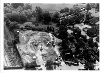 Chipping Hill excavations, Witham © Essex County Council | 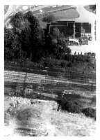 Chipping Hill excavations, Witham © Essex County Council |
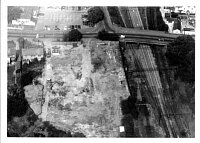 Chipping Hill excavations, Witham © Essex County Council | 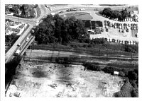 Chipping Hill excavations, Witham © Essex County Council |
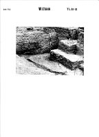 1933-35 Excavations, Witham © Essex County Council | 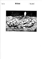 1933-35 Excavations, Witham © Essex County Council |
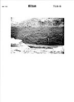 1933-35 Excavations, Witham © Essex County Council | 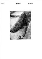 1933-35 Excavations, Witham © Essex County Council |
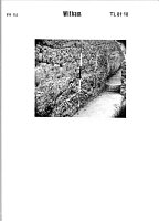 1933-35 Excavations, Witham © Essex County Council | 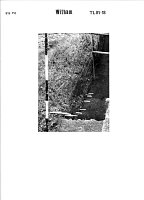 1933-35 Excavations, Witham © Essex County Council |
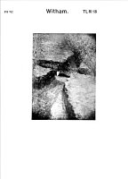 1933-35 Excavations, Witham © Essex County Council | 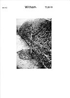 1933-35 Excavations, Witham © Essex County Council |
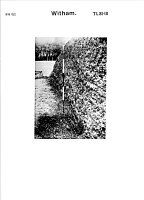 1933-35 Excavations, Witham © Essex County Council | 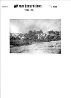 1933-35 Excavations, Witham © Essex County Council |
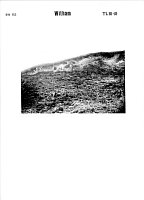 1933-35 Excavations, Witham © Essex County Council | 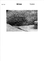 1933-35 Excavations, Witham © Essex County Council |
Search results generated by the HBSMR Gateway from exeGesIS SDM Ltd.