| Name: | Church of St Peter and St Paul, Bardfield |
|---|
| SMR Number: | 1209 |
|---|
| Type of record: | Monument |
|---|
| Grid Reference: | TL 686 265 |
|---|
| Map Sheet: | TL62NE |
|---|
| Parish: | BARDFIELD SALING, BRAINTREE, ESSEX |
|---|
Summary
Walls of flint rubble, dressings of shelly oolite and clunch.
Full description
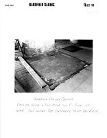
Walls of flint rubble, dressings of shelly oolite and clunch. Nave, south aisle and west tower and possibly south porch built in 1st half of 14th century, probably left unfinished at the time of the Black Death, 1348-1349. Consecrated 1380 when the chancel was added. Round tower is one of a group in north west Essex and is unusually late. The south west angle of the south aisle was rebuilt, probably when the former south porch was destroyed. Chancel roof has moulded wall-plates of the 14th century. Features and fittings: windows of the first half of the 14th century and 1380, doorways of 1st half of 14th century, indent of mid C15, late 15th century font, 14th century glass, piscina of 14th century, screen in chancel of 14th century. <1> 14th century with chancel probably completed last. West tower, windows look early 14th century, early-mid 14th century windows in nave and chancel, marked difference in style between south arcade and chancel arch-latter has late 14th century looking responds. Screen contemporary with chancel. <2> Water colour by Kenneth Rowtree in ERO, print from magazine in SMR. <3> Evidence of an altar or chapel previously dedicated to St Margaret refered to in 1424. Author of letter thought south aisle of present church was the chantry of St Margaret. Why such a large building here?-Was it a calling place for pilgrims. <4> The floor below the 18th century gallery at the west end is tiled with medieval floor tiles. West of the south doorway are part of an early wall painting and inscriptions. Sedile below the south east window. <5> Drainage trenches around the south side of the church revealed the robber trench for the former east bay of the chancel which had been shortened. <6> Letter in SMR from former Vicar with copy of photograph of church, taken before damage from enemy action during the last war. This shows two doorways in the E end. Even if these were originally open arches, they seem to suggest that the original E end was other than a chancel. "I think it suggests some other use for that part of the building - which I am still inclined to think may have been a shrine". The Vicar has drawn up an account of the `Restoration Years' at Bardfield Saling (1973-1987) incorporating reports of discoveries made during this period (see above). <7> <8> <9> In June 1994 the cement gutter was removed along the south and east sides of the church exposing the 14thC foundations. These have a moulded base in oolitic limestone, comprising a weathering witha hollow chamfer oversailing an ashlar course. This is above a bottom course with a chamfered weathering. Depth of the foundation is at least 350mm and unusually the exterior ground level seems hardly to have risen since the 14thC rebuilding of the church. Work on underpinning also revealed the existence of buttress remains which makes it possible to reconstruct the appearance of the south elevation of the aisle, with buttresses at regular intervals symmetrically framing the windows. Immediately west of the missing buttress the foundation of the aisle is made of ashlar below ground level. West of the aisle a semi-octagonal base of dressed oolitic limestone was found projecting out at ground level. This was left in situ. West of the porch were found the medieval foundations of the porch. Four purbeck marble paving stones, possibly seats from the porch were lifted and examined. The buttress at the south west corner of the nave is founded on a massive boulder like that seen just outside the churchyard. The chancel foundation has no plinth or offset and looks much earlier possibly 12th/13thC. An in situ medieval tile pavement was seen 200mm below ground level near the north half of the east wall of the chancel. The tiles bear the heraldic emblems of the Tyrell family. They are provisionally dated to the 15th C.<10>
Site Assessment = Round tower is one of a group in north west Essex and is unusually late. <1> "The round tower is one of 6 remaining in Essex and is the only example in the United Kingdom of the decorated period and, therefore, apparently the last of its kind to be built in Medieval times". <5> Church may have originally been mainly concerned with a pilgrimage shrine? <7>
unknown, unknown, unknown (Photograph). SEX57534.
<1> RCHME, 1916, An Inventory of the Historical Monuments in Essex - Volume 1, Vol 1, pp11-12 (DESC TEXT). SEX701.
<2> Pevsner, N, 1954, The Buildings of England, Essex, p62 (DESC TEXT). SEX83.
<3> Rowntree, K, unknown, Bardfield (or little) Saling Church (Graphic material). SEX4428.
<4> Pope, Rev. RJ, 1975, SMR (CORRESPONDENCE). SEX4429.
<5> Department of the Environment, 1985, List of Buildings of Special Architectural or Historic Interest: Braintree, pp10-11 (DESC TEXT). SEX4383.
<6> Andrews, DD, 1987, Bardfield Saling Church. Drain digging 1987 (DESC TEXT). SEX4430.
<7> Pope, Rev. RJ, 1987, Little (Bardfield) Saling Church (CORRESPONDENCE). SEX4431.
<8> unknown, unknown, SMR, with letter in SMR (Photograph). SEX224.
<9> Pope, Rev. RJ, unknown, DESC TEXT , account of restoration years (1973-87) (DESC TEXT). SEX4432.
<10> Andrews, D, 1994, Bardfield Saling Church, 1994 - with sketch (DESC TEXT). SEX54106.
Monument Types
- CHURCH (C14, Medieval - 1066 AD to 1539 AD)
- FONT (C15, Medieval - 1066 AD to 1539 AD)
- WALL (C14, Medieval - 1066 AD to 1539 AD)
Associated Finds
- BRASS (Medieval - 1066 AD to 1539 AD)
- FLOOR TILE (Medieval - 1066 AD to 1539 AD)
- FONT (Medieval - 1066 AD to 1539 AD)
- WINDOW (Medieval - 1066 AD to 1539 AD)
Associated Events
- SALV RECORD by Andrews, DD, (Ref: ?)
Protected Status
- Listed Building (EH) (I) 1122802: CHURCH OF ST PETER AND ST PAUL
Sources and further reading
| --- | Photograph: unknown. unknown. unknown. |
| <1> | DESC TEXT: RCHME. 1916. An Inventory of the Historical Monuments in Essex - Volume 1. Vol 1, pp11-12. |
| <2> | DESC TEXT: Pevsner, N. 1954. The Buildings of England, Essex. p62. |
| <3> | Graphic material: Rowntree, K. unknown. Bardfield (or little) Saling Church. |
| <4> | CORRESPONDENCE: Pope, Rev. RJ. 1975. SMR. |
| <5> | DESC TEXT: Department of the Environment. 1985. List of Buildings of Special Architectural or Historic Interest: Braintree. pp10-11. |
| <6> | DESC TEXT: Andrews, DD. 1987. Bardfield Saling Church. Drain digging 1987. |
| <7> | CORRESPONDENCE: Pope, Rev. RJ. 1987. Little (Bardfield) Saling Church. |
| <8> | Photograph: unknown. unknown. SMR. with letter in SMR. |
| <9> | DESC TEXT: Pope, Rev. RJ. unknown. DESC TEXT . account of restoration years (1973-87). |
| <10> | DESC TEXT: Andrews, D. 1994. Bardfield Saling Church. 1994 - with sketch. |
Related records
| 27538 | Part of: Church of St Peter and St Paul, Bardfield Sailing (Listed Building) |
Images
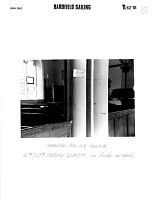 Church of St Peter and St Paul, Bardfield Saling, Braintree © Essex County Council | 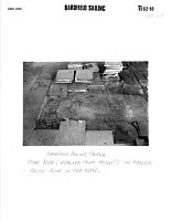 Church of St Peter and St Paul, Bardfield Saling, Braintree © Essex County Council |
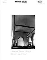 Church of St Peter and St Paul, Bardfield Saling, Braintree © Essex County Council | 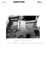 Church of St Peter and St Paul, Bardfield Saling, Braintree © Essex County Council |
 Church of St Peter and St Paul, Bardfield Saling, Braintree © Essex County Council | 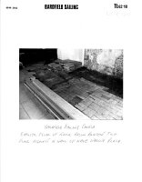 Church of St Peter and St Paul, Bardfield Saling, Braintree © Essex County Council |
 No image description available © Essex County Council | |
Search results generated by the HBSMR Gateway from exeGesIS SDM Ltd.