If you think this information is inaccurate please e-mail corrections to
Hertfordshire HER
.
| HHER Number: | 50 |
|---|
| Type of record: | Monument |
|---|
| Name: | GRIM'S DITCH, FROM BERKHAMSTED TO LEYLANDS FARM, BUCKS |
|---|
Summary
Prehistoric earthwork
Images
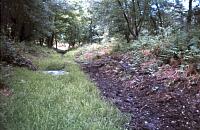
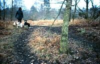
 No image caption available © Hertfordshire County Council |  No image caption available © Hertfordshire County Council |
| Grid Reference: | SP 945 087 |
|---|
| Map Sheet: | SP90NW |
|---|
| Parish: | Northchurch, Dacorum, Hertfordshire |
|---|
| Tring, Dacorum, Hertfordshire |
|---|
| Wigginton, Dacorum, Hertfordshire |
|---|
| Map: | Show location on Streetmap |
|---|
Monument Types
- LINEAR EARTHWORK (Prehistoric - 8500 BC to 101 BC)
Associated Events
- Geophysical survey of Grim's Ditch, NW of Berkhamsted, 1998 (Ref: 201)
- Excavation on line of A41 Berkhamsted to Kings Langley bypass, 1991-92
Protected Status
- Area of Archaeological Significance 14
- Scheduled Ancient Monument 35345-9
- SHINE: Section of Grim's Ditch northwest of Berkhamsted
- Scheduled Ancient Monument 35346: HERTFORDSHIRE GRIM'S DITCH: 1350M LONG SECTION BETWEEN KILN ROAD AND CHESHAM ROAD
Full description
Probable boundary ditch, surviving in sections mostly in woodland, extending from SP 9729 0812 in the east to SP 9165 0857, at Longcroft Farm, on the county boundary, and ultimately to c. SP 9105 0815 at Leylands Farm, Bucks. Preservation varies <1>. A section cut through it at Hastoe revealed the ditch was originally 5.5m deep. The only dateable find was an Iron Age sherd <2, 5>. See also [49]. See also the 1998 survey <3> of cropmarks [2022] NE of Woodcock Hill and [2023] to the south east. A section was excavated in 1992, east of Hamberlins Wood before the building of the A41. See [11476] <4>.
At Wigginton Bottom the earthwork is shown on the 1878 OS map <5> extended beyond the Clayhill cottages [17557], but the sharp turn to the SE has disappeared. The earthwork then reappears south of Crawleys Lane and extends SE above the Bulbourne valley, before petering out at Berkhamsted. Property boundaries suggest it once ran for some distance further along the hillside.
Ancient Monuments Field Report (Unpublished document). SHT8300.
Mike Daniels (HCC), site report, 27.11.87 field notes (Unpublished document). SHT7000.
Note in Records of Bucks 19/3 (1973) (Article in serial). SHT9388.
<1> Bucks Herald, 24.5.73 (Article in serial). SHT676.
<2> Berkhamsted Gazette, 25.5.1973 (Serial). SHT2056.
<3> Thorn, Brett, 1998, Grim's Ditch archaeological and management survey Phase II, RNO 302 (Report). SHT7300.
<4> Last, Jonathan, 2001, A41 Berkhamsted and Kings Langley bypasses (summarised from draft revised updated project design), RNO 977 (Unpublished document). SHT6483.
<5> Whinney, R J B, & Davis, N J, 1973, Exavation of a section of Grim's Ditch, Easter 1973 (Unpublished document). SHT16876.
<6> Dyer, James F, 1963, The Chiltern Grim's Ditch; Antiquity vol.37, 46-9 (Article in serial). SHT4275.
Sources and further reading
| --- | Unpublished document: Mike Daniels (HCC), site report. 27.11.87 field notes. |
| --- | Unpublished document: Ancient Monuments Field Report. |
| --- | Article in serial: Note in Records of Bucks 19/3 (1973). |
| <1> | Article in serial: Bucks Herald, 24.5.73. |
| <2> | Serial: Berkhamsted Gazette. 25.5.1973. |
| <3> | Report: Thorn, Brett. 1998. Grim's Ditch archaeological and management survey Phase II. archaeological survey. RNO 302. |
| <4> | Unpublished document: Last, Jonathan. 2001. A41 Berkhamsted and Kings Langley bypasses (summarised from draft revised updated project design). RNO 977. |
| <5> | Unpublished document: Whinney, R J B, & Davis, N J. 1973. Exavation of a section of Grim's Ditch, Easter 1973. |
| <6> | Article in serial: Dyer, James F. 1963. The Chiltern Grim's Ditch; Antiquity vol.37, 46-9. |
Related records
| 2022 | Parent of: GRIM'S DITCH, DARR'S LANE, NORTHCHURCH (Monument) |
| 15575 | Parent of: GRIM'S DITCH, FROM BUCKS COUNTY BOUNDARY TO CLAYHILL, WIGGINTON (Monument) |
| 2023 | Parent of: GRIM'S DITCH, SHOOTERSWAY, BERKHAMSTED (Monument) |
| 11476 | Parent of: SECTION OF GRIM'S DITCH, WEST OF NORTHCHURCH, BERKHAMSTED (Monument) |
Search results generated by the HBSMR Gateway from exeGesIS SDM Ltd.