If you have any feedback or new information about this record, please email the Southampton HER (her@southampton.gov.uk).
Data derived from Heritage Gateway will not be acceptable for any use associated with development proposals and other planning matters.
For important guidance on the use of this record, please click
here
. © Southampton City Council
| HER Number: | MSH157 |
|---|
| Type of Record: | Monument |
|---|
| Name: | Town Defences - site of first tower south of East Gate (“First Tower”) |
|---|
| Grid Reference: | SU 4215 1147 |
|---|
| Map: | Show location on Streetmap |
|---|
Summary
A now-demolished medieval tower on the eastern town wall, the first tower south of East Gate. In 1454 it had three defensive loops. In 1805 Englefield described it as semi-circular, and it may then have had a surviving loop, or loops - an arrow loop converted to gun loop. The tower was still standing in about 1846 although had been demolished by 1870. Its site is marked on Ordnance Survey maps, although the accuracy of this depiction is uncertain.
The date of the eastern town wall and towers is uncertain. Much of it could be broadly contemporary with the northern town wall, so of late 13th century date (1260 to 1291), however a mid-14th century or later date has also been proposed.
The robbed foundation trench of the half-round tower was found during an archaeological excavation on land at 72 – 74 Canal Walk in 2010 (SOU 1482). It provided some evidence for the tower’s construction and size. Adjacent to the foundation trench was a large feature thought to have been dug to provide a flat working platform for construction of the tower. Some limited dating evidence was found. The tower was probably demolished in the early 19th century, and the stone foundations entirely dug out.
Protected Status: None recorded
Other Statuses/Codes: None Recorded
Monument Type(s):
- FLANKING TOWER (Built, Medieval - 1260 AD? to 1291 AD?)
- FLANKING TOWER (extant, Medieval to Post Medieval - 1260 AD? to 1883 AD?)
- INTERVAL TOWER (Built, Medieval - 1260 AD? to 1291 AD?)
- INTERVAL TOWER (extant, Medieval to Post Medieval - 1260 AD? to 1883 AD?)
- FLANKING TOWER (Built, Medieval - 1325 AD? to 1375 AD?)
- INTERVAL TOWER (Built, Medieval - 1325 AD? to 1375 AD?)
- FLANKING TOWER (Altered, Medieval - 1377 AD to 1400 AD)
- INTERVAL TOWER (Altered, Medieval - 1377 AD to 1400 AD)
- FLANKING TOWER (Built, Post Medieval - 1846 AD? to 1883 AD)
- INTERVAL TOWER (Demolished, Post Medieval - 1846 AD? to 1883 AD)
Full description
Records for the town defences are currently being enhanced and it is intended that further details will be added to this description at a later date. (SCC HER 4/12/09)
------------------------------------
SOU 1482 (excavation & watching brief on land at 72 – 74 Canal Walk in 2008-2011):
[1]: (Evidence all from the 2010 excavation, HER.)
Evidence was revealed relating to the construction of the medieval rampart and a tower of the town’s medieval defences.
The foundation trench for the half-round tower was found, although the tower walls had been entirely robbed/removed. The foundation trench provided some evidence for the tower’s construction. It was cut through the rampart deposits to the level of the natural brickearth, presumably to provide a firm footing and avoid subsidence. The foundation was only provided for the outer part of the tower structure. The rear corners of the tower would presumably have been bonded to the town wall*. Tower dimensions appeared to be c5.5m wide and c3.45m deep. (Comparison with similar towers on north town wall – MSH21 & MSH22.) The tower was probably demolished in the early 19th century (map evidence). The stone foundations were entirely dug out, leaving a robber trench of similar dimensions to the original foundation trench.
Adjacent to the tower foundation trench (feature 98) was a large flat-based feature (feature 104) thought to have been dug into the rampart to provide a flat working platform for construction of the tower. The fill of feature 104 included mortar and limestone fragments, and a sherd of high medieval pottery, and it was overlain by early modern deposits.
* The author seems to consider that the tower was built after the town wall, although they may have been built together. HER.
HER 27/5/2015: The rampart contained much residual Late Saxon and Anglo-Norman material, but no later medieval finds to provide a firmer date for its construction. The sherd of high medieval (1250 - 1350 AD) pottery in feature 104 provides at least some evidence for the construction date of the tower. The excavation showed that the site of the tower shown on current OS Mastermap is roughly correct.
(See separate records for earlier evidence, and other evidence relating to the town defences.)
Sources / Further Reading
| [1] | SSH4435 - Archaeological Report: PR Cottrell & GL Elliott. 2011. Archaeological excavation and watching brief at 72 – 74 Canal Walk, Southampton.. SOU 1482. |
Associated Finds: None recorded
Associated Events
- ESH1865 - Excavation and watching brief at 72-74 Canal Walk between 2008 and 2011 (Ref: SOU 1482)
Related records
| MSH14 | Child of: Town Defences - town wall, towers and gates |
| MSH5568 | Peer (Chronological): 72-74 Canal Walk - early modern deposits and finds |
| MSH4869 | Peer (Chronological): 72-74 Canal Walk - Late Saxon to Anglo-Norman deposits and finds |
| MSH5565 | Peer (Chronological): 72-74 Canal Walk - medieval town rampart |
| MSH5564 | Peer (Chronological): 72-74 Canal Walk - Prehistoric and Roman evidence |
Associated Links: None recorded
Images
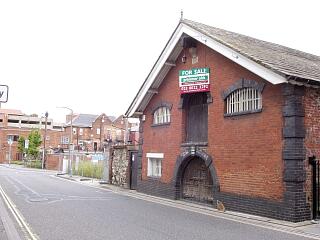
 Old Bond Store and remants of east town wall, Back of the Walls south of East Street, 6/9/09, © I Peckham |  Old Bond Store and section of stone wall, probably not part of town wall, Back of the Walls, 6/9/09, © I Peckham |
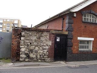
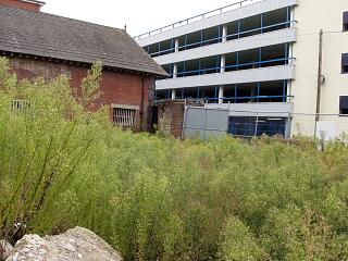
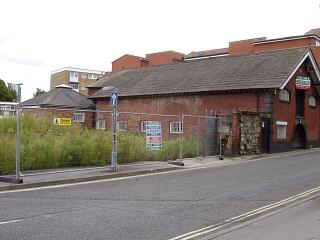
 Old Bond Store and section of stone wall, probably not part of town wall, Back of the Walls, 6/9/09, © I Peckham |  Old Bond Store, Back of the Walls, 6/9/09, © I Peckham |
If you have any feedback or new information about this record, please email the Southampton HER (her@southampton.gov.uk).
Search results generated by the HBSMR Gateway from exeGesIS SDM Ltd.