If you have any feedback or new information about this record, please email the Southampton HER (her@southampton.gov.uk).
Data derived from Heritage Gateway will not be acceptable for any use associated with development proposals and other planning matters.
For important guidance on the use of this record, please click
here
. © Southampton City Council
| HER Number: | MSH1866 |
|---|
| Type of Record: | Monument |
|---|
| Name: | Town Defences - site of tower along the Arcades |
|---|
| Grid Reference: | SU 4181 1132 |
|---|
| Map: | Show location on Streetmap |
|---|
Summary
The remains of this tower are visible in the stretch of town wall known as the Arcades, above the 10th bay from the north and piers either side. The tower is mentioned in the 1454 terrier, when it is said to have three defensive loops. The foundations of the demolished part of the tower were exposed during archaeological excavations in Western Esplanade in 1987/9 (SOU 301), along with the foundations of two similar towers (MSH1865 and MSH1867). All three towers were half-round with crudely built foundations, in marked contrast to the well-built foundations of the Arcades (MSH919). It is suggested that the three towers were built after 1360 but before the Arcades were built in about 1380, being inserted into gaps between the houses on the quayside; however the building sequence is uncertain. The tower had a door in the rear wall. The front of the tower was demolished in or soon after 1775. At some stage the tower was blocked off level with the arcade piers; this blocking was removed in about 1994.
Protected Status: None recorded
Other References/Statuses
- HER backup file (new series): SOU 242 (paper & digital) etc
- HER backup file (new series): SOU 301 paper and digital, etc
- Old Southampton SMR No/Backup file: SU 4111 SE 36, 93
Monument Type(s):
Full description
Records for the town defences are currently being enhanced and it is intended that further details will be added to this description at a later date. The summary incorporates new information not yet included in this description. (SCC HER 8/12/09)
----------------------------------------------------------------------------------
IP 15/3/04: Speed's map of c1611 [1] shows possibly four ?towers along the stretch of town wall now known as the Arcades. The 1771 map [2] and 1971 map [3] both show three half-round towers along this stretch of wall, one just south of Simnel Street/Bridles Gate, one between Simnel Street and Blue Anchor Lane, and one south of Blue Anchor Lane. (The fourth ?tower shown in [1] may be the gate at Blue Anchor Lane rather than a tower.) The location of these three towers can only be estimated from the maps. The 1846 map [4] does not show the towers, so they had presumably been demolished by then. This record refers to the tower between Simnel Street and Blue Anchor Lane.
SOU 301 (Evaluation Trench and Excavation at The Arcades, Western Esplanade in 1987/1988):
[7][9]: The town wall was built in c1380 AD. Three half-round towers were built along its length; the foundations of the demolished towers were uncovered.
(See also [5][6][8][10][11].)
(IP 15/3/04: It is unclear whether the tower foundations were uncovered during the 1985 watching brief at the Arcades (SOU 242), or in the SOU 301 evaluation trenches. The foundations were certainly revealed during the SOU 301 excavation.)
GIS: Location of tower estimated using [2][3]; SOU 301 location plan not yet checked. IP 15/3/04.
Sources / Further Reading
| --- | SSH3085 - Unpublished document: Ancient Monument File AM33 - West Walls (Town Walls). |
| --- | SSH3086 - Unpublished document: Ancient Monument File AM34 - Western Arcades (Town Walls). |
| [1] | SSH681 - Map: Speed. 1596/1611. Speed's Map of Southampton published 1596 and 1611 (black and white version). Paper. |
| [2] | SSH921 - Map: P Mazell. 1771. A Plan of Southampton and of the Polygon 1771. Paper. |
| [3] | SSH922 - Map: T Milne (surveyor). 1791. Plan of the Town of Southampton 1791. Paper. |
| [4] | SSH679 - Map: Campbell/Yolland/Royal Engineers. 1846. Plan of the Borough of Southampton surveyed in 1845-6.. Paper. Sheets 25 and 28 |
| [5] | SSH1913 - Excavation archive: SOU 301 Archive. Archive Guide and location plan P45 |
| [6] | SSH680 - Serial: The Society for Medieval Archaeology. 1988. Medieval Archaeology, Vol 32, 1988 (for 1987). p 254 |
| [7] | SSH871 - Serial: The Society for Medieval Archaeology. 1989. Medieval Archaeology, Vol 33, 1989 (for 1988). p 192 |
| [8] | SSH626 - Serial: M Hughes (ed), Hampshire County Council. 1988. Archaeology in Hampshire Annual Report for 1987. pp 22 - 23 |
| [9] | SSH869 - Serial: M Hughes (ed), Hampshire County Council. 1989. Archaeology in Hampshire Annual Report for 1988. p 25 |
| [10] | SSH712 - Serial: Morton, AD (ed), SCC. 1990. Annual Report of the Southampton Archaeological & Heritage Management Section 1990. p 64 |
| [11] | SSH521 - Serial: Morton, AD (ed), SCC. 1991. Annual Report of the Southampton Archaeological & Heritage Management Section for 1990-1991. pp 26 - 27 |
Associated Finds: None recorded
Associated Events
- ESH1550 - Excavation at The Arcades, Western Esplanade in 1987/1988 (part of Phase 2 of work on The Arcades) (Ref: SOU 301)
- ESH242 - Watching Brief on Test Pits at The Arcades, Western Esplanade in 1985 (Phase 1 of work on The Arcades) (Ref: SOU 242)
- ESH301 - Evaluation Excavation at The Arcades, Western Esplanade in 1987 (first part of Phase 2 of work on The Arcades) (Ref: SOU 301)
Related records
| MSH14 | Child of: Town Defences - town wall, towers and gates |
Associated Links: None recorded
Images
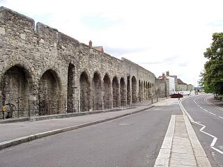 The Arcades, Western Esplanade, 21.6.09, © I Peckham | 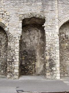 The Arcades, Western Esplanade - detail of site of tower (10th "arcade" working southwards), 21.6.09, © I Peckham |
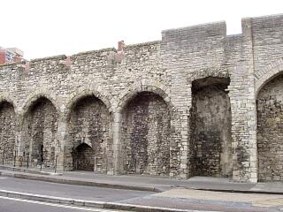 The Arcades, Western Esplanade, 21.6.09, © I Peckham | 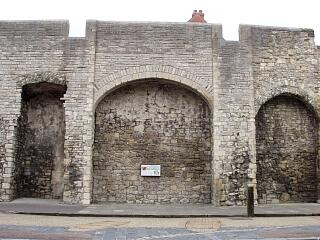 The Arcades, Western Esplanade - eleventh "arcade" (working southwards), 21.6.09, © I Peckham |
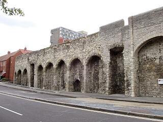 The Arcades, Western Esplanade - north part, 21.6.09, © I Peckham | 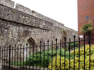 Inside of town wall north of Blue Anchor Lane, 21.6.09, © I Peckham |
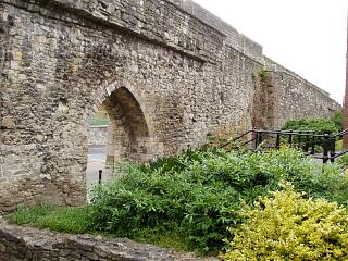 Inside of town wall north of Blue Anchor Lane, 21.6.09, © I Peckham | 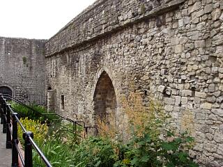 Inside of town wall north of King John's Palace, 21.6.09, © I Peckham |
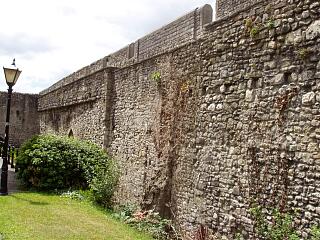 Inside of town wall north of King John's Palace, 21.6.09, © I Peckham | 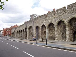 The Arcades, Western Esplanade, 21.6.09, © I Peckham |
If you have any feedback or new information about this record, please email the Southampton HER (her@southampton.gov.uk).
Search results generated by the HBSMR Gateway from exeGesIS SDM Ltd.