If you have any feedback or new information about this record, please email the Southampton HER (her@southampton.gov.uk).
Data derived from Heritage Gateway will not be acceptable for any use associated with development proposals and other planning matters.
For important guidance on the use of this record, please click
here
. © Southampton City Council
| HER Number: | MSH20 |
|---|
| Type of Record: | Monument |
|---|
| Name: | Town Defences - town wall between Arundel Tower and "Another Tower" to the east |
|---|
| Grid Reference: | SU 4191 1163 |
|---|
| Map: | Show location on Streetmap |
|---|
Summary
The section of northern town wall between Arundel Tower (MSH12) and the next tower to the east (MSH642, known as “Another Tower”) was probably built in the late 13th century, between 1260 and 1291, along with the rest of the north wall. Parts of it have been demolished. The above-ground remains are listed and scheduled.
Protected Status
- Scheduled Monument 1001927
- Listed Building (I) 1340005: TOWN WALLS: SECTION OF WALL RUNNING WEST FROM BARGATE TO ARUNDEL TOWER AND THEN SOUTH TO POINT JUST SOUTH OF CASTLE WATER GATE. IT INCLUDES ARUNDEL TOWER, CATCHCOLD TOWER, GARDEROBE TOWER, THE 40 STEPS, CASTLE WATER GATE & CASTLE VAULT & THE TOWN WALLS
Other References/Statuses
- HER backup file (new series): SOU 462 paper and digital, etc, not yet LibraryLinked
- HER backup file (new series): SOU 561 paper and digital, not yet LibraryLinked
- Old Southampton SMR No/Backup file: SU 4111 NE 19 also SU 4111 NE 25, 49 (BU)
- Old Southampton SMR No/Backup file: SU 4111 NE 25 also SU 4111 NE 44 (BU)
- Old Southampton SMR No/Backup file: SU 4111 NE 7 also SU 4111 NE 37
Monument Type(s):
Full description
Records for the town walls are currently being enhanced and it is intended that further details will be added to this description at a later date. The summary incorporates new information not yet included in this description. (SCC HER 11/12/09)
---------------------------------------
[1]: Listed Building Description. TOWN WALLS - Section of wall running west from Bargate to Arundel Tower and then south to point just south of Castle Water Gate. It includes Arundel Tower, Catchcold Tower, Garderobe Tower, The 40 Steps, Castle Water Gate and Castle Vault (formerly listed as Section of Town Wall running from the point of junction with the Castle Wall just north of Simnel Street to its eastern termination just west of Bargate) (Grade I).
Mediaeval City Walls. …. Scheduled as an ancient monument.
(This section of the town wall is not specifically mentioned. SCC HER)
---------------------------------------
SOU 564 (Excavation in "Mayes Car Park" in 1958):
[2] SOU 564 Results: In a trench against the inner face of the northern town wall, 54ft (16.46m) east of Arundel Tower, the unmortared rubble foundations of the town wall were exposed. Earlier deposits and deposits associated with the town wall construction had been removed by later disturbance, including the car park construction. (A photograph in [1] shows a pipe trench.) The foundation courses of the wall were offset by 7" (17.8cm). (See also [3].)
SOU 856 (Watching Brief on groundworks for New Public Conveniences in Mayes Car Park in 1959):
[15][16] SOU 856 Results: During groundworks for a new toilet block in 1959, the foundations of the inner (southern) face of the town wall were exposed. The base of the foundations was found to be only 18" below the (then) car park surface. The only deposits exposed were natural gravel and sand.
SOU 622 (Watching Brief in Bargate Street by Aberg in 1960):
[13][14] SOU 622 Results: A watching brief was carried out in 1960, on a trench against the exterior/north side of the northern town wall in Bargate Street, just east of the Inner Ring Road (Castle Way - IP). The work was associated with the construction of the new Inner Ring Road. The base of the footings of the town wall were found 9 inches BMGS, sitting on hard orange gravel, possibly the packed fill of a construction trench, cutting yellow sand.
SOU 638 (Watching Brief next to the Arundel Tower Public House in 1960):
[5] SOU 638 Results: A trench was observed on the south side of Bargate Street, against the exterior face of the northern town wall, next to the Arundel Tower Public House. The footings of the town wall were exposed and the base of the town wall was seen to rest on undisturbed gravel. (IP 1997: The public house has since been demolished. The trench was located just west of the present day Castle Way. There is a photograph [6] apparently of the SOU 638 trench. See event record.)
SOU 462 (Watching Brief for the New Footbridge across Castle Way in 1988):
[4]: Trenches 1 and 2 were situated against the north face of this part of the town wall, east of Castle Way. The town wall was exposed in both trenches. Made ground was noted, but no archaeologically significant deposits were present. Natural deposits were sand (T1) and dark orange gravel (T2). (The sand is probably Bracklesham Beds - IP.)
- Trench 3 was dug against the north face of the town wall just west of Castle Way. Made ground was noted, but no archaeologically significant deposits were present. The natural deposits were dark orange gravel.
(Trenches not yet plotted on GIS - see backup file for location sketch.)
SOU 445 (Excavations at Another Tower, Bargate Street in 1991):
[7] SOU 445: The north face of part of the base of this section of the town wall was revealed in Trench C. Its relationship to the adjacent "Another Tower", also revealed in the trench, was not ascertained due to a later repair to the town wall. Demolished to just above footing level in the 19th century. See report.
SOU 591 (Watching Brief on most of the Videotron Cable Trenches in 1994):
[8] SOU 591 Trench 1: A wall was observed, 0.42m BGS, on the line of the demolished town wall. It has been interpreted as being part of the town wall. Location - south of Bargate Street, at entrance to car park access road/service road, just east of a standing section of town wall. (Grid Reference = SU 4194 1163)
SOU 1711 Trench 3 (watching brief on a cable trench dug in Bargate Street in 2016):
[17]: Trench 3 was some 350mm deep. On the south side of Bargate Street, a construction trench of the Town Wall or its robber trench were observed.
(GIS: East end roughly plotted using fig 1 in [7]. Historic maps not very helpful.)
Sources / Further Reading
| --- | SSH3071 - Unpublished document: Ancient Monument File AM2 - Arundel Tower. |
| [1] | SSH2888 - Digital archive: English Heritage. 2005. Listed Buildings System dataset for Southampton. |
| [2] | SSH508 - Monograph: C Platt and R Coleman-Smith et al. 1975. Excavations in Medieval Southampton 1953 - 1969, Vol 1: The Excavation Reports. pp 23, 140, 142, 145, plate 11 |
| [3] | SSH676 - Serial: The Society for Medieval Archaeology. 1959. Medieval Archaeology, Vol 3, 1959 (for 1958). p310 |
| [4] | SSH703 - Excavation archive: 1988. SOU 462 Watching Brief Archive. Smart 7A, site notes and sketches |
| [5] | SSH575 - Excavation archive: A Aberg. Aberg's Weekly Reports. 30/11/1960 |
| [6] | SSH721 - Photograph: Aberg and Pallister. Aberg and Pallister's Photographic Archive/Card Index. Photo 223 |
| [7] | SSH131 - Archaeological Report: M Smith. 1993. Excavation at "Another Tower", Bargate Street, Southampton. SOU 445. All |
| [8] | SSH693 - Serial: The Society for Medieval Archaeology. 1992. Medieval Archaeology, Vol 36, 1992 (for 1991). p 234 |
| [9] | SSH592 - Serial: Morton, AD (ed), SCC. 1994. Archaeological Investigations in Southampton for April 1991 to December 1993. p13 |
| [10] | SSH692 - Serial: M Hughes (ed), Hampshire County Council. 1992. Archaeology in Hampshire Annual Report for 1991. p28 |
| [11] | SSH208 - Archaeological Report: Portland Terrace–French Street (medieval town) (Videotron). SOU 591. All |
| [12] | SSH591 - Serial: Morton, AD (ed), SCC. 1995. Archaeological Investigations in Southampton for 1994. p22 |
| [13] | SSH574 - Excavation archive: A Aberg. 1958-62. Aberg's Building Sites Notebook 1958-62. Folio 67 reverse |
| [14] | SSH575 - Excavation archive: A Aberg. Aberg's Weekly Reports. 26/10/1960 |
| [15] | SSH574 - Excavation archive: A Aberg. 1958-62. Aberg's Building Sites Notebook 1958-62. Page 79 reverse |
| [16] | SSH575 - Excavation archive: A Aberg. Aberg's Weekly Reports. Oct 1958/May 1959 Report |
| [17] | SSH5887 - Archaeological Report: AK Fedorowicz and AD Russel. 2017. Archaeological Watching Brief on the City Fibre Project, Southampton.. SOU 1711. |
Associated Finds: None recorded
Associated Events
- ESH1219 - Watching Brief on most of the Videotron Cable Trenches in 1994 (Ref: SOU 591)
- ESH445 - Excavations at Another Tower, Bargate Street in 1991 (Ref: SOU 445)
- ESH462 - Watching Brief for the New Footbridge across Castle Way in 1988 (Ref: SOU 462)
- ESH564 - Excavation in "Mayes Car Park" in 1958 (Ref: SOU 564)
- ESH622 - Watching Brief in Bargate Street by Aberg in 1960 (Ref: SOU 622)
- ESH638 - Watching Brief next to the Arundel Tower Public House in 1960 (Ref: SOU 638)
- ESH856 - Watching Brief on groundworks for New Public Conveniences in Mayes Car Park in 1959 (Ref: SOU 856)
- ESH2370 - Watching Brief on the City Fibre Project in Palmerston Road, Hanover Buildings, Bargate Street and Castle Way in 2016 (Ref: SOU 1711)
Related records
| MSH14 | Child of: Town Defences - town wall, towers and gates |
| MSH651 | Peer (Chronological): South of Bargate Street - Layers |
Associated Links: None recorded
Images
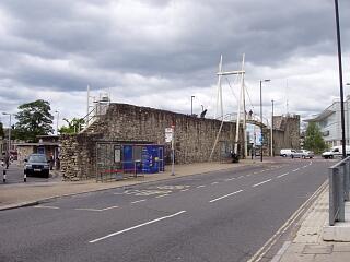 Town wall and Arundel Tower, Bargate Street, 21.6.09, © I Peckham | 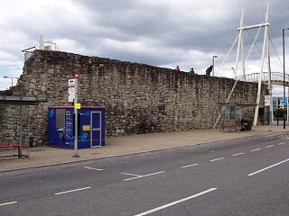 Town wall, Bargate Street, 21.6.09, © I Peckham |
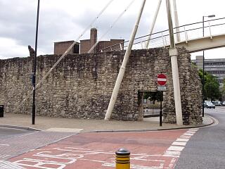 Town wall, Bargate Street, 21.6.09, © I Peckham | 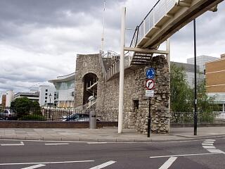 Town wall and Arundel Tower, Castle Way, 21.6.09, © I Peckham |
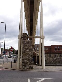 Town wall, Castle Way, 21.6.09, © I Peckham | 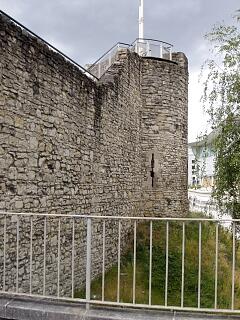 Arundel Tower, Bargate Street, 21.6.09, © I Peckham |
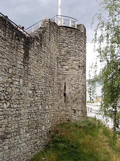 Arundel Tower, Bargate Street, 21.6.09, © I Peckham | 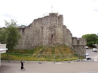 Arundel Tower and spur work, 21.6.09, © I Peckham |
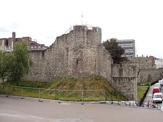 Arundel Tower, spur work and town walls, 21.6.09, © I Peckham | 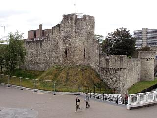 Arundel Tower, spur work and town walls, 21.6.09, © I Peckham |
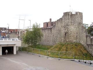 Arundel Tower and town walls, 21.6.09, © I Peckham | 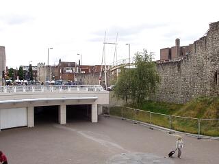 Town wall between Bargate and Arundel Tower, 21.6.09, © I Peckham |
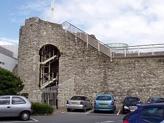 Arundel Tower and town wall, Albion Place, 21.6.09, © I Peckham | 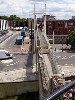 North town wall and Bargate from top of Arundel Tower, 21.6.09, © I Peckham |
If you have any feedback or new information about this record, please email the Southampton HER (her@southampton.gov.uk).
Search results generated by the HBSMR Gateway from exeGesIS SDM Ltd.