If you have any feedback or new information about this record, please email the Southampton HER (her@southampton.gov.uk).
Data derived from Heritage Gateway will not be acceptable for any use associated with development proposals and other planning matters.
For important guidance on the use of this record, please click
here
. © Southampton City Council
| HER Number: | MSH217 |
|---|
| Type of Record: | Monument |
|---|
| Name: | Town Defences - town wall between the fourth and fifth tower south of Eastgate |
|---|
| Grid Reference: | SU 4213 1123 |
|---|
| Map: | Show location on Streetmap |
|---|
Summary
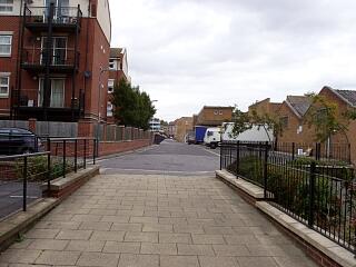
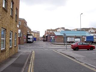
This part of the eastern town wall has been demolished above-ground. The date of the eastern town wall is uncertain. It could be broadly contemporary with the northern town wall, so probably of late 13th century date (1260 to 1291), however a mid-14th century or later date has also been suggested.
Protected Status: None recorded
Other References/Statuses
- HER backup file (new series): SOU 357 (paper & digital)
- Old Southampton SMR No/Backup file: SU 4211 SW 8
Monument Type(s):
Full description
Records for the town defences are currently being enhanced and it is intended that further details will be added to this description at a later date. (SCC HER 4/12/09)
---------------------------------
SOU 357 (watching brief on the southeast corner of Bernard Street and Back of the Walls in 1957):
IP 13/12/02: The face of this part of the town wall may have been exposed on this watching brief during the excavation of a new basement in 1957. One source for the site [1] mentions the town wall face, and includes a sketch plan showing the "old wall remaining", possibly the town wall. But the second source [2] does not mention the town wall.
([2] is probably the primary source.) Current OS map layers show the approximate line of the wall just west of the site.
SOU 689 (Watching brief on pipe laying along Back of the Walls in 1956):
IP 22/12/97: There are at least two (possibly three or four) photographic prints in [3] showing different points along this stretch of the town wall. The exact location of some of the prints is uncertain (see [4]).
Sources / Further Reading
| [1] | SSH572 - Excavation archive: Friends of Old Southampton Survey Section (FOOSSS). Friends of Old Southampton Survey Section Watching Brief Records. |
| [2] | SSH555 - Excavation archive: Friends of Old Southampton Survey Section (FOOSSS). 1957. Friends of Old Southampton Survey Section Notes - *Chief Surveyor's Report to Friends of Old Southampton upon the Acivities of the Survey Section (Excavations Observed Since Las |
| [3] | SSH1056 - Excavation archive: Watching Brief Archive for SOU 689.. 4 photographs |
| [4] | SSH1057 - Map: I Peckham. 1997/2003. Photocopy of OS SU 41/4211 SW 1948, annotated re SOU 689.. Paper. |
Associated Finds: None recorded
Associated Events
- ESH357 - Watching Brief on the southeast corner of Bernard Street and Back of the Walls in 1957 (Ref: SOU 357)
- ESH689 - Watching Brief on Back of the Walls in 1956 (Ref: SOU 689)
Related records
| MSH14 | Child of: Town Defences - town wall, towers and gates |
Associated Links: None recorded
Images
 Line of demolished east town wall along Back of the Walls, north of Briton Street, looking north, 6/9/09, © I Peckham |  Line of demolished east town wall along Back of the Walls, looking south, 6/9/09, © I Peckham |
If you have any feedback or new information about this record, please email the Southampton HER (her@southampton.gov.uk).
Search results generated by the HBSMR Gateway from exeGesIS SDM Ltd.