If you have any feedback or new information about this record, please email the Southampton HER (her@southampton.gov.uk).
Data derived from Heritage Gateway will not be acceptable for any use associated with development proposals and other planning matters.
For important guidance on the use of this record, please click
here
. © Southampton City Council
| HER Number: | MSH854 |
|---|
| Type of Record: | Monument |
|---|
| Name: | Southampton Castle – west curtain wall of north/outer bailey |
|---|
| Grid Reference: | SU 4184 1150 |
|---|
| Map: | Show location on Streetmap |
|---|
Summary
This part of the west curtain wall of Southampton Castle runs from the south end of Forest View northwards to the buttress at the junction of the west and north curtain walls. (South of Forest View the curtain wall may be a different build - MSH715 - however the location of the change in build is uncertain. There may have been a tower at that point – MSH855.)
The wall enclosed the west side of the north/outer bailey. The documentary evidence may suggest that the wall was built between 1191-5. However it is not clear from the archaeological evidence whether the outer bailey existed at that time. There is no direct archaeological evidence for the construction of the west wall, although indirect evidence may support a late 13th/early 14th century construction date.
Archaeological investigations outside 1 Forest View in 1999/2001 (SOU 996) yield some evidence for a medieval rebuild to the top of the wall, and the construction of a stone structure (MSH2233). The stone structure may have been part of an east-west wall which divided the bailey (MSH3412) or part of a tower (MSH855).
Several archaeological investigations have shown that the top of the natural cliff was some way east of the wall. The gap between the cliff and wall was eventually filled in; however it may have been open during the life of the castle, providing an additional line of defence.
Protected Status
- Listed Building (I) 1340005: TOWN WALLS: SECTION OF WALL RUNNING WEST FROM BARGATE TO ARUNDEL TOWER AND THEN SOUTH TO POINT JUST SOUTH OF CASTLE WATER GATE. IT INCLUDES ARUNDEL TOWER, CATCHCOLD TOWER, GARDEROBE TOWER, THE 40 STEPS, CASTLE WATER GATE & CASTLE VAULT & THE TOWN WALLS
- Scheduled Monument 1001927: Town wall: section from 75 yards (70m) East of Arundel Tower to limit of castle site including Arundel and Catchcold Towers
Other Statuses/Codes: None Recorded
Monument Type(s):
Full description
[1]: Extract from Listed Building Description. TOWN WALLS. Section of wall running west from Bargate to Arundel Tower and then south to point just south of Castle Water Gate. It includes Arundel Tower, Catchcold Tower, Garderobe Tower, The 40 Steps, Castle Water Gate and Castle Vault (formerly listed as Section of Town Wall running from the point of junction with the Castle Wall just north of Simnel Street to its eastern termination just west of Bargate). Grade I.
(This section of wall is not specifically mentioned.)
----------------------------------------------
The following are in chronological order.
[4]: Money spent at the castle in 1191-5 has been associated with the construction of the west curtain wall. However it is here, based on the SOU 29 archaeological excavation evidence, that the castle bailey was originally much smaller, and was only extended northwards later, perhaps after 1241; the evidence was inconclusive and the north bailey rampart may have been constructed in the 12th or 13th century. A large late 13th/early 14th century limekiln was found on SOU 29. The lime may have been used to build the north bailey wall, and perhaps also the part of the west wall north of Castle Vault. Some possible evidence of pitch production was found; this may have been used in waterproof cement for the west wall. (See castle parent record MSH23 for details.)
SOU 850 (drawing of the town wall adjacent to 1 Forest View, Western Esplanade in 1997):
Prior to and during the repair of the wall. Probably the west face was drawn. No further information available.
SOU 996 (excavation & watching brief during repair work on the castle wall outside 1 Forest View in 1999/2001):
[2]: Two small trenches were located within the area of Southampton Castle bailey, adjacent to the castle wall (later incorporated into the town wall). Remains of part of the circuit wall to the castle, probably built some time between the mid-12th and late-13th centuries, were exposed (Phase 1). In its earliest form it was 2.2m wide (which corresponds to remains found at SOUs 441 and 565 to the south - see separate record). This had been partially demolished to a height of 8.58m, and a thinner wall (0.55m wide) built on its western edge. This may have been done in order to provide a wall walk (which would have been 1.65m wide - SCC HER), although the top of the earlier wall was uneven, and this would have been 0.74m lower than the dismantled top of the wall found on SOUs 441 and 565, suggesting the wall reductions on each site were done for different purposes. The rebuilding of the top of the wall may have been associated with the construction of a substantial stone-built structure at the south end of the site, although this cannot be proved due to later disturbance. This structure may have of medieval or post-medieval date (Phase 2, see MSH2233 and below). [The construction of a substantial, brick-built drain in the 19th century, had involved the partial dismantling and rebuilding of the castle wall here (see separate record). It is not clear whether the drain was built when the area was in use as gardens or during the laying out of Forest View (by 1867).]
SOU 1118 (watching brief at 7 Forest View in 2001):
[3]: Fig 6 is an E-W cross section through the exposed deposits. The top of the natural cliff was revealed about 17m east of the west wall of the outer bailey. The gap between the cliff and wall appeared to have been used for tipping household rubbish from at least the late medieval period until the area was levelled and turned into gardens in the early 19th century. The evidence suggests that the hollow behind the wall had been open during the life of the castle, with a steep bank rising to ground level within the castle. Defence of the castle from the bailey wall would probably have been carried out from a wall walk, rather than the ground, as had previously been thought. This would have helped prevent the wall being accessed by attackers who had breached the defences elsewhere.
(The bailey wall itself was not exposed during this work.)
[5]: The substantial stone-built structure found on SOU 996 (MSH2233) is reinterpreted in this report. It is suggested that it was the west end of an E/W stone wall which divided the castle bailey, and that there may have been a tower here (see MSH855).
SCC HER 24/11/09: Several archaeological investigations have shown that the top of the natural cliff was some way east of the wall.
Sources / Further Reading
| --- | SSH3068 - Unpublished document: Ancient Monument File AM17 - North-west town walls. |
| [1] | SSH2888 - Digital archive: English Heritage. 2005. Listed Buildings System dataset for Southampton. LBS 135948 |
| [2] | SSH2083 - Archaeological Report: JI Russel and MP Smith. 2001. Report on the watching brief with option to excavate on land at the front of 1 Forest View, Southampton.. SOU 996. |
| [3] | SSH2097 - Archaeological Report: V Mead and JI Russel. 2001. Report on the archaeological watching brief at 7 Forest View, Southampton.. SOU 1118. |
| [4] | SSH516 - Monograph: J Oxley (ed). 1986. Excavations at Southampton Castle. Southampton Archaeological Monograph 3. concluding chapters |
| [5] | SSH2216 - Archaeological Report: MA Leivers. 2003. Report on an archaeological watching brief at 1 Forest View, Southampton.. SOU 1232. |
Associated Finds: None recorded
Associated Events
- ESH1118 - Watching Brief at 7 Forest View in 2001 (Ref: SOU 1118)
- ESH850 - Drawing of the town wall adjacent to 1 Forest View, Western Esplanade in 1997 (Ref: SOU 850)
- ESH996 - Watching Brief with option to excavate on land at the front of 1 Forest View in 1999 and 2001 (Ref: SOU 996)
Related records
| MSH23 | Child of: Former Southampton Castle |
| MSH3418 | Child of: Southampton Castle – west curtain wall (all) |
| MSH2233 | Peer (Chronological): Land at the front of 1 Forest View - Remains of Stone Building |
| MSH2600 | Peer (Chronological): Land at the front of 1 Forest View - Site of Post-Medieval Gardens |
Associated Links: None recorded
Images
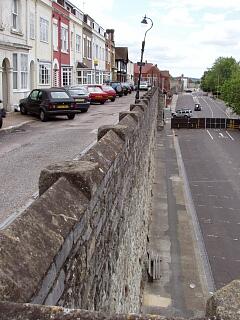 Top of town wall southwards from castle buttress, Forest View, 21.6.09, © I Peckham | 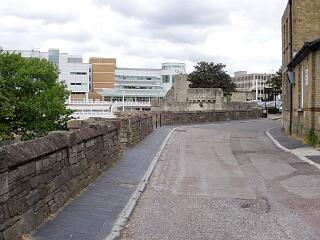 Town wall and towers looking north from Forest View, 21.6.09, © I Peckham |
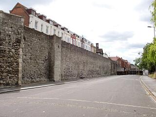 Garderobe Tower, castle buttress and town wall, Western Esplanade, 21.6.09, © I Peckham | 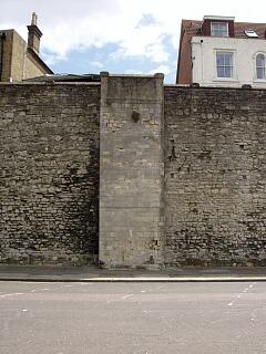 Castle buttress and town wall, Western Esplanade, 21.6.09, © I Peckham |
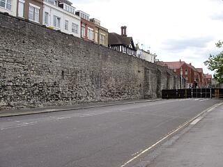 West town wall southwards of the castle buttress, Western Esplanade, 21.6.09, © I Peckham | 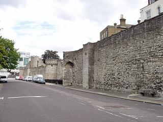 Catchcold Tower, Garderobe Tower, castle buttress and town wall, Western Esplanade, 21.6.09, © I Peckham |
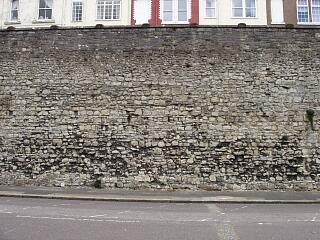 Town wall south of castle buttress (below Forest View), Western Esplanade - putlog holes, 21.6.09, © I Peckham | 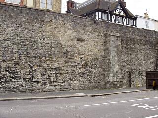 West town wall below Forest View and Cement Terrace, Western Esplanade, 21.6.09, © I Peckham |
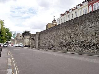 West town wall below Forest View and towers to north, Western Esplanade, 21.6.09, © I Peckham | 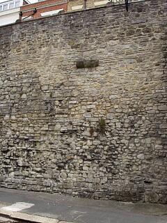 West town wall below Forest View and Cement Terrace, Western Esplanade - detail, 21.6.09, © I Peckham |
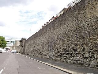 West town wall below Forest View, Western Esplanade, 21.6.09, © I Peckham | 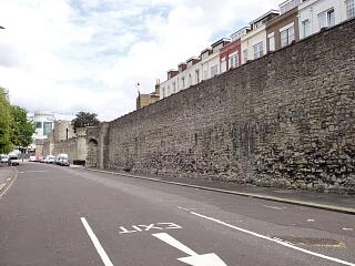 West town wall below Forest View and towers in distance, Western Esplanade, 21.6.09, © I Peckham |
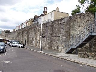 West town wall by Castle Vault, Watergate and Castle Hall, Western Esplanade, 21.6.09, © I Peckham | |
If you have any feedback or new information about this record, please email the Southampton HER (her@southampton.gov.uk).
Search results generated by the HBSMR Gateway from exeGesIS SDM Ltd.