If you have any feedback or new information about this record, please email the Southampton HER (her@southampton.gov.uk).
Data derived from Heritage Gateway will not be acceptable for any use associated with development proposals and other planning matters.
For important guidance on the use of this record, please click
here
. © Southampton City Council
| HER Number: | MSH855 |
|---|
| Type of Record: | Monument |
|---|
| Name: | Southampton Castle - site of tower along west curtain wall |
|---|
| Grid Reference: | SU 4184 1146 |
|---|
| Map: | Show location on Streetmap |
|---|
Summary
A map published in 1611 shows a tower roughly half way along the west wall of the castle bailey, on the former shoreline. The tower may have been at the west end of an east-west wall that divided the bailey (MSH3412). In 1883, Davies noted some broken bonding in this area, as if a buttress had been removed. Today, some limited evidence of this tower may survive.
Protected Status: None recorded
Other References/Statuses
- National Monuments Record (ex OS Antiquity Record): SU 41 SW 4
- National Monuments Record (ex OS Antiquity Record): SU 41 SW 96
Monument Type(s):
Full description
See Parent Record MSH23 for a summary of the documentary and excavation evidence for Southampton Castle, a discussion of the development of the Castle, and a full list of sources. The evidence below is in chronological order.
------------------------------------------------------
[1]: 1611 map. Tower shown.
[10]: c1630 map. Tower shown.
[2]: 1771 map. Rectangular tower shown some way south of the line of Castle Lane (assuming the line hasn’t changed), although the map isn’t especially accurate in this area.
[3]: 1791 map. Rectangular tower shown.
[4]: 1802 map. Rectangular tower shown.
[5]: 1846 map. The castle wall in this area is shown as now, with some buttresses but no tower.
[6]: Davies, 1883. (Describing the town and castle wall.) “The walls, probably of Norman date and about 38 feet high, now continue southward some 370 feet, being common both to the town and castle, as far as the remains of a tower at the south-west angle of the castle baily. Somewhat more than half-way the bonding in the face of the curtain is broken for about 15 feet perpendicular in two lines, giving something the appearance of a coped buttress cut back flush with the wall. In a straight line with this, foundations as of a strong wall have been discovered to the rear, curiously coinciding with a line of wall drawn in Speed’s (1596) plan...... Close south of this broken bond there commences a series of six rectangular buttresses....” (etc).
[370 feet = 112.8m, 15 feet = 4.57m.]
[7][8]: NMR. Marks the tower just north of Cement Terrace, citing [9] and maps [1][2][3][10].
[11]: The 1611 map [1] appears to show a tower on the west wall of the castle bailey, along the former shoreline. This tower is roughly where the projected line of an E/W stone wall found on SOU 1232 to the east joins the castle bailey wall. Today, the bailey wall at this point differs from the wall face on either side, and there may well have been a tower here. This area has recently shown signs of collapse and has had to be rebuilt (see SOU 996). It is suggested that the SOU 1232 wall, and a stone structure found on SOU 996 (MSH2233) is part of an E/W wall shown on the 1611 map, apparently dividing the castle bailey.
SCC HER: The E/W wall dividing the castle bailey has been found on other sites (see MSH3412 for details and dating). The 1611 map shows the tower as being some way south of this wall.
GIS: Dimensions given in [6] used to roughly plot the tower in GIS.
Sources / Further Reading
| [1] | SSH681 - Map: Speed. 1596/1611. Speed's Map of Southampton published 1596 and 1611 (black and white version). Paper. |
| [2] | SSH921 - Map: P Mazell. 1771. A Plan of Southampton and of the Polygon 1771. Paper. |
| [3] | SSH922 - Map: T Milne (surveyor). 1791. Plan of the Town of Southampton 1791. Paper. |
| [4] | SSH923 - Map: John Doswell and Sons (surveyor), T Baker and Son (publisher). 1802. Plan of Southampton from an Actual Survey 1802. Paper. |
| [5] | SSH679 - Map: Campbell/Yolland/Royal Engineers. 1846. Plan of the Borough of Southampton surveyed in 1845-6.. Paper. |
| [6] | SSH664 - Bibliographic reference: JS Davies. 1883. A History of Southampton. pp 73-74 |
| [7] | SSH2624 - Unpublished document: NMR/OS. 1969-1982. NMR/OS Antiquity Record SU 41 SW 4. |
| [8] | SSH2655 - Unpublished document: NMR/OS. 1969. NMR/OS Antiquity Record SU 41 SW 96. |
| [9] | SSH3199 - Article in serial: PG Stone. 1934. A Vanished Castle. PHFC&AS Vol XII Part 3, 1934, 241-270. |
| [10] | SSH3198 - Map: ?. c1630. Plan of Southampton (About 1630) - From the original, attributed to a French Spy, in the British Museum.. Paper. |
| [11] | SSH2216 - Archaeological Report: MA Leivers. 2003. Report on an archaeological watching brief at 1 Forest View, Southampton.. SOU 1232. |
Associated Finds: None recorded
Associated Events: None recorded
Related records
| MSH23 | Child of: Former Southampton Castle |
| MSH3418 | Child of: Southampton Castle – west curtain wall (all) |
Associated Links: None recorded
Images
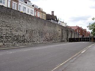 West town wall southwards of the castle buttress, Western Esplanade, 21.6.09, © I Peckham | 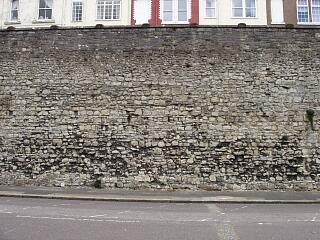 Town wall south of castle buttress (below Forest View), Western Esplanade - putlog holes, 21.6.09, © I Peckham |
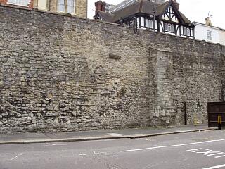 West town wall below Forest View and Cement Terrace, Western Esplanade, 21.6.09, © I Peckham | 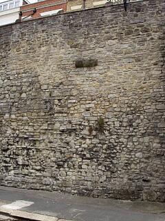 West town wall below Forest View and Cement Terrace, Western Esplanade - detail, 21.6.09, © I Peckham |
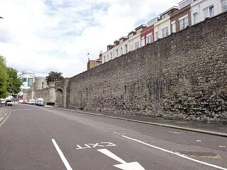 West town wall below Forest View and towers in distance, Western Esplanade, 21.6.09, © I Peckham | 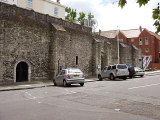 West town wall by Castle Vault and Castle Hall, Western Esplanade, 21.6.09, © I Peckham |
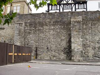 West town wall by Castle Vault, Western Esplanade, 21.6.09, © I Peckham | 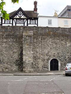 West town wall by Castle Vault, Western Esplanade, 21.6.09, © I Peckham |
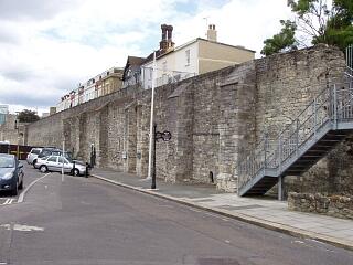 West town wall by Castle Vault, Watergate and Castle Hall, Western Esplanade, 21.6.09, © I Peckham | |
If you have any feedback or new information about this record, please email the Southampton HER (her@southampton.gov.uk).
Search results generated by the HBSMR Gateway from exeGesIS SDM Ltd.