See important
guidance on the use of this record.
If you have any comments or new information about this record, please email us.
| HER Number: | MDV102615 |
|---|
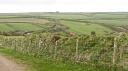
| Name: | Two small structures on the south-east of Horsey Island |
|---|
Summary
Two small open-fronted structures are visible on aerial photographs from 1945 to 2010 on the outer side of the sea wall defences around Horsey Island. They are interpreted as early twentieth century shelters relating to the agricultural or, most probably, the fishing industry, rather than military activity. The structures are made from corrugated iron and plywood.
Location
| Grid Reference: | SS 482 335 |
|---|
| Map Sheet: | SS43SE |
|---|
| Admin Area | Devon |
|---|
| Civil Parish | Heanton Punchardon |
|---|
| District | North Devon |
|---|
Protected Status: none recorded
Other References/Statuses
- Old DCC SMR Ref: SS43SE/256/1
Monument Type(s) and Dates
- SHELTER (Edwardian to World War II - 1904 AD to 1945 AD (Between))
Full description
Ordnance Survey, 1880-1899, First Edition Ordnance 25 inch map (Cartographic). SDV336179.
No structures are depicted in this location.
Royal Air Force, 1946, RAF/106G/UK/1655, NMR RAF/106G/1655 4199-4200 11-JUL-1946 (Aerial Photograph). SDV349996.
Two rectangular structures are visible, and small white features on the marsh are likely to be sheep grazing.
Royal Air Force, 1960, RAF/543/1017, NMR RAF/543/1017 PSFO-0025 SS4832/6 10-AUG-1960 (Aerial Photograph). SDV349659.
Two open fronted rectangular structures are visible.
Next Perspectives, 2010, Next Perspectives PGA Tile Ref:, Next Perspectives PGA Tile Ref: SS4833 08-APR-2010 (Aerial Photograph). SDV349899.
Two small rectangular structures are visible.
Hegarty, C. + Knight, S., 2011-2012, North Devon Coast Area of Outstanding Natural Beauty National Mapping Programme Project (Interpretation). SDV349018.
Two small open-fronted structures, approximately 2 by 2.5 metres in plan, are visible on aerial photographs from 1945 to 2010. No buildings are depicted here on the 1904-1906 Ordnance Survey mapping and they are likely therefore to date to the early twentieth century. They are located on the outside of the seawall around Horsey Island, and possibly built into the embankment. Their orientation, facing upstream on the Taw estuary at the point that it is joined by the River Caen, suggests that they are related to intertidal or maritime activity. They do not appear to have an obvious military character and are constructed of corrugated iron and plywood. The more plausible explanation is that they are shelters for people engaged in the agricultural or fishing industry; sheep appear to be grazing on the seaward side of the marsh on 1946 aerial photographs but it is most likely that they are related to fishing activity.
Hegarty, C. & Knight, S., 2012-2013, North Devon Area of Outstanding Natural Beauty National Mapping Programme Project site visit, 19-FEB-2013 (Site Visit). SDV349357.
The shelters are extant and constructed of corrugated iron and plywood.
Sources / Further Reading
| SDV336179 | Cartographic: Ordnance Survey. 1880-1899. First Edition Ordnance 25 inch map. First Edition Ordnance Survey 25 inch Map. Map (Digital). |
| |
| | |
| SDV349018 | Interpretation: Hegarty, C. + Knight, S.. 2011-2012. North Devon Coast Area of Outstanding Natural Beauty National Mapping Programme Project. AC Archaeology Report. ACD383/2/1. Digital. |
| |  |
| | Linked documents:1 |
| SDV349357 | Site Visit: Hegarty, C. & Knight, S.. 2012-2013. North Devon Area of Outstanding Natural Beauty National Mapping Programme Project site visit. ND AONB NMP. Digital. 19-FEB-2013. |
| |  |
| | Linked images:24 |
| SDV349659 | Aerial Photograph: Royal Air Force. 1960. RAF/543/1017. Royal Air Force Aerial Photograph. Photograph (Paper). NMR RAF/543/1017 PSFO-0025 SS4832/6 10-AUG-1960. |
| |
| | |
| SDV349899 | Aerial Photograph: Next Perspectives. 2010. Next Perspectives PGA Tile Ref:. Pan Government Agreement Aerial Photographs. Digital. Next Perspectives PGA Tile Ref: SS4833 08-APR-2010. [Mapped feature: #62083 ] |
| |
| | |
| SDV349996 | Aerial Photograph: Royal Air Force. 1946. RAF/106G/UK/1655. Royal Air Force Aerial Photograph. Photograph (Paper). NMR RAF/106G/1655 4199-4200 11-JUL-1946. |
| |
| | |
Associated Monuments: none recorded
Associated Finds: none recorded
Associated Events
- EDV6132 - North Devon Area of Outstanding Natural Beauty NMP Project (Ref: ACD383/2/1)
| Date Last Edited: | Oct 1 2020 5:50PM |
|---|
Search results generated by the HBSMR Gateway from exeGesIS SDM Ltd.