See important
guidance on the use of this record.
If you have any comments or new information about this record, please email us.
| HER Number: | MDV48778 |
|---|
| Name: | Chimney at Furzehill Mine |
|---|
Summary
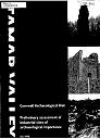
Chimney on north side of road between Lower Birch and Gullytown, at southern end of Furzehill mine workings. Late 18th or early 19th century.
Location
| Grid Reference: | SX 436 652 |
|---|
| Map Sheet: | SX46NW |
|---|
| Admin Area | Devon |
|---|
| Civil Parish | Bere Ferrers |
|---|
| District | West Devon |
|---|
| Ecclesiastical Parish | BERE FERRERS |
|---|
Protected Status: none recorded
Other References/Statuses
- Old DCC SMR Ref: SX46NW/538/1
Monument Type(s) and Dates
- CHIMNEY (XVIII to XIX - 1790 AD to 1861 AD (Between))
Full description
Claughton, P. F., 03/03/1993, Mine at Bere Alston; Collapse of Ground at Cleave Mine (Correspondence). SDV359155.
The surviving chimney on the site of Birch Mine is from an engine erected on the site in the 1840s, not that erected by Crawshay.
Claughton, P. F., 04/01/1993, Mine at Bere Alston; Collapse of Ground at Cleave Mine. (Correspondence). SDV344106.
Birch Mine was part of an extended Furzehill on the run of the vein north of the road from Bere Alston to Weirquay, and was worked in the first quarter of the 19th century. An engine shaft (engine installed in 1790s) lies immediately to the north of the road, still marked by a surviving (later) chimney.
Ordnance Survey, 1884, Untitled Source (Cartographic). SDV344105.
"Chimney" marked.
Ordnance Survey, 1954, SX46NW (Cartographic). SDV340283.
Cranstone, D., 1991, The Lead Industry, 1G (Report - non-specific). SDV90317.
Nance, R. W. + Nance, R. D., 1996, A Survey of Engine Houses on the Mines of South Devon, 119 (Article in Serial). SDV241746.
Lone stack with decorative brickwork and ruinous walls at base.
Buck, C., 1998, Preliminary Assessment of Industrial Sites of Archaeological Importance in the Tamar Valley, 55 (Report - Assessment). SDV336795.
Site visit 11th March 1998. Extant full height chimney, seems stable but covered with vegetation.
Rippon, S. + Claughton, P. + Smart, C., 2009, Mining in a Medieval Landscape: The Royal Silver Mines of the Tamar Valley (Monograph). SDV344097.
Sources / Further Reading
| SDV241746 | Article in Serial: Nance, R. W. + Nance, R. D.. 1996. A Survey of Engine Houses on the Mines of South Devon. Mining History: Bulletin PDMHS. The Archaeology of Mining and Metallurgy in South-West Britain. 13, Number 2. A4 Paperback. 119. |
| |
| | |
| SDV336795 | Report - Assessment: Buck, C.. 1998. Preliminary Assessment of Industrial Sites of Archaeological Importance in the Tamar Valley. Cornwall Archaeological Unit Report. A4 Stapled + Digital. 55. |
| |  |
| | Linked documents:1 |
| SDV340283 | Cartographic: Ordnance Survey. 1954. SX46NW. Ordnance Survey 6 inch map. Map (Paper). |
| |
| | |
| SDV344097 | Monograph: Rippon, S. + Claughton, P. + Smart, C.. 2009. Mining in a Medieval Landscape: The Royal Silver Mines of the Tamar Valley. Mining in a Medieval Landscape: The Royal Silver Mines of the Tamar Valley. Paperback Volume. |
| |
| | |
| SDV344105 | Cartographic: Ordnance Survey. 1884. First Edition Ordnance Survey 25 inch Map. Unknown. |
| |
| | |
| SDV344106 | Correspondence: Claughton, P. F.. 04/01/1993. Mine at Bere Alston; Collapse of Ground at Cleave Mine.. Letter and Map. A4 Stapled + Digital. |
| SDV359155 | Correspondence: Claughton, P. F.. 03/03/1993. Mine at Bere Alston; Collapse of Ground at Cleave Mine. Letter. A4 Single Sheet + Digital. |
| SDV90317 | Report - non-specific: Cranstone, D.. 1991. The Lead Industry. English Heritage Monuments Protection Programme Step 3 Site Assessments. A4 Stapled. 1G. |
| |
| | |
Associated Monuments
| MDV41528 | Part of: Part of Furzehill Mine, or Birch Mine (Monument) |
Associated Finds: none recorded
Associated Events: none recorded
| Date Last Edited: | Sep 8 2015 3:45PM |
|---|
Search results generated by the HBSMR Gateway from exeGesIS SDM Ltd.