See important
guidance on the use of this record.
If you have any comments or new information about this record, please email us.
| HER Number: | MDV51123 |
|---|
| Name: | Lower Saltworks on Seaton Marshes |
|---|
Summary
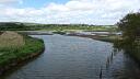
The eighteenth century Lower or Little Saltworks were sited on Seaton Marshes. Earthwork mounds and a curvilinear bank and ditch visible on aerial photographs from the 1940s onwards may be associated, and are clearly visible on the ground.
Location
| Grid Reference: | SY 247 903 |
|---|
| Map Sheet: | SY29SW |
|---|
| Admin Area | Devon |
|---|
| Civil Parish | Seaton |
|---|
| District | East Devon |
|---|
| Ecclesiastical Parish | SEATON |
|---|
Protected Status
- SHINE: Saltworking on reclaimed land of the former (medieval) harbour of the Axe Estuary at Seaton
Other References/Statuses
- National Monuments Record: SY29SE29
- Old DCC SMR Ref: SY29SW/144/3
- Pastscape: 897741
- SHINE Candidate (Yes)
Monument Type(s) and Dates
- SALT WORKS (Post Medieval to XIX - 1540 AD to 1900 AD (Between))
Full description
Royal Air Force, 1946, RAF/106G/UK/1412, RAF/106G/UK/1412 RP 3322-3323 13-APR-1946 (Aerial Photograph). SDV352504.
Several earthwork mounds are visible, although indistinct.
Royal Air Force, 1963, RAF/58/5607, NMR RAF/58/5607 F21 342-343 22-JAN-1963 (Aerial Photograph). SDV355896.
The earthwork mounds are clearly visible under light snow cover. Map object party based on this source.
Ordnance Survey, 1971, OS/71006, NMR OS/71006 22-23 07-MAR-1971 (Aerial Photograph). SDV355898.
The earthworks are visible as roughy rectangular mounds.
Ordnance Survey, 1974, OS/74216 V, NMR OS/71006 22-23 07-MAR-1971 (Aerial Photograph). SDV361883.
The earthworks are visible as roughy rectangular mounds.
Parkinson, M., 1985, The Axe Estuary and its Marshes, 39-48 (Article in Serial). SDV122290.
A lease of 1727 refers to 2 saltworks, and a 1733 auction broadsheet records '2 salthouses with four pans thereto belonging to Seaton Marsh now in perfect good order'. Details of the auction in the Trevelyan records refer to saltpans sisterns, boyling pans and the 'ower work' or 'little saltwork' and the 'upper work' or the 'whitecross work'. Stukeley evidently sketched the lower works. Two of the saltpans are shown on the 1st edition Ordnance Survey map, 1809, and their banks can still be seen in a field named as Salt ploton the Tithe Map (1839-40). The saltworks seem to have fallen out of use after the auction and they were for lease again in 1741, when 3 saltworks are referred to, and again in 1742 when 'Severall salthouses, pans and other works' are referred to. Salt Plot was completely reshaped during drainage works in 1851-3, destroying some of the saltpan evidence.
Turton, S. D. + Weddell, P. J., 1993, Archaeological Appraisal of the Salt Industry on Seaton Marshes, East Devon, 8 (Report - non-specific). SDV120092.
The Lower Saltworks, also called the little saltworks, were located to the south-east of the church within Salt Plot. They were notionally sketched by Stukeley in the 18th century when he referred to the Seaton marshes as being 'full of saltpans'. The location of two or possibly three saltpans can be seen on the Ordnance Survey surveyor's draft of 1806-1807. Various documents of the first half of the 18th century refer to two or three salthouses or saltworks in addition to saltpans, cisterns and boiling pans. Saltworking appears to have continued on the marsh until the early 19th century. However, extensive alterations carried out from circa 1850 onwards have destroyed some of the earthworks which are taken to be the remains of saltworking. The southern part of Salt Plot now lies under made-up ground immediately north of the car park and incorporates a children's playground. The northern part is still used for rough grazing. Next to a low bank on the west side is a long rectangular platform in the approximate position of the ?salthouse shown on Parkinson's plan. Two, possibly three, rectangular features lie to the east, presumably the remains of saltpans, covered with low scrub. Another possible feature not shown by Parkinson is visible at north end of Salt Plot adjacent to drain which separates it from Church Plot. Drainage channels are also visible.
Ordnance Survey, 1996, OS/96602, DCC GM 076/99 276-277 24-JUL-1999 (Aerial Photograph). SDV355897.
A car park is visible on the southern part of the site.
Barford, P. + Fielding, A. + Penney S., 1998, Monuments Protection Programme: The Salt Industry. Step 1 Report. Consultation Report April 1998, 82 (Report - non-specific). SDV355881.
Environment Agency, 2006, LiDAR data JPEG image (1 metre resolution), LIDAR SY2490 Environment Agency D0064558 21-APR-2006 (Cartographic). SDV355899.
Three roughly rectangular earthwork mounds are visible. Map object partly based on this source.
ARCA, 2008, Axe Estuary Wetlands, Seaton, Devon. Geoarchaeological and Bioarchaeological Assessment, 56-7 (Report - Scientific). SDV347895.
The site of a probable salt extraction area was examined by magnetometry survey and through analysis of LiDAR data. The magnetometry results were unfortunately of little use, partly due to the fact that debris resulting from heat was not present in the survey area and also because a metal tank and pipe obscured the data from the central area. However, the LiDAR data shows the presence of earthworks in this area that do not appear to have an agricultural application and that, therefore, correspond with saltworking features.
National Monuments Record, 2011, 897741 (National Monuments Record Database). SDV348657.
Stukeley, writing in 1724, says that the Axe above Seaton, was 'full of salt pans' and indicates their situation on an entraving in the area of Seaton marsh [Note that Pastscape gives the NGR as SY 25 91]. Other details: SY29SE29. Record last updated: N/A.
Hegarty, C., Knight, S. and Sims, R., 2013 - 2014, South Devon Coast RCZAS National Mapping Programme Project Site Visit, 09-MAY-2014 (Site Visit). SDV351142.
Earthwork mounds are clearly visible in Salt Plot. Rushes grwing around the base of the mounds help to define their extent.
Hegarty, C. + Knight, S. + Sims, R., 2013-2014, South Devon Coast Rapid Coastal Zone Assessment Survey National Mapping Programme Project (Interpretation). SDV351146.
A number of earthwork mounds are visible on aerial photographs between 1946 and 2012.
In the centre of the area at circa SY2478290382 three roughly rectangular earthwork mounds, circa 20 by 30 metres, 50 by 30 metres and 20 by 40 metres, are visible. These are bounded by very straight drainage ditches, although it is not clear whether the drains avoided pre-existing mounds, or whether the mounds were created from the ditch spoil, perhaps to function as stock refuges in times of inundation. One mound appears to have been impacted by the construction of the drains on the west and another by possible small scale extraction of material in the late 1940s or early 1950s, resulting in an irregular outline to its north-west corner. These three mounds are clearly visible on images derived from Lidar data captured in 2006 and are likely to survive.
The location of all the earthworks in the area named ‘salt plot’ on the Tithe map raises the possibility that they are related to the post-medieval salterns. The earthworks in the south of the area at circa SY2476690257 appeared from the 1946 aerial photographs to have been cut by later drainage ditches, suggesting that they did pre-date the late nineteenth century. A wide curvilinear ditch immediately to the south, with an embankment on its southern side, was visible as an earthwork; this was also cut by the straight drainage ditches and may have been related to saltmaking, or perhaps an earlier phase of reclamation. All of the earthworks in this southern area were probably levelled or covered over between 1971 and 1996 when the land was developed.
Two further rectilinear mounds are visible in the very north of the area at circa SY2486290460, although their form is less clear and a more feasible interpretation for these could be as drainage ditch spoil.
Sources / Further Reading
| SDV120092 | Report - non-specific: Turton, S. D. + Weddell, P. J.. 1993. Archaeological Appraisal of the Salt Industry on Seaton Marshes, East Devon. Exeter Museums Archaeological Field Unit Report. 93.93. A4 Stapled + Digital. 8. [Mapped feature: #93893 ] |
| |
| | |
| SDV122290 | Article in Serial: Parkinson, M.. 1985. The Axe Estuary and its Marshes. Transactions of the Devonshire Association. 117. A5 Paperback. 39-48. |
| |
| | |
| SDV347895 | Report - Scientific: ARCA. 2008. Axe Estuary Wetlands, Seaton, Devon. Geoarchaeological and Bioarchaeological Assessment. ARCA Report. 0809-2. A4 Stapled + Digital. 56-7. |
| |
| | |
| SDV348657 | National Monuments Record Database: National Monuments Record. 2011. 897741. National Monuments Record Database. Website. |
| |
| | |
| SDV351142 | Site Visit: Hegarty, C., Knight, S. and Sims, R.. 2013 - 2014. South Devon Coast RCZAS National Mapping Programme Project Site Visit. AC Archaeology. Digital. 09-MAY-2014. |
| |  |
| | Linked images:48 |
| SDV351146 | Interpretation: Hegarty, C. + Knight, S. + Sims, R.. 2013-2014. South Devon Coast Rapid Coastal Zone Assessment Survey National Mapping Programme Project. AC Archaeology Report. Digital. |
| |  |
| | Linked documents:1 |
| SDV352504 | Aerial Photograph: Royal Air Force. 1946. RAF/106G/UK/1412. Royal Air Force Aerial Photograph. Photograph (Paper). RAF/106G/UK/1412 RP 3322-3323 13-APR-1946. |
| |
| | |
| SDV355881 | Report - non-specific: Barford, P. + Fielding, A. + Penney S.. 1998. Monuments Protection Programme: The Salt Industry. Step 1 Report. Consultation Report April 1998. English Heritage Report. Digital + A4. 82. |
| SDV355896 | Aerial Photograph: Royal Air Force. 1963. RAF/58/5607. Royal Air Force Aerial Photograph. Photograph (Paper). NMR RAF/58/5607 F21 342-343 22-JAN-1963. |
| |
| | |
| SDV355897 | Aerial Photograph: Ordnance Survey. 1996. OS/96602. Ordnance Survey. Photograph (Paper). DCC GM 076/99 276-277 24-JUL-1999. |
| |
| | |
| SDV355898 | Aerial Photograph: Ordnance Survey. 1971. OS/71006. Ordnance Survey. Photograph (Paper). NMR OS/71006 22-23 07-MAR-1971. |
| |
| | |
| SDV355899 | Cartographic: Environment Agency. 2006. LiDAR data JPEG image (1 metre resolution). Environment Agency LiDAR data. Digital. LIDAR SY2490 Environment Agency D0064558 21-APR-2006. |
| |
| | |
| SDV361883 | Aerial Photograph: Ordnance Survey. 1974. OS/74216 V. Ordnance Survey. Photograph (Paper). NMR OS/71006 22-23 07-MAR-1971. |
| |
| | |
Associated Monuments
| MDV51124 | Related to: Church Plot Field Name, Seaton (Monument) |
| MDV42560 | Related to: Medieval Salt Works at Seaton (Monument) |
| MDV42587 | Related to: Saltworks on Seaton Marsh (Monument) |
Associated Finds: none recorded
Associated Events
- EDV5342 - Geoarchaeological Survey of the Axe Estuary Wetlands, Seaton
- EDV6127 - Rapid Coastal Zone Assessment Survey National Mapping Programme (NMP) for South-West England - South Coast Devon (Ref: ACD618)
| Date Last Edited: | Apr 8 2020 11:30PM |
|---|
Search results generated by the HBSMR Gateway from exeGesIS SDM Ltd.