See important
guidance on the use of this record.
If you have any comments or new information about this record, please email us.
| HER Number: | MDV59653 |
|---|
| Name: | Stafford Arms, Back Lane, Barnstaple |
|---|
Summary
Public house shown on late 19th century map, formerly known as the Brickmaker's Arms.
Location
| Grid Reference: | SS 560 330 |
|---|
| Map Sheet: | SS53SE |
|---|
| Admin Area | Devon |
|---|
| Civil Parish | Barnstaple |
|---|
| District | North Devon |
|---|
| Ecclesiastical Parish | BARNSTAPLE |
|---|
Protected Status: none recorded
Other References/Statuses
- Old DCC SMR Ref: SS53SE/592/1
Monument Type(s) and Dates
- INN (XVIII to XIX - 1701 AD to 1900 AD)
Full description
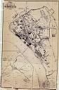
Wood, J., 1843, Plan of the Town of Barnstaple from Actual Survey (Cartographic). SDV91852.
Brickmakers Inn marked. Map object based on this Source.
Ordnance Survey, 1880-1899, First Edition Ordnance 25 inch map (Cartographic). SDV336179.
"PH" marked. Map object based on this Source.
Collings, A. G., 1998, Archaeological Assessment of the New Bus Station at Albert Lane Car Park, Barnstaple (Report - Assessment). SDV336397.
'Stafford Arms' fronting Trinity Street. Listed in the 1770 land tax assessment, under Back Lane, as the 'Brickmakers Arms'. Named as the 'Brickmaker's Inn' on Wood's map of 1843, located facing the junction of Back Lane and Brick Lane. By 1866 it had become the 'Stafford Arms', and the streets renamed Trinity Street and Summerland Street.
Ordnance Survey, 2012, MasterMap (Cartographic). SDV348725.
Site now occupied by bus station.
Southwest Archaeology, 2013, Greater Barnstaple Area Project Database, Mapping Area 1293 (Un-published). SDV351581.
Sources / Further Reading
| SDV336179 | Cartographic: Ordnance Survey. 1880-1899. First Edition Ordnance 25 inch map. First Edition Ordnance Survey 25 inch Map. Map (Digital). |
| |
| | |
| SDV336397 | Report - Assessment: Collings, A. G.. 1998. Archaeological Assessment of the New Bus Station at Albert Lane Car Park, Barnstaple. Exeter Archaeology Report. 98.58. A4 Stapled + Digital. |
| |
| | |
| SDV348725 | Cartographic: Ordnance Survey. 2012. MasterMap. Ordnance Survey. Map (Digital). |
| |
| | |
| SDV351581 | Un-published: Southwest Archaeology. 2013. Greater Barnstaple Area Project Database. Greater Barnstaple Area Project. Digital. Mapping Area 1293. |
| |
| | |
| SDV91852 | Cartographic: Wood, J.. 1843. Plan of the Town of Barnstaple from Actual Survey. Unknown. |
| |  |
| | Linked images:1 |
Associated Monuments: none recorded
Associated Finds: none recorded
Associated Events: none recorded
| Date Last Edited: | Aug 26 2022 3:35PM |
|---|
Search results generated by the HBSMR Gateway from exeGesIS SDM Ltd.